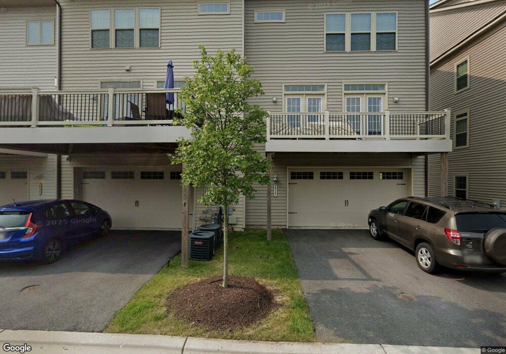
2927 Middleham Ct Hanover, MD 21076
Estimated Value: $596,000 - $682,000
3
Beds
4
Baths
2,785
Sq Ft
$229/Sq Ft
Est. Value
About This Home
This home is located at 2927 Middleham Ct, Hanover, MD 21076 and is currently estimated at $638,232, approximately $229 per square foot. 2927 Middleham Ct is a home located in Anne Arundel County with nearby schools including Meade Heights Elementary School, MacArthur Middle School, and Meade High School.
Ownership History
Date
Name
Owned For
Owner Type
Purchase Details
Closed on
Mar 2, 2022
Sold by
Nwanneka Okwesili Christine
Bought by
Okwesili Christine Nwanneka
Current Estimated Value
Purchase Details
Closed on
Oct 6, 2017
Sold by
Nvr Inc
Bought by
Okwesili Christine N and Okwesili Peter I
Home Financials for this Owner
Home Financials are based on the most recent Mortgage that was taken out on this home.
Original Mortgage
$465,000
Interest Rate
3.37%
Mortgage Type
Adjustable Rate Mortgage/ARM
Purchase Details
Closed on
Jan 26, 2017
Sold by
Rnb Properties Llc
Bought by
Nvr Inc
Create a Home Valuation Report for This Property
The Home Valuation Report is an in-depth analysis detailing your home's value as well as a comparison with similar homes in the area
Home Values in the Area
Average Home Value in this Area
Purchase History
| Date | Buyer | Sale Price | Title Company |
|---|---|---|---|
| Okwesili Christine Nwanneka | -- | Title365 | |
| Okwesili Christine N | $465,000 | None Available | |
| Nvr Inc | $459,000 | None Available |
Source: Public Records
Mortgage History
| Date | Status | Borrower | Loan Amount |
|---|---|---|---|
| Previous Owner | Okwesili Christine N | $465,000 |
Source: Public Records
Tax History
| Year | Tax Paid | Tax Assessment Tax Assessment Total Assessment is a certain percentage of the fair market value that is determined by local assessors to be the total taxable value of land and additions on the property. | Land | Improvement |
|---|---|---|---|---|
| 2025 | $5,814 | $548,800 | $155,000 | $393,800 |
| 2024 | $5,814 | $521,633 | $0 | $0 |
| 2023 | $5,649 | $494,467 | $0 | $0 |
| 2022 | $5,266 | $467,300 | $135,000 | $332,300 |
| 2020 | $5,235 | $467,300 | $135,000 | $332,300 |
| 2019 | $5,389 | $482,100 | $140,000 | $342,100 |
| 2018 | $4,787 | $472,100 | $0 | $0 |
| 2017 | $428 | $42,000 | $0 | $0 |
| 2016 | -- | $0 | $0 | $0 |
Source: Public Records
Map
Nearby Homes
- 2914 Middleham Ct
- 2918 Middleham Ct
- 2816 Brewers Crossing Way
- 2812 Brewers Crossing Way Unit 43
- 7808 Union Hill Dr
- 2854 Brewers Crossing Way Unit 1
- 7652 Telamon Way
- 7725 Duncannon Ln
- 7729 Duncannon Ln
- 2932 Hebron Ln
- 2829 Fredericksburg Rd
- 3006 Frayser Farm Rd
- 2784 Fredericksburg Rd
- 3103 Potters Hill Rd
- 3462 Jacobs Ford Way
- 7820 Mine Run Rd
- 7838 Mine Run Rd
- 3433 Jacobs Ford Way
- 3723 Cedar Mountain Way
- 7911 Mine Run Rd
- 2923 Middleham Ct
- 2925 Middleham Ct
- 2933 Middleham Ct
- 2931 Middleham Ct
- 2935 Middleham Ct
- 2919 Middleham Ct
- 2917 Middleham Ct
- 2911 Middleham Ct
- 2905 Middleham Ct
- 2936 Middleham Ct
- 2932 Middleham Ct
- 2910 Stagg Ln
- 2908 Middleham Ct
- 2907 Middleham Ct
- 2910 Middleham Ct
- 2912 Stagg Ln
- 2912 Middleham Ct
- 3003 Bretons Ridge Way
- 2909 Middleham Ct
- 2906 Middleham Ct
Your Personal Tour Guide
Ask me questions while you tour the home.