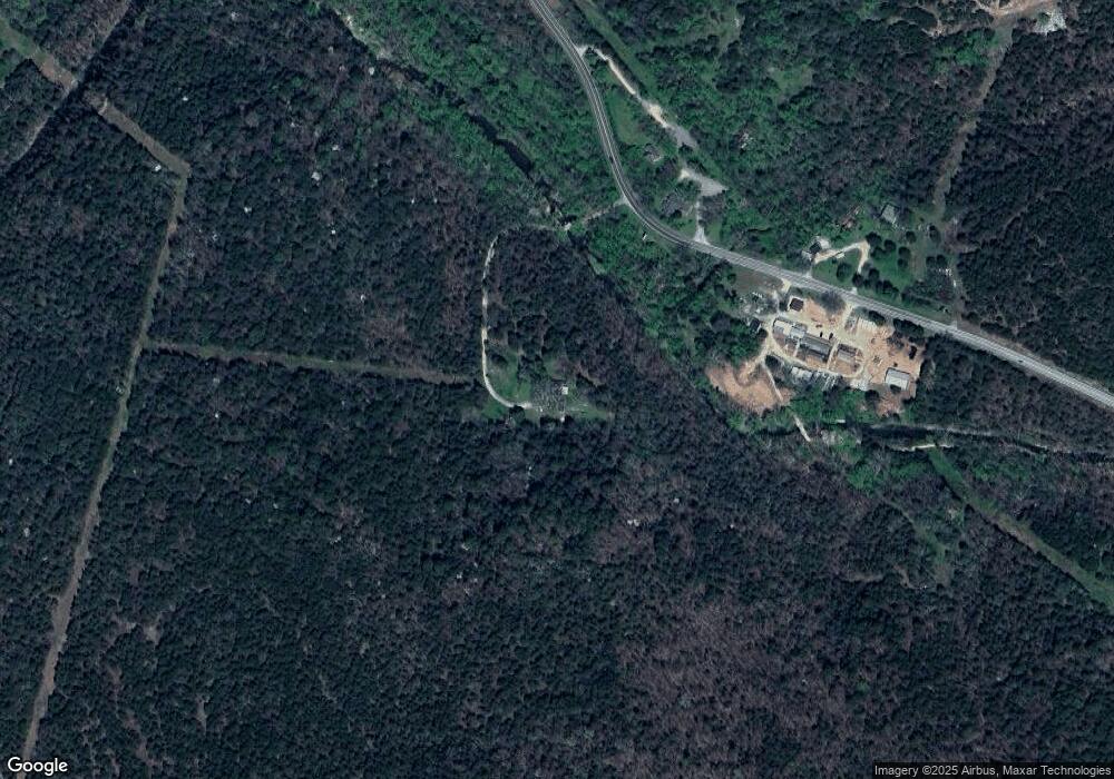
2928 Highway 23 N Eureka Springs, AR 72631
Estimated Value: $122,000 - $313,000
--
Bed
1
Bath
1,074
Sq Ft
$190/Sq Ft
Est. Value
About This Home
This home is located at 2928 Highway 23 N, Eureka Springs, AR 72631 and is currently estimated at $204,290, approximately $190 per square foot. 2928 Highway 23 N is a home located in Carroll County with nearby schools including Eureka Springs Elementary School, Eureka Springs Middle School, and Eureka Springs High School.
Ownership History
Date
Name
Owned For
Owner Type
Purchase Details
Closed on
Sep 3, 2003
Sold by
Martin
Bought by
Wolven
Current Estimated Value
Purchase Details
Closed on
Dec 16, 1993
Sold by
Davis
Bought by
Martin
Purchase Details
Closed on
Apr 3, 1992
Sold by
Davis
Bought by
Martin
Purchase Details
Closed on
May 6, 1986
Bought by
Frm George-Grace Dalstrom
Purchase Details
Closed on
Nov 3, 1983
Bought by
From Re and Grace Dalstrom
Purchase Details
Closed on
Jan 5, 1971
Bought by
Rr Rw
Create a Home Valuation Report for This Property
The Home Valuation Report is an in-depth analysis detailing your home's value as well as a comparison with similar homes in the area
Home Values in the Area
Average Home Value in this Area
Purchase History
| Date | Buyer | Sale Price | Title Company |
|---|---|---|---|
| Wolven | $88,000 | -- | |
| Martin | $2,000 | -- | |
| Martin | $55,000 | -- | |
| Frm George-Grace Dalstrom | -- | -- | |
| From George Dalstrom | -- | -- | |
| From Re | $30,000 | -- | |
| Rr Rw | -- | -- |
Source: Public Records
Tax History Compared to Growth
Tax History
| Year | Tax Paid | Tax Assessment Tax Assessment Total Assessment is a certain percentage of the fair market value that is determined by local assessors to be the total taxable value of land and additions on the property. | Land | Improvement |
|---|---|---|---|---|
| 2024 | $614 | $12,730 | $3,970 | $8,760 |
| 2023 | $612 | $12,730 | $3,970 | $8,760 |
| 2022 | $615 | $12,730 | $3,970 | $8,760 |
| 2021 | $614 | $12,710 | $3,990 | $8,720 |
| 2020 | $614 | $12,710 | $3,990 | $8,720 |
| 2019 | $613 | $12,710 | $3,990 | $8,720 |
| 2018 | $568 | $12,710 | $3,990 | $8,720 |
| 2017 | $504 | $12,710 | $3,990 | $8,720 |
| 2016 | $459 | $8,700 | $1,670 | $7,030 |
| 2014 | -- | $8,700 | $1,670 | $7,030 |
Source: Public Records
Map
Nearby Homes
- 0 Arkansas 23
- TBD Holiday Island Dr Unit 6
- 8 W Bluff Ln
- Lots 4 & 5 of Block W Bluff Ln Unit 301
- 9 W Bluff Ln
- 51 Cypress Point Ln
- 11 La Costa Dr
- 35 Cypress Point Ln
- Two Parcel Cr-206
- 62 Cypress Point Ln
- 56 Cypress Point Ln
- 0 S Hills Loop Unit 1302197
- 29 Cypress Point Ln
- 17 La Costa Dr
- 27 Cypress Point Ln
- 25 Cypress Point Ln
- 8 Cypress Point Ln
- 12 Cypress Point Ln
- 14 Cypress Point Ln
- 37 Cypress Point Ln
- 2883 Highway 23 N
- 2798 Highway 23 N
- 3031 Highway 23 N
- 0 Cr 187 Rd Unit 545269
- 00 Highway 187
- Lot 7 Hwy 187 Hwy
- 21.7 Acres Hwy 187 Hwy
- Lot 6 Hwy 187 Hwy
- Lot 8 Hwy 187 Hwy
- 0 5 107 Acres Mol Hwy 187 Hwy Unit 546230
- 99 Highway 187
- 3269 Highway 23 N
- 3194 Highway 23 N
- 3269 Arkansas 23
- 2829 Highway 23 S
- 2434 Highway 23 N
- 3492 Highway 23 N
- 3548 Highway 23 N
- 1990 Highway 23 N
- 452 Highway 187