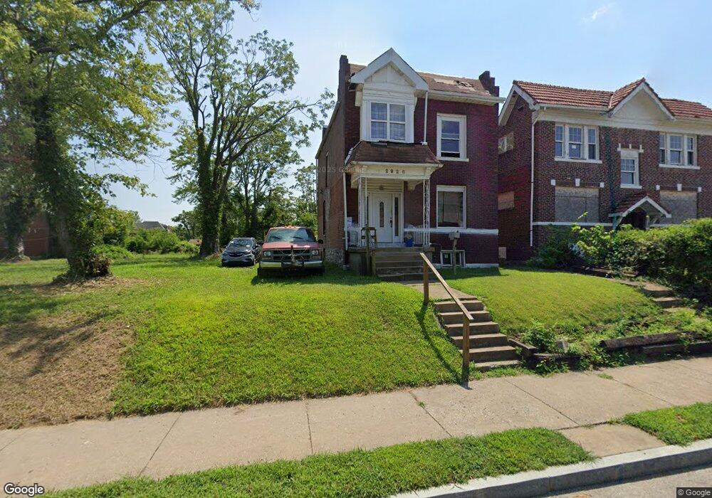
2928 N Euclid Ave Saint Louis, MO 63115
Kingsway NeighborhoodEstimated Value: $85,000 - $152,000
3
Beds
1
Bath
1,408
Sq Ft
$84/Sq Ft
Est. Value
About This Home
This home is located at 2928 N Euclid Ave, Saint Louis, MO 63115 and is currently estimated at $118,500, approximately $84 per square foot. 2928 N Euclid Ave is a home located in St. Louis City with nearby schools including Hickey Elementary School, Sumner High School, and North Side Community Elementary School.
Ownership History
Date
Name
Owned For
Owner Type
Purchase Details
Closed on
Dec 7, 2016
Sold by
Parcels Of Land Encumbered With Delinque
Bought by
Land Reutilization Authority Of The City
Current Estimated Value
Purchase Details
Closed on
Sep 21, 2012
Sold by
The Bank Of New York Mellon
Bought by
Taylor Robert L
Purchase Details
Closed on
Jul 28, 2011
Sold by
Simms Leslie
Bought by
The Bank Of New York Mellon and The Bank Of New York
Purchase Details
Closed on
Jan 29, 2007
Sold by
A 1 Properties Inc
Bought by
Simms Leslie
Home Financials for this Owner
Home Financials are based on the most recent Mortgage that was taken out on this home.
Original Mortgage
$79,200
Interest Rate
10.58%
Mortgage Type
New Conventional
Purchase Details
Closed on
May 25, 2006
Sold by
Wells Fargo Bank Na
Bought by
A-1 Properties Inc
Purchase Details
Closed on
Jan 24, 2006
Sold by
Harris Sophornia J
Bought by
Wells Fargo Bank Na and National City Mortgage Loan Trust 2005-1
Purchase Details
Closed on
Jan 31, 2005
Sold by
The Harris Group Property Solutions Llc
Bought by
Harris Sophornia J
Home Financials for this Owner
Home Financials are based on the most recent Mortgage that was taken out on this home.
Original Mortgage
$89,600
Interest Rate
6.62%
Mortgage Type
Purchase Money Mortgage
Purchase Details
Closed on
Sep 27, 2004
Sold by
Citadel Partners Development Llc
Bought by
The Harris Group Property Solutions Llc
Home Financials for this Owner
Home Financials are based on the most recent Mortgage that was taken out on this home.
Original Mortgage
$18,000
Interest Rate
5.81%
Mortgage Type
Purchase Money Mortgage
Purchase Details
Closed on
Feb 14, 2003
Sold by
Provident Bank
Bought by
Citadel Partners Development Llc
Purchase Details
Closed on
Nov 28, 2001
Sold by
Bradley Sarah and Bradley B E
Bought by
The Provident Bank
Create a Home Valuation Report for This Property
The Home Valuation Report is an in-depth analysis detailing your home's value as well as a comparison with similar homes in the area
Home Values in the Area
Average Home Value in this Area
Purchase History
| Date | Buyer | Sale Price | Title Company |
|---|---|---|---|
| Land Reutilization Authority Of The City | -- | None Available | |
| Taylor Robert L | -- | None Available | |
| The Bank Of New York Mellon | $4,500 | None Available | |
| Simms Leslie | -- | Griffin Title Llc | |
| A-1 Properties Inc | -- | None Available | |
| Wells Fargo Bank Na | $85,000 | None Available | |
| Harris Sophornia J | -- | Nations Title Agency Of Miss | |
| The Harris Group Property Solutions Llc | -- | Capital Title | |
| Citadel Partners Development Llc | -- | -- | |
| The Provident Bank | $29,000 | -- |
Source: Public Records
Mortgage History
| Date | Status | Borrower | Loan Amount |
|---|---|---|---|
| Previous Owner | Simms Leslie | $79,200 | |
| Previous Owner | Harris Sophornia J | $89,600 | |
| Previous Owner | The Harris Group Property Solutions Llc | $18,000 |
Source: Public Records
Tax History Compared to Growth
Tax History
| Year | Tax Paid | Tax Assessment Tax Assessment Total Assessment is a certain percentage of the fair market value that is determined by local assessors to be the total taxable value of land and additions on the property. | Land | Improvement |
|---|---|---|---|---|
| 2025 | -- | $300 | $300 | -- |
| 2024 | -- | $300 | $300 | -- |
| 2023 | -- | $300 | $300 | $0 |
| 2022 | -- | $300 | $300 | -- |
| 2021 | $0 | $300 | $300 | $0 |
| 2020 | $0 | $2,470 | $300 | $2,170 |
| 2019 | $0 | $2,470 | $300 | $2,170 |
| 2018 | $0 | $2,330 | $300 | $2,030 |
| 2017 | $0 | $2,340 | $300 | $2,030 |
| 2016 | $251 | $2,660 | $630 | $2,030 |
| 2015 | $230 | $2,660 | $630 | $2,030 |
| 2014 | $284 | $2,660 | $630 | $2,030 |
| 2013 | -- | $3,390 | $630 | $2,760 |
Source: Public Records
Map
Nearby Homes
- 2834 N Euclid Ave
- 2832 N Euclid Ave
- 4830 Ashland Ave
- 4810 Saint Louis Ave
- 4822 Ashland Ave
- 4950 Labadie Ave
- 4755 Saint Louis Ave
- 4741 Greer Ave
- 4753 Maffitt Ave
- 4845-4847 Northland Ave
- 4860 Northland Ave
- 4721 Northland Ave
- 5049 Saint Louis Ave
- 4669 Elmbank Ave
- 5426 N Euclid Ave
- 5483 N Euclid Ave
- 5429 N Euclid Ave
- 5437 N Euclid Ave
- 4627 Maffitt Ave
- 5151 Terry Ave
- 2926 N Euclid Ave
- 2934 N Euclid Ave
- 2920 N Euclid Ave
- 2938 N Euclid Ave
- 4859 Labadie Ave
- 2942 N Euclid Ave
- 2914 N Euclid Ave
- 4855 Labadie Ave
- 2944 N Euclid Ave
- 4854 Greer Ave
- 4853 Labadie Ave
- 4902 Labadie Ave
- 4852 Greer Ave
- 4851 Labadie Ave
- 4848 Greer Ave
- 4908 Labadie Ave
- 4846 Greer Ave
- 4847 Labadie Ave
- 4912 Labadie Ave
- 4844 Greer Ave