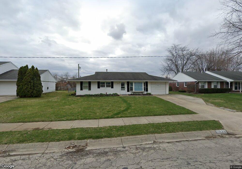
2929 Cavins Dr Springfield, OH 45503
Estimated Value: $180,909 - $198,000
3
Beds
2
Baths
1,169
Sq Ft
$162/Sq Ft
Est. Value
About This Home
This home is located at 2929 Cavins Dr, Springfield, OH 45503 and is currently estimated at $189,227, approximately $161 per square foot. 2929 Cavins Dr is a home located in Clark County with nearby schools including Kenton Elementary School, Roosevelt Middle School, and Springfield High School.
Ownership History
Date
Name
Owned For
Owner Type
Purchase Details
Closed on
Feb 23, 2007
Sold by
Gladman James
Bought by
Gladman Carlos
Current Estimated Value
Purchase Details
Closed on
Feb 9, 2007
Sold by
Estate Of Janice Green
Bought by
Gladman Carlos and Gladman Larry
Purchase Details
Closed on
Feb 5, 2007
Sold by
Gladman Larry
Bought by
Gladman Carlos
Purchase Details
Closed on
Oct 19, 1999
Sold by
Allen Donna Jean
Bought by
Green Janice N
Purchase Details
Closed on
Jun 17, 1996
Sold by
Elliott Andrew W
Bought by
Runyan Gail D and Runyan Christina
Create a Home Valuation Report for This Property
The Home Valuation Report is an in-depth analysis detailing your home's value as well as a comparison with similar homes in the area
Home Values in the Area
Average Home Value in this Area
Purchase History
| Date | Buyer | Sale Price | Title Company |
|---|---|---|---|
| Gladman Carlos | $8,000 | Attorney | |
| Gladman Carlos | $8,000 | Attorney | |
| Gladman Carlos | -- | None Available | |
| Gladman Carlos | -- | Attorney | |
| Green Janice N | $80,000 | -- | |
| Runyan Gail D | $76,000 | -- |
Source: Public Records
Tax History
| Year | Tax Paid | Tax Assessment Tax Assessment Total Assessment is a certain percentage of the fair market value that is determined by local assessors to be the total taxable value of land and additions on the property. | Land | Improvement |
|---|---|---|---|---|
| 2025 | $1,990 | $49,600 | $9,790 | $39,810 |
| 2024 | $1,795 | $38,130 | $9,300 | $28,830 |
| 2023 | $2,621 | $38,130 | $9,300 | $28,830 |
| 2022 | $1,402 | $38,130 | $9,300 | $28,830 |
| 2021 | $1,198 | $31,350 | $6,990 | $24,360 |
| 2020 | $1,202 | $31,350 | $6,990 | $24,360 |
| 2019 | $1,206 | $31,350 | $6,990 | $24,360 |
| 2018 | $1,113 | $28,630 | $7,410 | $21,220 |
| 2017 | $1,112 | $27,923 | $7,413 | $20,510 |
| 2016 | $1,114 | $27,923 | $7,413 | $20,510 |
| 2015 | $999 | $27,503 | $6,993 | $20,510 |
| 2014 | $994 | $27,503 | $6,993 | $20,510 |
| 2013 | $984 | $27,503 | $6,993 | $20,510 |
Source: Public Records
Map
Nearby Homes
- 1516 Hyannis Dr
- 1225 Vester Ave
- 3124 El Camino Dr
- 2553 Derr Rd
- 3135 Imperial Blvd
- 2439 Greystone Ln
- 1032 Armsgate Rd
- 1924 Marinette Dr
- 1315 Greystone Dr
- 1323 Greystone Dr
- 1046 Fruitland Rd
- 1811 Devon Dr
- 615 Villa Rd Unit K
- 2824 Balsam Dr
- 1040 Carson Ln
- 1139 Bradford Dr
- 1948 Falmouth Ave
- 3214 Revels St
- 3250 Argonne Ln N
- 3153 Argonne Ln N
- 2935 Cavins Dr
- 2923 Cavins Dr
- 2918 Derr Rd
- 2941 Cavins Dr
- 2920 Derr Rd
- 2916 Derr Rd
- 2926 Cavins Dr
- 2940 Cavins Dr
- 3007 Cavins Dr
- 1404 Attleboro Ave
- 2908 Cavins Dr
- 2924 Derr Rd
- 1405 Marinette Dr
- 3011 Cavins Dr
- 1405 Attleboro Ave
- 2926 Derr Rd
- 1410 Attleboro Ave
- 3012 Cavins Dr
- 1411 Marinette Dr
- 2900 Cavins Dr
Your Personal Tour Guide
Ask me questions while you tour the home.