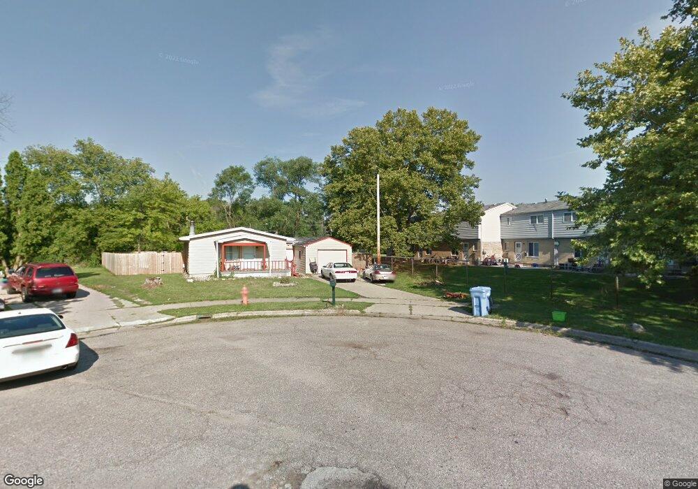
2929 Cranbrook Ave Lansing, MI 48906
Northwestside NeighborhoodEstimated Value: $146,000 - $162,916
3
Beds
2
Baths
1,152
Sq Ft
$135/Sq Ft
Est. Value
About This Home
This home is located at 2929 Cranbrook Ave, Lansing, MI 48906 and is currently estimated at $155,229, approximately $134 per square foot. 2929 Cranbrook Ave is a home located in Ingham County with nearby schools including Cumberland Elementary School, Pattengill Academy, and J.W. Sexton High School.
Ownership History
Date
Name
Owned For
Owner Type
Purchase Details
Closed on
Jul 1, 2008
Sold by
Davis Chey D and Granroth Chey D
Bought by
Nevills Amanda M and Richmond Lynda L
Current Estimated Value
Home Financials for this Owner
Home Financials are based on the most recent Mortgage that was taken out on this home.
Original Mortgage
$59,430
Outstanding Balance
$38,495
Interest Rate
6.15%
Mortgage Type
FHA
Estimated Equity
$116,734
Purchase Details
Closed on
Nov 21, 2000
Sold by
Davis Lahine Lane
Bought by
Granroth Chey D
Create a Home Valuation Report for This Property
The Home Valuation Report is an in-depth analysis detailing your home's value as well as a comparison with similar homes in the area
Home Values in the Area
Average Home Value in this Area
Purchase History
| Date | Buyer | Sale Price | Title Company |
|---|---|---|---|
| Nevills Amanda M | $60,150 | Multiple | |
| Granroth Chey D | -- | -- | |
| Estate Of Dedlarer Leggions Lahine Lane | -- | -- |
Source: Public Records
Mortgage History
| Date | Status | Borrower | Loan Amount |
|---|---|---|---|
| Open | Nevills Amanda M | $59,430 |
Source: Public Records
Tax History
| Year | Tax Paid | Tax Assessment Tax Assessment Total Assessment is a certain percentage of the fair market value that is determined by local assessors to be the total taxable value of land and additions on the property. | Land | Improvement |
|---|---|---|---|---|
| 2025 | $2,282 | $60,300 | $11,800 | $48,500 |
| 2024 | $18 | $49,800 | $11,800 | $38,000 |
| 2023 | $2,141 | $46,000 | $11,800 | $34,200 |
| 2022 | $1,932 | $40,600 | $9,800 | $30,800 |
| 2021 | $1,892 | $36,000 | $7,900 | $28,100 |
| 2020 | $1,880 | $35,200 | $7,900 | $27,300 |
| 2019 | $1,801 | $34,400 | $7,900 | $26,500 |
| 2018 | $1,690 | $31,300 | $7,900 | $23,400 |
| 2017 | $1,617 | $31,300 | $7,900 | $23,400 |
| 2016 | $1,564 | $28,400 | $7,900 | $20,500 |
| 2015 | $1,564 | $27,400 | $15,752 | $11,648 |
| 2014 | $1,564 | $27,300 | $19,847 | $7,453 |
Source: Public Records
Map
Nearby Homes
- 3733 Colchester Rd
- 2601 Newport Dr
- 3500 Colchester Rd
- 3230 Sheffer Ave
- 3304 Sheffer Ave
- 3017 Alfred Ave
- 2313 Kuerbitz Dr
- 3116 Colchester Rd
- 2206 Kuerbitz Dr
- 2300 Byrnes Rd
- 3336 Tecumseh River Rd
- 4221 N Grand River Ave
- 2302 Northwest Ave
- 1805 Boynton Dr
- 1920 Byrnes Rd
- 4005 N Grand River Ave
- 1930 Briarwood Dr
- 2800 Tecumseh River Rd
- 3723 Springbrook Ln
- Lot 1a Rachael Fairfax Dr
- 2927 Cranbrook Ave
- 2925 Cranbrook Ave
- 2923 Cranbrook Ave
- 2900 N Waverly Rd
- 3726 Delta River Dr
- 3718 Delta River Dr
- 3708 Delta River Dr
- 3700 Delta River Dr
- 2924 Cranbrook Ave
- 2920 Cranbrook Ave
- 2916 Cranbrook Ave
- 3662 Delta River Dr
- 3727 Delta River Dr
- 3658 Delta River Dr
- 3663 Delta River Dr
- 2925 Arcadia Dr
- 3715 Delta River Dr
- 3005 Arcadia Dr
- 2921 Arcadia Dr
- 3827 Delta River Dr
Your Personal Tour Guide
Ask me questions while you tour the home.