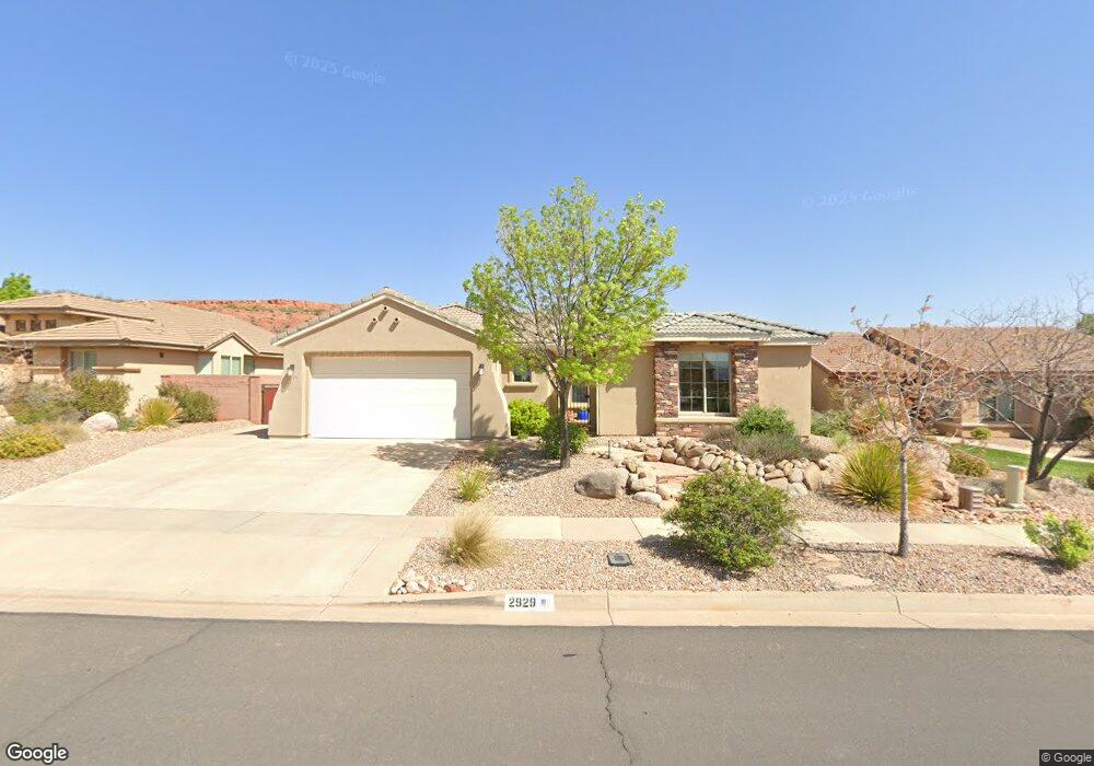
2929 E Slick Rock Rd Unit 667 Washington, UT 84780
Coral Canyon NeighborhoodEstimated Value: $548,034 - $601,000
4
Beds
2
Baths
1,756
Sq Ft
$327/Sq Ft
Est. Value
About This Home
This home is located at 2929 E Slick Rock Rd Unit 667, Washington, UT 84780 and is currently estimated at $574,517, approximately $327 per square foot. 2929 E Slick Rock Rd Unit 667 is a home located in Washington County with nearby schools including Coral Canyon School, Pine View Middle School, and Fossil Ridge Intermediate School.
Ownership History
Date
Name
Owned For
Owner Type
Purchase Details
Closed on
Feb 20, 2013
Sold by
Smith David L and Smith Mindy V
Bought by
David And Mindy Smith Family Trust and Smith David L
Current Estimated Value
Purchase Details
Closed on
Apr 17, 2006
Sold by
Smith David L and Smith Mindy V
Bought by
Smith David L and Smith Mindy
Home Financials for this Owner
Home Financials are based on the most recent Mortgage that was taken out on this home.
Original Mortgage
$58,250
Interest Rate
5.84%
Mortgage Type
Stand Alone Second
Create a Home Valuation Report for This Property
The Home Valuation Report is an in-depth analysis detailing your home's value as well as a comparison with similar homes in the area
Home Values in the Area
Average Home Value in this Area
Purchase History
| Date | Buyer | Sale Price | Title Company |
|---|---|---|---|
| David And Mindy Smith Family Trust | -- | None Available | |
| Smith David L | -- | Accommodation | |
| Smith David L | -- | Southern Utah Title Co |
Source: Public Records
Mortgage History
| Date | Status | Borrower | Loan Amount |
|---|---|---|---|
| Closed | Smith David L | $58,250 | |
| Open | Smith David L | $233,050 |
Source: Public Records
Tax History
| Year | Tax Paid | Tax Assessment Tax Assessment Total Assessment is a certain percentage of the fair market value that is determined by local assessors to be the total taxable value of land and additions on the property. | Land | Improvement |
|---|---|---|---|---|
| 2025 | $2,261 | $285,120 | $66,440 | $218,680 |
| 2023 | $2,349 | $296,285 | $60,665 | $235,620 |
| 2022 | $2,537 | $296,395 | $57,750 | $238,645 |
| 2021 | $2,229 | $393,500 | $73,500 | $320,000 |
| 2020 | $2,087 | $346,000 | $73,500 | $272,500 |
| 2019 | $2,233 | $356,300 | $73,500 | $282,800 |
| 2018 | $2,081 | $166,485 | $0 | $0 |
| 2017 | $1,858 | $140,195 | $0 | $0 |
| 2016 | $1,864 | $132,440 | $0 | $0 |
| 2015 | $1,826 | $125,840 | $0 | $0 |
| 2014 | $1,779 | $123,255 | $0 | $0 |
Source: Public Records
Map
Nearby Homes
- 2948 E Slick Rock Rd Unit 687
- 1928 N Chapman Dr
- 2872 E View Pointe Dr
- 2872 E View Pointe Dr Unit 207
- 1964 Creek Side Ct Unit 312
- 1862 N Chapman Dr
- 2914 E Chapman Cir
- 0 Leora Dr
- 1907 N Creek Side Ct
- 1757 N Summerhill Cir
- 2602 E Spring Canyon Dr Unit 749
- 1731 N Firerock Cir
- 1672 N Ranch View Dr
- 3278 E Sweetwater Springs Dr
- 3296 E Hidden Springs Dr
- 3352 E Sweetwater Springs Dr
- 2187 N Territory Canyon Dr
- 1593 N Horizon Pkwy Unit 123
- 1607 N Daylight St Unit 134
- 1579 N Horizon Pkwy Unit 124
- 2915 E Slick Rock Rd Unit 668
- 2943 E Slick Rock Rd Unit 666
- 2957 E Slick Rock Rd Unit 665
- 2924 E Autumn Rose Dr Unit 655
- 2938 E Autumn Rose Dr Unit 656
- 2889 E Slick Rock Rd Unit 670
- 2954 E Autumn Rose Dr Unit 657
- 2910 E Autumn Rose Dr
- 2971 E Slick Rock Rd Unit 664
- 2934 E Slick Rock Rd Unit 688
- 2918 E Slick Rock Rd Unit 689
- 2902 E Slick Rock Rd Unit 690
- 2962 E Slick Rock Rd Unit 686
- 2968 E Autumn Rose Dr Unit 658
- 2088 N Red Canyon Cir Unit 671
- 2985 E Slick Rock Rd Unit 663
- 2096 N Red Canyon Cir Unit 672
- 2975 E Slick Rock Rd Unit 681
- 2890 E Slick Rock Rd Unit 691
- 2906 E Autumn Rose Dr Unit 653
Your Personal Tour Guide
Ask me questions while you tour the home.