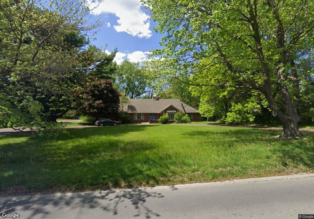
2929 Lovers Ln Saint Joseph, MO 64506
Lovers Lane NeighborhoodEstimated Value: $394,000 - $467,000
Studio
--
Bath
2,847
Sq Ft
$151/Sq Ft
Est. Value
About This Home
This home is located at 2929 Lovers Ln, Saint Joseph, MO 64506 and is currently estimated at $429,869, approximately $150 per square foot. 2929 Lovers Ln is a home located in Buchanan County with nearby schools including Field Elementary School, Bode Middle School, and Central High School.
Ownership History
Date
Name
Owned For
Owner Type
Purchase Details
Closed on
Aug 27, 2019
Sold by
Ford Peggya A
Bought by
Ford Robert M
Current Estimated Value
Purchase Details
Closed on
Dec 27, 2011
Sold by
Tr The Commerce Trust Co and Co Jacob M Ford Ii Amendment And
Bought by
Ford John J and Ford Robert M
Purchase Details
Closed on
Dec 22, 2011
Sold by
Ford Bartlett
Bought by
Ford Robert M
Create a Home Valuation Report for This Property
The Home Valuation Report is an in-depth analysis detailing your home's value as well as a comparison with similar homes in the area
Home Values in the Area
Average Home Value in this Area
Purchase History
| Date | Buyer | Sale Price | Title Company |
|---|---|---|---|
| Ford Robert M | -- | None Available | |
| Ford John J | -- | First American Title | |
| Ford Robert M | -- | First American Title |
Source: Public Records
Tax History
| Year | Tax Paid | Tax Assessment Tax Assessment Total Assessment is a certain percentage of the fair market value that is determined by local assessors to be the total taxable value of land and additions on the property. | Land | Improvement |
|---|---|---|---|---|
| 2025 | $3,455 | $50,860 | $5,130 | $45,730 |
| 2024 | $3,400 | $47,670 | $5,130 | $42,540 |
| 2023 | $3,400 | $47,670 | $5,130 | $42,540 |
| 2022 | $3,137 | $47,670 | $5,130 | $42,540 |
| 2021 | $3,151 | $47,670 | $5,130 | $42,540 |
| 2020 | $3,132 | $47,670 | $5,130 | $42,540 |
| 2019 | $3,025 | $47,670 | $5,130 | $42,540 |
| 2018 | $2,730 | $47,670 | $5,130 | $42,540 |
| 2017 | $2,704 | $47,670 | $0 | $0 |
| 2015 | $2 | $47,670 | $0 | $0 |
| 2014 | $2,966 | $47,670 | $0 | $0 |
Source: Public Records
Map
Nearby Homes
- 28 Court Ln
- 3111 Carlisle Ct
- 3109 Carlisle Ct
- 3107 Carlisle Ct
- 3117 Miller Ave
- 3413 W Colony Square
- 2634 Lucille Ave
- 2611 Parallel Ave
- 2610 Parallel Ave
- 2502 Flintstone Dr
- 3309 Mueller Ln
- 2918 Kimbrough Ln
- 3103 Cook Rd
- 2715 Cook Rd
- 00 Lot 2 Highway 169
- 4502 Orchard Rd
- 2520 N 35th St
- 3509 Robin Ln
- 2204 Ashland Ave
- 3309 Westwood Dr
Your Personal Tour Guide
Ask me questions while you tour the home.