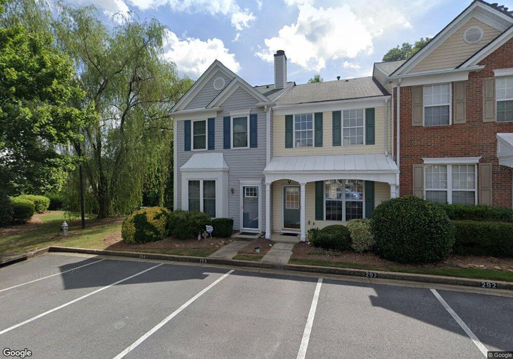
293 Devonshire Dr Unit 293 Alpharetta, GA 30022
Estimated Value: $307,000 - $323,000
2
Beds
3
Baths
1,184
Sq Ft
$264/Sq Ft
Est. Value
About This Home
This home is located at 293 Devonshire Dr Unit 293, Alpharetta, GA 30022 and is currently estimated at $312,607, approximately $264 per square foot. 293 Devonshire Dr Unit 293 is a home located in Fulton County with nearby schools including Hillside Elementary School, Holcomb Bridge Middle School, and Centennial High School.
Ownership History
Date
Name
Owned For
Owner Type
Purchase Details
Closed on
May 5, 2010
Sold by
Federal Natl Mtg Assn Fnma
Bought by
Miller Amy M
Current Estimated Value
Home Financials for this Owner
Home Financials are based on the most recent Mortgage that was taken out on this home.
Original Mortgage
$92,000
Outstanding Balance
$60,526
Interest Rate
4.99%
Mortgage Type
New Conventional
Estimated Equity
$252,081
Purchase Details
Closed on
Feb 2, 2010
Sold by
Pnc Mtg
Bought by
Federal Natl Mtg Assn Fnma
Purchase Details
Closed on
Dec 20, 2006
Sold by
Rampley Amy S
Bought by
Crawford Courtney
Home Financials for this Owner
Home Financials are based on the most recent Mortgage that was taken out on this home.
Original Mortgage
$104,800
Interest Rate
6.19%
Mortgage Type
New Conventional
Create a Home Valuation Report for This Property
The Home Valuation Report is an in-depth analysis detailing your home's value as well as a comparison with similar homes in the area
Home Values in the Area
Average Home Value in this Area
Purchase History
| Date | Buyer | Sale Price | Title Company |
|---|---|---|---|
| Miller Amy M | -- | -- | |
| Federal Natl Mtg Assn Fnma | -- | -- | |
| Pnc Mtg | $109,585 | -- | |
| Crawford Courtney | $139,900 | -- |
Source: Public Records
Mortgage History
| Date | Status | Borrower | Loan Amount |
|---|---|---|---|
| Open | Miller Amy M | $92,000 | |
| Previous Owner | Crawford Courtney | $104,800 |
Source: Public Records
Tax History
| Year | Tax Paid | Tax Assessment Tax Assessment Total Assessment is a certain percentage of the fair market value that is determined by local assessors to be the total taxable value of land and additions on the property. | Land | Improvement |
|---|---|---|---|---|
| 2025 | $599 | $122,720 | $22,520 | $100,200 |
| 2023 | $3,419 | $121,120 | $18,960 | $102,160 |
| 2022 | $2,788 | $105,960 | $17,200 | $88,760 |
| 2021 | $2,608 | $81,880 | $11,480 | $70,400 |
| 2020 | $2,515 | $76,800 | $11,360 | $65,440 |
| 2019 | $374 | $75,440 | $11,160 | $64,280 |
| 2018 | $1,735 | $61,480 | $7,400 | $54,080 |
| 2017 | $1,494 | $51,200 | $7,560 | $43,640 |
| 2016 | $1,494 | $51,200 | $7,560 | $43,640 |
| 2015 | $1,780 | $51,200 | $7,560 | $43,640 |
| 2014 | $1,170 | $38,160 | $7,960 | $30,200 |
Source: Public Records
Map
Nearby Homes
- 292 Devonshire Dr
- 205 Devonshire Dr
- 145 Riversong Dr
- 26 S Riversong Ln
- 2895 Shurburne Dr
- 44 Nesbit Place Unit 44
- 1002 Township Square
- 315 Laurel Ln
- 2880 Georgian Manor Dr
- 425 Hackberry Ln
- 420 Hackberry Ct Unit 1
- 650 Granby Hill Place
- 656 Granby Hill Place
- 135 Lazy Laurel Chase
- 220 Ridge Point Ct
- 9220 Mackinac Dr
- 160 Lazy Laurel Chase
- 105 Lazy Laurel Chase
- 480 Chimney Bluff
- 520 Niagara Cir
- 291 Devonshire Dr
- 290 Devonshire Dr
- 289 Devonshire Dr
- 294 Devonshire Dr
- 288 Devonshire Dr
- 287 Devonshire Dr
- 295 Devonshire Dr
- 295 Devonshire Dr
- 296 Devonshire Dr
- 286 Devonshire Dr Unit 286
- 285 Devonshire Dr
- 297 Devonshire Dr
- 284 Devonshire Dr
- 298 Devonshire Dr
- 283 Devonshire Dr
- 299 Devonshire Dr
- 299 Devonshire Dr Unit 299
- 282 Devonshire Dr Unit 282
- 320 Devonshire Dr
- 321 Devonshire Dr
Your Personal Tour Guide
Ask me questions while you tour the home.