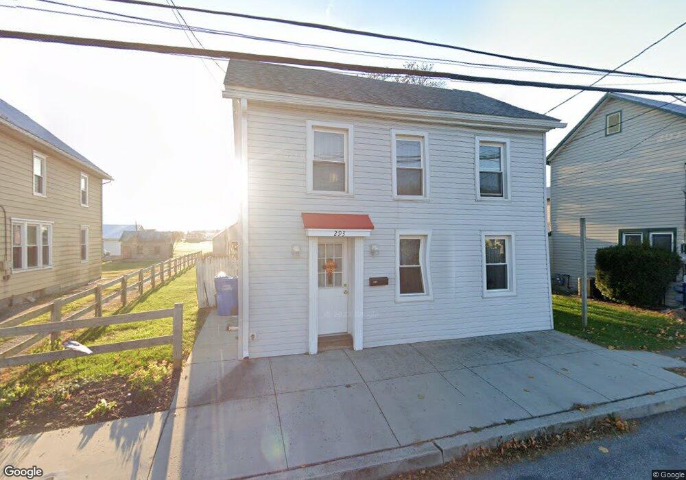
293 N Locust Point Rd New Kingstown, PA 17072
Estimated Value: $176,000 - $232,000
2
Beds
1
Bath
1,163
Sq Ft
$174/Sq Ft
Est. Value
About This Home
This home is located at 293 N Locust Point Rd, New Kingstown, PA 17072 and is currently estimated at $202,400, approximately $174 per square foot. 293 N Locust Point Rd is a home with nearby schools including Silver Spring Elementary School, Eagle View Middle School, and Cumberland Valley High School.
Ownership History
Date
Name
Owned For
Owner Type
Purchase Details
Closed on
Aug 29, 2014
Sold by
Deutsche Bank Nat Trust Co
Bought by
Gates Linden
Current Estimated Value
Purchase Details
Closed on
Nov 1, 2013
Sold by
Anderson Sheriff Ronny R and Cole Nathan R
Bought by
Deutsche Bank Natl Trust Co Tr
Purchase Details
Closed on
Aug 31, 2005
Sold by
Kieffer Larry R
Bought by
Cole Nathan R
Home Financials for this Owner
Home Financials are based on the most recent Mortgage that was taken out on this home.
Original Mortgage
$80,699
Interest Rate
5.81%
Mortgage Type
New Conventional
Create a Home Valuation Report for This Property
The Home Valuation Report is an in-depth analysis detailing your home's value as well as a comparison with similar homes in the area
Home Values in the Area
Average Home Value in this Area
Purchase History
| Date | Buyer | Sale Price | Title Company |
|---|---|---|---|
| Gates Linden | $22,000 | -- | |
| Deutsche Bank Natl Trust Co Tr | -- | -- | |
| Cole Nathan R | $100,874 | -- |
Source: Public Records
Mortgage History
| Date | Status | Borrower | Loan Amount |
|---|---|---|---|
| Previous Owner | Cole Nathan R | $80,699 |
Source: Public Records
Tax History Compared to Growth
Tax History
| Year | Tax Paid | Tax Assessment Tax Assessment Total Assessment is a certain percentage of the fair market value that is determined by local assessors to be the total taxable value of land and additions on the property. | Land | Improvement |
|---|---|---|---|---|
| 2025 | $2,007 | $124,500 | $20,600 | $103,900 |
| 2024 | $1,909 | $124,500 | $20,600 | $103,900 |
| 2023 | $1,812 | $124,500 | $20,600 | $103,900 |
| 2022 | $1,768 | $124,500 | $20,600 | $103,900 |
| 2021 | $1,730 | $124,500 | $20,600 | $103,900 |
| 2020 | $1,697 | $124,500 | $20,600 | $103,900 |
| 2019 | $1,669 | $124,500 | $20,600 | $103,900 |
| 2018 | $1,641 | $124,500 | $20,600 | $103,900 |
| 2017 | $1,612 | $124,500 | $20,600 | $103,900 |
| 2016 | -- | $124,500 | $20,600 | $103,900 |
| 2015 | -- | $124,500 | $20,600 | $103,900 |
| 2014 | -- | $124,500 | $20,600 | $103,900 |
Source: Public Records
Map
Nearby Homes
- 292 N Locust Point Rd
- 38 Ashburg Dr
- 122 Silver Cir Unit DEVONSHIRE
- 122 Silver Cir Unit HAWTHORNE
- 32 Pamela Dr
- 312 Bahama Cir
- 85 Hillside Rd
- 404 Venice Ave
- 82 Malibu Blvd
- 76 Malibu Blvd
- 506 Palm Beach Ave
- 3 Woodstock Ct
- 240 Key West Blvd
- 27 Bella Vista Dr
- 0 Northwatch Ln
- 54 Monarch Dr
- 133 Rex Dr
- 121 Rich Valley Rd
- 98 Margaret Dr
- 124 Coopers Hawk Dr
- 293 N Locust Point Rd
- 295 N Locust Point Rd
- 291 N Locust Point Rd
- 297 N Locust Point Rd
- 297 N Locust Point Rd
- 288 N Locust Point Rd
- 290 N Locust Point Rd
- 287 S Locust Point Rd
- 295 N Locust Point Rd
- 285 N Locust Point Rd
- 282 N Locust Point Rd
- 281 N Locust Point Rd
- 280 N Locust Point Rd
- 278 N Locust Point Rd
- 0 N Locust Point Rd
- 12 W Main St
- 12 W Main St
- 8 W Main St
- 19 W Main St
- 3 E Main St