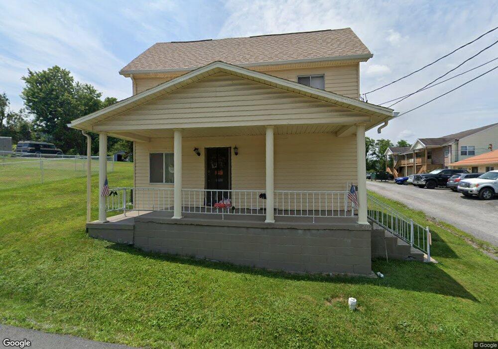
293 N Main St Morgantown, WV 26505
Estimated Value: $157,000 - $267,000
3
Beds
1
Bath
1,384
Sq Ft
$144/Sq Ft
Est. Value
About This Home
This home is located at 293 N Main St, Morgantown, WV 26505 and is currently estimated at $199,071, approximately $143 per square foot. 293 N Main St is a home located in Monongalia County with nearby schools including Suncrest Elementary School, Suncrest Middle School, and Morgantown High School.
Ownership History
Date
Name
Owned For
Owner Type
Purchase Details
Closed on
Oct 12, 2013
Sold by
Kosten Linda K
Bought by
Clover & Main Llc
Current Estimated Value
Home Financials for this Owner
Home Financials are based on the most recent Mortgage that was taken out on this home.
Original Mortgage
$100,848
Outstanding Balance
$75,838
Interest Rate
4.52%
Mortgage Type
New Conventional
Estimated Equity
$123,233
Purchase Details
Closed on
Dec 15, 2009
Sold by
West Virginia Inc
Bought by
Kosten Linda
Purchase Details
Closed on
Oct 12, 2009
Sold by
Kesner Connie
Bought by
West Virgnia Inc
Create a Home Valuation Report for This Property
The Home Valuation Report is an in-depth analysis detailing your home's value as well as a comparison with similar homes in the area
Home Values in the Area
Average Home Value in this Area
Purchase History
| Date | Buyer | Sale Price | Title Company |
|---|---|---|---|
| Clover & Main Llc | $126,060 | None Available | |
| Kosten Linda | $60,500 | None Available | |
| West Virgnia Inc | $32,525 | None Available |
Source: Public Records
Mortgage History
| Date | Status | Borrower | Loan Amount |
|---|---|---|---|
| Open | Clover & Main Llc | $100,848 |
Source: Public Records
Tax History Compared to Growth
Tax History
| Year | Tax Paid | Tax Assessment Tax Assessment Total Assessment is a certain percentage of the fair market value that is determined by local assessors to be the total taxable value of land and additions on the property. | Land | Improvement |
|---|---|---|---|---|
| 2024 | $1,688 | $64,020 | $16,320 | $47,700 |
| 2023 | $1,685 | $64,020 | $16,320 | $47,700 |
| 2022 | $1,609 | $63,120 | $16,320 | $46,800 |
| 2021 | $1,616 | $63,120 | $16,320 | $46,800 |
| 2020 | $1,621 | $63,120 | $16,320 | $46,800 |
| 2019 | $1,631 | $63,120 | $16,320 | $46,800 |
| 2018 | $1,635 | $63,120 | $16,320 | $46,800 |
| 2017 | $1,473 | $56,640 | $15,360 | $41,280 |
| 2016 | $1,449 | $55,440 | $14,160 | $41,280 |
| 2015 | $1,366 | $54,180 | $12,900 | $41,280 |
| 2014 | $1,275 | $52,500 | $11,820 | $40,680 |
Source: Public Records
Map
Nearby Homes
- 1477 Center Hill Ave
- 1485 Center Hill Ave
- 395 Kensington Ave
- 1358 Bitonti St
- 1356 Bitonti St
- 440 Herman Ave
- 441 Kensington Ave
- 429 Mansfield Ave
- 99 Scotts Run Rd
- 1397 Fairfield St
- 532 & 532 1/2 Herman Ave
- 1205 University Commons Dr
- 1448 Main St
- 7205 University Commons Dr
- 00 Scotts Run Rd
- 3233 University Ave
- 560 Plymouth Ave
- 1232 Lions Ave
- 119 Jespy Dr
- 159 Main St
- 289 N Main St
- 292 Normandy St
- 288 Normandy St
- 257 N Main St
- 1486 Clover St
- 280 N Main St
- 289 Sherwood St
- 1476 Saratoga Ave
- 1472 Saratoga Ave
- 268 N Main St
- 1460 Saratoga Ave
- 288 Sherwood St Unit A
- 288 Sherwood St Unit C
- 288 Sherwood St
- 272 Normandy St
- 284 Sherwood St
- 268 Normandy St
- 1467 Saratoga Ave
- 274 Sherwood St
- 253 N Main St