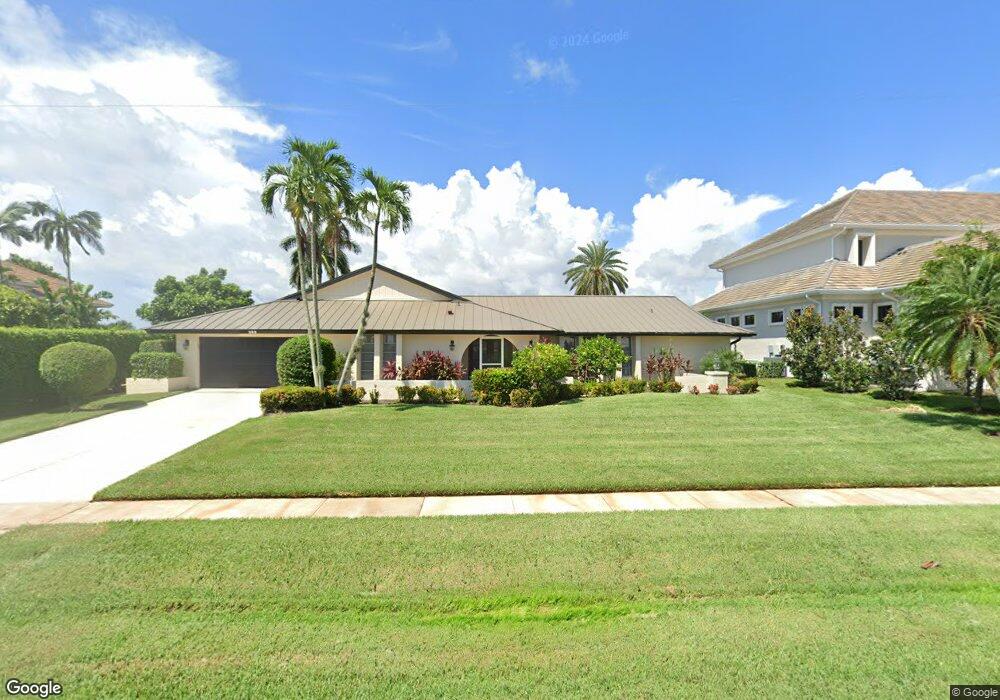
293 Polynesia Ct Marco Island, FL 34145
Estimated Value: $1,913,000 - $3,702,000
4
Beds
3
Baths
2,583
Sq Ft
$1,031/Sq Ft
Est. Value
About This Home
This home is located at 293 Polynesia Ct, Marco Island, FL 34145 and is currently estimated at $2,662,343, approximately $1,030 per square foot. 293 Polynesia Ct is a home located in Collier County with nearby schools including Tommie Barfield Elementary School, Manatee Middle School, and Lely High School.
Ownership History
Date
Name
Owned For
Owner Type
Purchase Details
Closed on
Aug 31, 2023
Sold by
Montgomery Marilyn S
Bought by
Montgomery Marilyn S and Patton Mindy C
Current Estimated Value
Purchase Details
Closed on
Apr 12, 2017
Sold by
Montgomery Marilyn S and Montgomery Charles E
Bought by
Montgomery Charles E and Montgomery Marilyn S
Purchase Details
Closed on
Aug 29, 2003
Sold by
Montgomery Charles E
Bought by
Montgomery Marilyn S
Purchase Details
Closed on
Mar 31, 2000
Sold by
Good Earth Land L L C
Bought by
Montgomery Charles E and Montgomery Marilyn S
Purchase Details
Closed on
Jul 9, 1999
Sold by
Denny Robert F
Bought by
Good Earth Land L L C
Create a Home Valuation Report for This Property
The Home Valuation Report is an in-depth analysis detailing your home's value as well as a comparison with similar homes in the area
Home Values in the Area
Average Home Value in this Area
Purchase History
| Date | Buyer | Sale Price | Title Company |
|---|---|---|---|
| Montgomery Marilyn S | -- | None Listed On Document | |
| Montgomery Charles E | -- | Attorney | |
| Montgomery Marilyn S | -- | -- | |
| Montgomery Charles E | $830,000 | -- | |
| Good Earth Land L L C | $725,000 | -- |
Source: Public Records
Tax History
| Year | Tax Paid | Tax Assessment Tax Assessment Total Assessment is a certain percentage of the fair market value that is determined by local assessors to be the total taxable value of land and additions on the property. | Land | Improvement |
|---|---|---|---|---|
| 2025 | $9,106 | $1,042,428 | -- | -- |
| 2024 | $31,522 | $1,013,050 | -- | -- |
| 2023 | $31,522 | $3,327,809 | $3,076,091 | $251,718 |
| 2022 | $9,518 | $954,897 | $0 | $0 |
| 2021 | $9,839 | $927,084 | $0 | $0 |
| 2020 | $9,649 | $914,284 | $0 | $0 |
| 2019 | $8,825 | $823,422 | $0 | $0 |
| 2018 | $8,673 | $808,069 | $0 | $0 |
| 2017 | $9,387 | $863,034 | $0 | $0 |
| 2016 | $9,293 | $845,283 | $0 | $0 |
| 2015 | $9,481 | $839,407 | $0 | $0 |
| 2014 | $9,507 | $782,745 | $0 | $0 |
Source: Public Records
Map
Nearby Homes
- 287 Polynesia Ct
- 305 Polynesia Ct
- 290 Polynesia Ct
- 1791 Barbados Ave
- 275 Polynesia Ct
- 1790 Barbados Ave
- 313 Polynesia Ct
- 278 Polynesia Ct
- 318 Polynesia Ct
- 1781 Barbados Ave
- 287 Meadowlark Ct Unit 2
- 272 Polynesia Ct
- 1780 Barbados Ave
- 275 Meadowlark Ct
- 326 Polynesia Ct
- 329 Polynesia Ct
- 263 Meadowlark Ct
- 353 Polynesia Ct
- 313 Meadowlark Ct
- 0 Meadowlark Ct
Your Personal Tour Guide
Ask me questions while you tour the home.