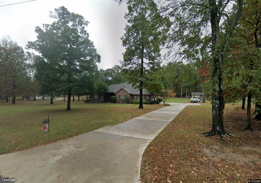
293 Stable Rd Ruston, LA 71270
Estimated Value: $325,000 - $380,859
3
Beds
2
Baths
2,078
Sq Ft
$167/Sq Ft
Est. Value
About This Home
This home is located at 293 Stable Rd, Ruston, LA 71270 and is currently estimated at $346,215, approximately $166 per square foot. 293 Stable Rd is a home located in Lincoln Parish with nearby schools including Choudrant Elementary School, Choudrant High School, and Ruston Junior High School.
Ownership History
Date
Name
Owned For
Owner Type
Purchase Details
Closed on
Aug 3, 2005
Sold by
Spiller Jerry Wade and Spiller Maxine Elizabeth Brannan
Bought by
Maxwell Willis Keith and Maxwell Therisa Dian
Current Estimated Value
Create a Home Valuation Report for This Property
The Home Valuation Report is an in-depth analysis detailing your home's value as well as a comparison with similar homes in the area
Purchase History
| Date | Buyer | Sale Price | Title Company |
|---|---|---|---|
| Maxwell Willis Keith | $25,000 | None Available |
Source: Public Records
Tax History
| Year | Tax Paid | Tax Assessment Tax Assessment Total Assessment is a certain percentage of the fair market value that is determined by local assessors to be the total taxable value of land and additions on the property. | Land | Improvement |
|---|---|---|---|---|
| 2025 | $2,664 | $33,559 | $6,310 | $27,249 |
| 2024 | $2,664 | $33,559 | $6,310 | $27,249 |
| 2023 | $2,231 | $26,852 | $2,882 | $23,970 |
| 2022 | $2,216 | $26,852 | $2,882 | $23,970 |
| 2021 | $2,180 | $26,852 | $2,882 | $23,970 |
| 2020 | $2,168 | $26,637 | $2,882 | $23,755 |
| 2019 | $2,280 | $27,654 | $2,882 | $24,772 |
| 2018 | $2,281 | $27,654 | $2,882 | $24,772 |
| 2017 | $2,287 | $27,654 | $2,882 | $24,772 |
| 2016 | $2,334 | $0 | $0 | $0 |
| 2015 | $2,442 | $26,816 | $2,681 | $24,135 |
| 2013 | $2,359 | $25,489 | $2,681 | $22,808 |
Source: Public Records
Map
Nearby Homes
- 145 Woodshire Ln
- 0 Stable Run Cir
- 197 Baxter Rd
- 173 Oak Alley Dr
- 135 Camillia Cir
- 634 Cheatwood Rd
- 0 Spillers Rd
- 209 Burgessville Rd
- 294 Moody Rd
- 150 Burgessville Rd
- 128 Marlou Cir
- 144 Creeks Crossing
- 155 Creekside Dr
- 00 Cheatwood Rd
- 1950 Louisiana 821
- 641 Goodgoin Rd
- 201 Vintage Ln
- 185 Mount Harmony Church Rd
- Lot 1B Unit 1 Harmony Church Rd
- 2420 Highway 33
- 305 Stable Rd
- 000 Stable Rd
- 265 Stable Rd
- 115 Wildflower Dr
- 257 Stable Rd
- 351 Stable Rd
- 182 Wildflower Dr
- 140 Wildflower Dr
- 237 Stable Rd
- 214 Par Road 441
- 177 Wildflower Dr
- 173 Wildflower Dr
- 359 Stable Rd
- 166 Wildflower Dr
- 375 Stable Rd
- 393 Stable Rd
- 161 Myrtis Dr
- 211 Branch Ln
- 125 Lavena Ln
- 136 Twin Oaks Ln
Your Personal Tour Guide
Ask me questions while you tour the home.