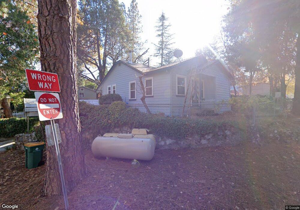
2930 Anderson Way Placerville, CA 95667
Estimated Value: $256,178 - $386,000
1
Bed
1
Bath
718
Sq Ft
$457/Sq Ft
Est. Value
About This Home
This home is located at 2930 Anderson Way, Placerville, CA 95667 and is currently estimated at $327,795, approximately $456 per square foot. 2930 Anderson Way is a home located in El Dorado County with nearby schools including El Dorado High School, Country Day Montessori, and El Dorado Adventist School.
Ownership History
Date
Name
Owned For
Owner Type
Purchase Details
Closed on
Apr 16, 1999
Sold by
Driscoll Edward D
Bought by
Driscoll Edward D
Current Estimated Value
Home Financials for this Owner
Home Financials are based on the most recent Mortgage that was taken out on this home.
Original Mortgage
$96,390
Outstanding Balance
$24,530
Interest Rate
7.1%
Mortgage Type
VA
Estimated Equity
$303,265
Purchase Details
Closed on
Oct 5, 1998
Sold by
Foley Ann W M
Bought by
Driscoll Edward D
Purchase Details
Closed on
May 3, 1994
Sold by
Tipane Gregory A and Tipane Laura M
Bought by
Foley Ann W M
Home Financials for this Owner
Home Financials are based on the most recent Mortgage that was taken out on this home.
Original Mortgage
$91,800
Interest Rate
8.1%
Mortgage Type
Assumption
Create a Home Valuation Report for This Property
The Home Valuation Report is an in-depth analysis detailing your home's value as well as a comparison with similar homes in the area
Home Values in the Area
Average Home Value in this Area
Purchase History
We collect this data history from publicly available records. To have your information removed, we recommend requesting removal directly through your county’s website.
| Date | Buyer | Sale Price | Title Company |
|---|---|---|---|
| Driscoll Edward D | -- | First American Title Ins Co | |
| Driscoll Edward D | -- | -- | |
| Foley Ann W M | $90,000 | Inter County Title Co |
Source: Public Records
Mortgage History
We collect this data history from publicly available records. To have your information removed, we recommend requesting removal directly through your county’s website.
| Date | Status | Borrower | Loan Amount |
|---|---|---|---|
| Open | Driscoll Edward D | $96,390 | |
| Previous Owner | Foley Ann W M | $91,800 |
Source: Public Records
Tax History
| Year | Tax Paid | Tax Assessment Tax Assessment Total Assessment is a certain percentage of the fair market value that is determined by local assessors to be the total taxable value of land and additions on the property. | Land | Improvement |
|---|---|---|---|---|
| 2025 | $1,298 | $122,248 | $39,180 | $83,068 |
| 2024 | $1,298 | $119,852 | $38,412 | $81,440 |
| 2023 | $1,283 | $117,503 | $37,659 | $79,844 |
| 2022 | $1,266 | $115,200 | $36,921 | $78,279 |
| 2021 | $1,252 | $112,943 | $36,198 | $76,745 |
| 2020 | $1,234 | $111,786 | $35,827 | $75,959 |
| 2019 | $1,219 | $109,595 | $35,125 | $74,470 |
| 2018 | $1,183 | $107,447 | $34,437 | $73,010 |
| 2017 | $1,166 | $105,341 | $33,762 | $71,579 |
| 2016 | $1,149 | $103,276 | $33,100 | $70,176 |
| 2015 | $1,098 | $101,726 | $32,603 | $69,123 |
| 2014 | $1,098 | $99,735 | $31,965 | $67,770 |
Source: Public Records
Map
Nearby Homes
- 2940 Anderson Way
- 2873 Anderson Way
- 2725 Clay St
- 2921 Miller Way
- 2852 Hocking St
- 1017 Utah Dr
- 1000 Utah Dr
- 1002 Utah Dr
- 1008 Utah Dr
- 2911 Clay St
- 1344 Village Ln
- 678 Main St
- 945 Crawford Drift Ct
- 944 Crawford Drift Ct
- 1380 Katie Ln
- 0 Lincoln Aly
- 2532 Golden Eagle Dr
- 2655 Mona Dr
- 3072 Spanish Ravine Rd
- 8325 County Rd M44
- 2910 Anderson Way
- 2914 Anderson Way
- 2873 Willow St
- 2869 Willow St
- 2929 Anderson Way
- 2904 Anderson Way
- 2879 Willow St
- 2915 Anderson Way
- 2919 Anderson Way
- 2911 Anderson Way
- 2905 Anderson Way
- 2870 Willow St
- 2901 Anderson Way
- 2864 Willow St
- 1102 Anderson Ct
- 0 Anderson Way Unit 221020619
- 0 Anderson Way
- 2897 Anderson Way
- 2816 Pennsylvania Ct
- 1113 Anderson Ct
Your Personal Tour Guide
Ask me questions while you tour the home.