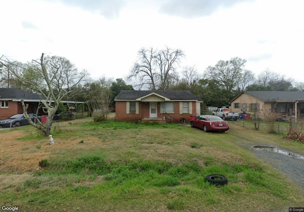
2932 Alfred Dr Macon, GA 31206
Estimated Value: $76,949 - $95,000
2
Beds
1
Bath
952
Sq Ft
$88/Sq Ft
Est. Value
About This Home
This home is located at 2932 Alfred Dr, Macon, GA 31206 and is currently estimated at $83,487, approximately $87 per square foot. 2932 Alfred Dr is a home located in Bibb County with nearby schools including Veterans Elementary School, Southwest High School, and Gilead Christian Academy.
Ownership History
Date
Name
Owned For
Owner Type
Purchase Details
Closed on
Apr 10, 2025
Sold by
Smith Betty L
Bought by
Smith Gregory Darnell and Smith Travis Chandler
Current Estimated Value
Purchase Details
Closed on
Jul 19, 2024
Sold by
Smith Gregory Darnell
Bought by
Smith Betty L and Smith Gregory Darnell
Purchase Details
Closed on
Dec 23, 1990
Sold by
Bank South Macon 1913/201
Bought by
Donaldson Bobby M and Donaldson Mildred
Create a Home Valuation Report for This Property
The Home Valuation Report is an in-depth analysis detailing your home's value as well as a comparison with similar homes in the area
Home Values in the Area
Average Home Value in this Area
Purchase History
| Date | Buyer | Sale Price | Title Company |
|---|---|---|---|
| Smith Gregory Darnell | -- | None Listed On Document | |
| Smith Betty L | -- | None Listed On Document | |
| Smith Betty L | -- | None Listed On Document | |
| Donaldson Bobby M | $28,000 | -- |
Source: Public Records
Tax History Compared to Growth
Tax History
| Year | Tax Paid | Tax Assessment Tax Assessment Total Assessment is a certain percentage of the fair market value that is determined by local assessors to be the total taxable value of land and additions on the property. | Land | Improvement |
|---|---|---|---|---|
| 2025 | $630 | $25,629 | $3,000 | $22,629 |
| 2024 | $651 | $25,629 | $3,000 | $22,629 |
| 2023 | $575 | $19,422 | $2,400 | $17,022 |
| 2022 | $557 | $16,085 | $3,194 | $12,891 |
| 2021 | $454 | $11,939 | $2,236 | $9,703 |
| 2020 | $331 | $8,528 | $1,597 | $6,931 |
| 2019 | $334 | $8,528 | $1,597 | $6,931 |
| 2018 | $539 | $8,473 | $1,597 | $6,876 |
| 2017 | $317 | $8,473 | $1,597 | $6,876 |
| 2016 | $292 | $8,425 | $1,597 | $6,828 |
| 2015 | $413 | $8,425 | $1,597 | $6,828 |
| 2014 | $158 | $8,425 | $1,597 | $6,828 |
Source: Public Records
Map
Nearby Homes
- 2972 Richard Dr
- 3078 Alfred Dr
- 2770 Bonnie Ave
- 2769 Nancy Dr
- 2768 Nancy Dr
- 2995 Virginia Dr
- 2801 Deeb Dr
- 2868 Barrett Ave
- 2960 Jadan Place
- 2704 Reynolds Dr
- 5711 Sterling Place
- 5746 Sterling Place
- 5756 Edwina Dr
- 5780 Edwina Dr
- 2830 Village Green Dr
- 2824 Village Green Dr
- 2841 Shamrock Dr
- 2775 Village Green Ln
- 5771 Satterfield Dr
- 2924 Alfred Dr
- 2940 Alfred Dr
- 2946 Alfred Dr
- 2916 Alfred Dr
- 2931 Richard Dr
- 2939 Richard Dr
- 2923 Richard Dr
- 2958 Alfred Dr
- 2910 Alfred Dr
- 2947 Richard Dr
- 2947 Richard Dr Unit Land
- 2917 Richard Dr
- 2929 Alfred Dr
- 2937 Alfred Dr
- 2921 Alfred Dr
- 2945 Alfred Dr
- 2913 Alfred Dr
- 2959 Richard Dr
- 2911 Richard Dr
- 2970 Alfred Dr