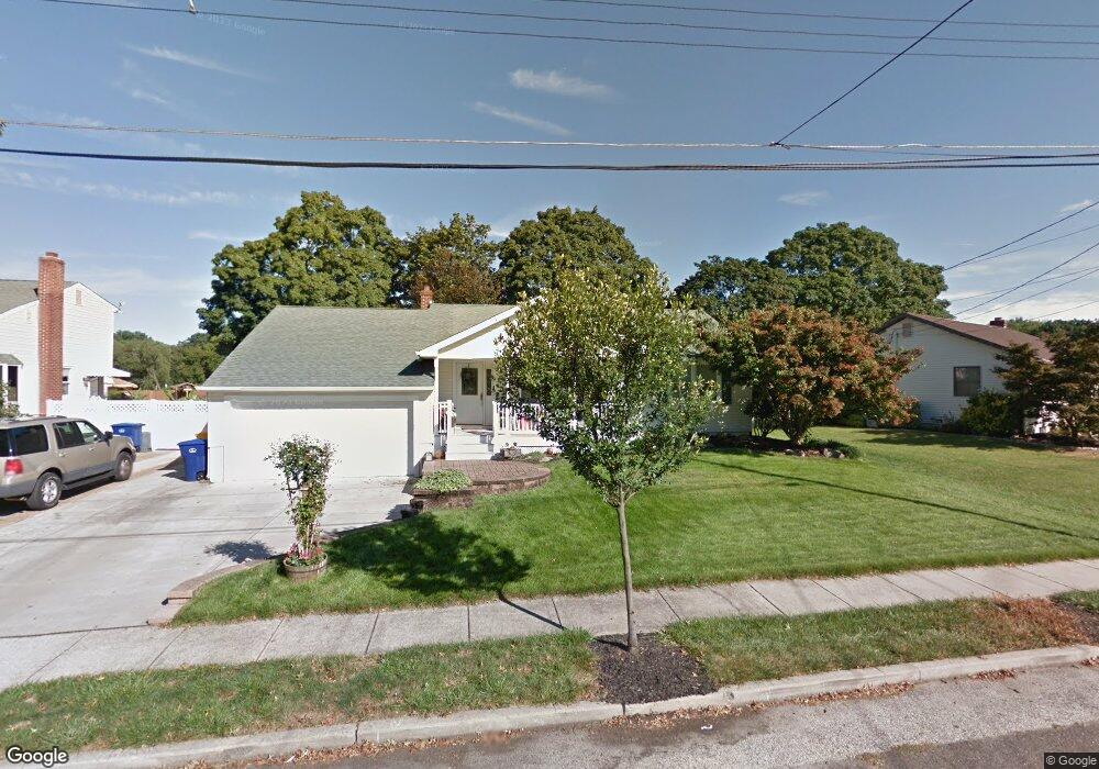
2932 Colgate Ave Delanco, NJ 08075
Estimated Value: $329,000 - $348,000
Studio
--
Bath
1,247
Sq Ft
$272/Sq Ft
Est. Value
About This Home
This home is located at 2932 Colgate Ave, Delanco, NJ 08075 and is currently estimated at $339,619, approximately $272 per square foot. 2932 Colgate Ave is a home located in Burlington County with nearby schools including M. Joan Pearson Elementary School, Walnut Street Middle School, and Benjamin Banneker Prep Charter School.
Ownership History
Date
Name
Owned For
Owner Type
Purchase Details
Closed on
Feb 26, 2024
Sold by
Mitchell Russell E and Mitchell Debra A
Bought by
Mitchell Wiley James and Mitchell Kailee Elizabeth
Current Estimated Value
Home Financials for this Owner
Home Financials are based on the most recent Mortgage that was taken out on this home.
Original Mortgage
$272,000
Outstanding Balance
$267,450
Interest Rate
6.6%
Mortgage Type
New Conventional
Estimated Equity
$72,169
Purchase Details
Closed on
Sep 27, 1989
Bought by
Mitchell Russel E and Mitchell Debra A
Create a Home Valuation Report for This Property
The Home Valuation Report is an in-depth analysis detailing your home's value as well as a comparison with similar homes in the area
Home Values in the Area
Average Home Value in this Area
Purchase History
| Date | Buyer | Sale Price | Title Company |
|---|---|---|---|
| Mitchell Wiley James | $320,000 | Hunter Title | |
| Mitchell Russel E | $106,000 | -- |
Source: Public Records
Mortgage History
| Date | Status | Borrower | Loan Amount |
|---|---|---|---|
| Open | Mitchell Wiley James | $272,000 |
Source: Public Records
Tax History
| Year | Tax Paid | Tax Assessment Tax Assessment Total Assessment is a certain percentage of the fair market value that is determined by local assessors to be the total taxable value of land and additions on the property. | Land | Improvement |
|---|---|---|---|---|
| 2025 | $6,916 | $196,600 | $48,300 | $148,300 |
| 2024 | $6,938 | $196,600 | $48,300 | $148,300 |
| 2023 | $6,938 | $196,600 | $48,300 | $148,300 |
| 2022 | $6,779 | $196,600 | $48,300 | $148,300 |
| 2021 | $6,757 | $196,600 | $48,300 | $148,300 |
| 2020 | $6,653 | $196,600 | $48,300 | $148,300 |
| 2019 | $6,468 | $196,600 | $48,300 | $148,300 |
| 2018 | $6,338 | $196,600 | $48,300 | $148,300 |
| 2017 | $6,218 | $196,600 | $48,300 | $148,300 |
| 2016 | $6,036 | $196,600 | $48,300 | $148,300 |
| 2015 | $5,935 | $196,600 | $48,300 | $148,300 |
| 2014 | $5,786 | $196,600 | $48,300 | $148,300 |
Source: Public Records
Map
Nearby Homes
- 390 Wheatley Ave
- 410 Illinois Ave
- 421 Lee Ave
- 610 Lee Ave
- 13 River Ln Unit V13
- 6 Fawn Ct Unit Z6
- 617 3rd St
- 19 Fox Ct Unit EE19
- 400 Magnolia St
- 22 River Ln Unit FF22
- 530 Magnolia St
- 301 Broad St
- 740 Perkins Ln
- 32 Quail Dr
- 509 Laurel St
- 213 Laurel St
- 2201 Burlington Ave
- 504 Bridge St
- 310 Front St
- 104B King St
- 2926 Colgate Ave
- 2942 Colgate Ave
- 2918 Colgate Ave
- 2933 Colgate Ave
- 2943 Colgate Ave
- 2925 Colgate Ave
- 1079 Detwiler Ave
- 2912 Colgate Ave
- 2919 Colgate Ave
- 1080 Detwiler Ave
- 1080 Nichols Ave
- 2936 Goucher Ave
- 2930 Goucher Ave
- 1071 Detwiler Ave
- 2924 Goucher Ave
- 2909 Colgate Ave
- 1079 Ashton Ave
- 1072 Detwiler Ave
- 2900 Colgate Ave
- 2918 Goucher Ave
Your Personal Tour Guide
Ask me questions while you tour the home.