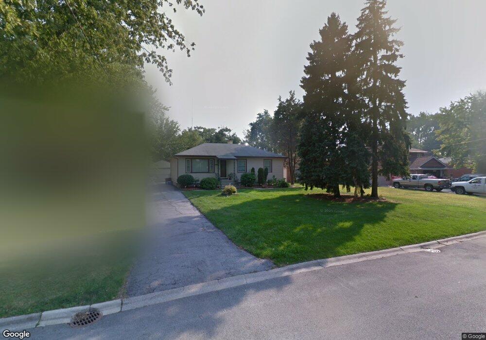
2933 172nd St Lansing, IL 60438
Estimated Value: $191,000 - $263,000
3
Beds
3
Baths
1,375
Sq Ft
$163/Sq Ft
Est. Value
About This Home
This home is located at 2933 172nd St, Lansing, IL 60438 and is currently estimated at $224,066, approximately $162 per square foot. 2933 172nd St is a home located in Cook County with nearby schools including Reavis Elementary School, Memorial Jr High School, and Thornton Fractnl So High School.
Ownership History
Date
Name
Owned For
Owner Type
Purchase Details
Closed on
Aug 1, 2005
Sold by
Ormsby Edward and Strubin Ceen
Bought by
Hawkins Twane
Current Estimated Value
Home Financials for this Owner
Home Financials are based on the most recent Mortgage that was taken out on this home.
Original Mortgage
$159,710
Outstanding Balance
$85,134
Interest Rate
5.89%
Mortgage Type
FHA
Estimated Equity
$138,932
Purchase Details
Closed on
Jul 2, 2001
Sold by
Burnett Mary
Bought by
Ormsby Edward and Strubin Ceen
Home Financials for this Owner
Home Financials are based on the most recent Mortgage that was taken out on this home.
Original Mortgage
$142,486
Interest Rate
7.14%
Mortgage Type
FHA
Purchase Details
Closed on
Sep 23, 1998
Sold by
Winblad Joseph H and Winblad Susan V
Bought by
Burnett Mary
Home Financials for this Owner
Home Financials are based on the most recent Mortgage that was taken out on this home.
Original Mortgage
$108,000
Interest Rate
6.98%
Create a Home Valuation Report for This Property
The Home Valuation Report is an in-depth analysis detailing your home's value as well as a comparison with similar homes in the area
Home Values in the Area
Average Home Value in this Area
Purchase History
| Date | Buyer | Sale Price | Title Company |
|---|---|---|---|
| Hawkins Twane | $162,000 | First American Title | |
| Ormsby Edward | $144,500 | Lawyers Title Insurance Corp | |
| Burnett Mary | $135,000 | -- |
Source: Public Records
Mortgage History
| Date | Status | Borrower | Loan Amount |
|---|---|---|---|
| Open | Hawkins Twane | $159,710 | |
| Previous Owner | Ormsby Edward | $142,486 | |
| Previous Owner | Burnett Mary | $108,000 |
Source: Public Records
Tax History Compared to Growth
Tax History
| Year | Tax Paid | Tax Assessment Tax Assessment Total Assessment is a certain percentage of the fair market value that is determined by local assessors to be the total taxable value of land and additions on the property. | Land | Improvement |
|---|---|---|---|---|
| 2024 | $6,587 | $17,005 | $8,505 | $8,500 |
| 2023 | $5,485 | $19,582 | $11,082 | $8,500 |
| 2022 | $5,485 | $14,597 | $9,696 | $4,901 |
| 2021 | $5,437 | $14,596 | $9,696 | $4,900 |
| 2020 | $6,743 | $14,596 | $9,696 | $4,900 |
| 2019 | $7,219 | $16,109 | $9,003 | $7,106 |
| 2018 | $7,082 | $16,109 | $9,003 | $7,106 |
| 2017 | $8,309 | $18,101 | $9,003 | $9,098 |
| 2016 | $6,318 | $14,051 | $8,311 | $5,740 |
| 2015 | $5,806 | $14,051 | $8,311 | $5,740 |
| 2014 | $5,753 | $14,051 | $8,311 | $5,740 |
| 2013 | $4,360 | $12,313 | $8,311 | $4,002 |
Source: Public Records
Map
Nearby Homes
- 17157 Chicago Ave
- 17303 Chicago Ave
- 17130 Park Ave
- 2950 Bernice Rd
- 2830 Bernice Rd
- 17002 Chicago Ave
- 3026 Bernice Rd Unit 308
- 17048 Lorenz Ave
- 17137 Greenbay Ave
- 3425 Bernice Ave
- 17153 Burnham Ave
- 3127 Bernice Rd Unit 2
- 3127 Bernice Rd Unit 6
- 17132 Walter St
- 17318 Walter St
- 17157 Walter St
- 17153 Walter St
- 17415 Burnham Ave
- 17303 Roy St
- 17419 Walter St
- 2931 172nd St
- 2937 172nd St
- 2925 172nd St
- 2941 172nd St
- 17158 Ridgewood Ave
- 17157 Ridgewood Ave
- 2921 172nd St
- 17154 Ridgewood Ave
- 17153 Ridgewood Ave
- 17204 Chicago Ave
- 2917 172nd St
- 17210 Chicago Ave
- 17148 Ridgewood Ave
- 17216 Chicago Ave
- 17179 Ridgewood Ave
- 17222 Chicago Ave
- 17158 Chicago Ave
- 17153 Oakwood Ave
- 17144 Ridgewood Ave
- 17154 Chicago Ave