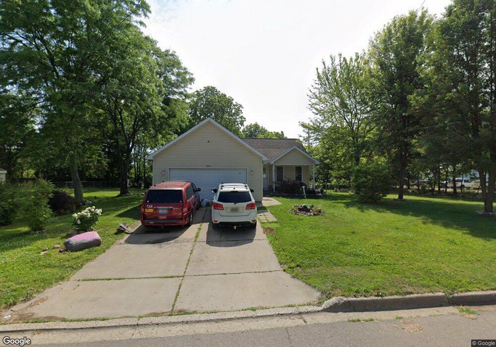
2933 Emerald Dr Kalamazoo, MI 49001
Milwood NeighborhoodEstimated Value: $244,000 - $261,406
3
Beds
2
Baths
1,269
Sq Ft
$198/Sq Ft
Est. Value
About This Home
This home is located at 2933 Emerald Dr, Kalamazoo, MI 49001 and is currently estimated at $251,352, approximately $198 per square foot. 2933 Emerald Dr is a home located in Kalamazoo County with nearby schools including Edison Environmental Science Academy, Milwood Magnet School, and Loy Norrix High School.
Ownership History
Date
Name
Owned For
Owner Type
Purchase Details
Closed on
Mar 12, 2013
Sold by
Martin Teddie M
Bought by
Martin Teddie M and Trainer Verle J
Current Estimated Value
Home Financials for this Owner
Home Financials are based on the most recent Mortgage that was taken out on this home.
Original Mortgage
$64,900
Outstanding Balance
$45,757
Interest Rate
3.52%
Mortgage Type
New Conventional
Estimated Equity
$205,595
Purchase Details
Closed on
Jan 13, 2005
Sold by
Anderson Theodore H and Anderson Ted
Bought by
Martin Teddie M
Home Financials for this Owner
Home Financials are based on the most recent Mortgage that was taken out on this home.
Original Mortgage
$70,000
Interest Rate
5.83%
Mortgage Type
Purchase Money Mortgage
Create a Home Valuation Report for This Property
The Home Valuation Report is an in-depth analysis detailing your home's value as well as a comparison with similar homes in the area
Home Values in the Area
Average Home Value in this Area
Purchase History
We collect this data history from publicly available records. To have your information removed, we recommend requesting removal directly through your county’s website.
| Date | Buyer | Sale Price | Title Company |
|---|---|---|---|
| Martin Teddie M | -- | Devon Title Company | |
| Martin Teddie M | $135,000 | Chicago Title |
Source: Public Records
Mortgage History
We collect this data history from publicly available records. To have your information removed, we recommend requesting removal directly through your county’s website.
| Date | Status | Borrower | Loan Amount |
|---|---|---|---|
| Open | Martin Teddie M | $64,900 | |
| Closed | Martin Teddie M | $70,000 |
Source: Public Records
Tax History
| Year | Tax Paid | Tax Assessment Tax Assessment Total Assessment is a certain percentage of the fair market value that is determined by local assessors to be the total taxable value of land and additions on the property. | Land | Improvement |
|---|---|---|---|---|
| 2025 | $2,124 | $147,500 | $0 | $0 |
| 2024 | $2,139 | $138,300 | $0 | $0 |
| 2023 | $2,800 | $119,800 | $0 | $0 |
| 2022 | $3,348 | $106,400 | $0 | $0 |
| 2021 | $3,238 | $99,800 | $0 | $0 |
| 2020 | $3,171 | $92,300 | $0 | $0 |
| 2019 | $2,971 | $79,500 | $0 | $0 |
| 2018 | $2,902 | $71,900 | $0 | $0 |
| 2017 | $2,979 | $67,400 | $0 | $0 |
| 2016 | $2,979 | $65,100 | $0 | $0 |
| 2015 | $2,979 | $62,600 | $0 | $0 |
| 2014 | $2,979 | $61,400 | $0 | $0 |
Source: Public Records
Map
Nearby Homes
- 3116 Whittier Dr
- 2211 Roseland Ave
- 1615 Homecrest Ave
- 1706 Miller Rd
- 1422 Reycraft Dr
- 1528 Roseland Ave
- 3129 Harvard St
- 1901 Fulton St
- 1334 Homecrest Ave
- 2022 Paddington Rd
- 1412 Winton Ave
- 1227 Reycraft Dr
- 1216 Southern Ave
- 3635 E Cork St
- 1103 Vassar Dr
- 1412 E Alcott St
- 2012 March St
- 1215 Palmer Ave
- 910 Miller Rd
- 1816 Bloomfield Ave
- 3009 Emerald Dr
- 2911 Emerald Dr
- 2930 Emerald Dr
- 3006 Emerald Dr
- 2928 Emerald Dr
- 3012 Emerald Dr
- 3023 Emerald Dr
- 3025 Emerald Dr
- 3016 Emerald Dr
- 2922 Emerald Dr
- 2907 Emerald Dr
- 3020 Emerald Dr
- 2914 Emerald Dr
- 2933 Nellbert St
- 3005 Nellbert St
- 2927 Nellbert St
- 3042 Emerald Dr
- 3011 Nellbert St
- 2908 Emerald Dr
- 3017 Nellbert St
Your Personal Tour Guide
Ask me questions while you tour the home.