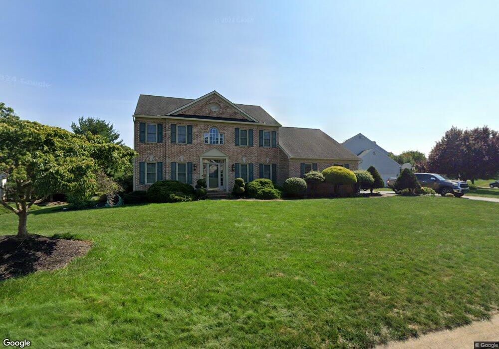
2934 Hearthside Ln Lancaster, PA 17601
East Hempfield NeighborhoodEstimated Value: $567,273 - $622,000
4
Beds
3
Baths
2,347
Sq Ft
$253/Sq Ft
Est. Value
About This Home
This home is located at 2934 Hearthside Ln, Lancaster, PA 17601 and is currently estimated at $593,568, approximately $252 per square foot. 2934 Hearthside Ln is a home located in Lancaster County with nearby schools including Centerville Elementary School, Centerville Middle School, and Hempfield High School.
Ownership History
Date
Name
Owned For
Owner Type
Purchase Details
Closed on
Jul 24, 2020
Sold by
Tollinger Thomas M and Tollinger Joan E
Bought by
Chau Nang Q and Chau Cecilia V
Current Estimated Value
Home Financials for this Owner
Home Financials are based on the most recent Mortgage that was taken out on this home.
Original Mortgage
$316,800
Outstanding Balance
$280,391
Interest Rate
3%
Mortgage Type
New Conventional
Estimated Equity
$313,177
Create a Home Valuation Report for This Property
The Home Valuation Report is an in-depth analysis detailing your home's value as well as a comparison with similar homes in the area
Home Values in the Area
Average Home Value in this Area
Purchase History
| Date | Buyer | Sale Price | Title Company |
|---|---|---|---|
| Chau Nang Q | $396,000 | Nova Abstract Llc East Hempf |
Source: Public Records
Mortgage History
| Date | Status | Borrower | Loan Amount |
|---|---|---|---|
| Open | Chau Nang Q | $316,800 |
Source: Public Records
Tax History
| Year | Tax Paid | Tax Assessment Tax Assessment Total Assessment is a certain percentage of the fair market value that is determined by local assessors to be the total taxable value of land and additions on the property. | Land | Improvement |
|---|---|---|---|---|
| 2025 | $7,017 | $324,700 | $73,300 | $251,400 |
| 2024 | $7,017 | $324,700 | $73,300 | $251,400 |
| 2023 | $6,877 | $324,700 | $73,300 | $251,400 |
| 2022 | $6,687 | $324,700 | $73,300 | $251,400 |
| 2021 | $6,581 | $324,700 | $73,300 | $251,400 |
| 2020 | $6,581 | $324,700 | $73,300 | $251,400 |
| 2019 | $6,469 | $324,700 | $73,300 | $251,400 |
| 2018 | $1,273 | $324,700 | $73,300 | $251,400 |
| 2017 | $6,461 | $256,600 | $64,200 | $192,400 |
| 2016 | $6,461 | $256,600 | $64,200 | $192,400 |
| 2015 | $1,297 | $256,600 | $64,200 | $192,400 |
| 2014 | $4,869 | $256,600 | $64,200 | $192,400 |
Source: Public Records
Map
Nearby Homes
- 3242 Elmae Dr
- 900 Cardinal Rd
- 9 Spring Walk Ct
- 1006 Country Place Dr
- 825 Robin Rd
- 2842 Wimbledon Ln
- 107 Treetops Dr
- 1049 Signal Hill Ln
- 401 Country Place Dr
- 2808 Spring Valley Rd
- 214 Winding Hill Dr
- 2838 Harrisburg Pike
- 123 Pinnacle Point Dr
- 2523 Nolt Rd
- 3710 Little Mac Dr
- 1400 Limestone Ridge
- 906 Snapper Dam Rd
- 3301 Marietta Ave
- 3059 Buckthorn Dr
- 1828 Buchers Mill
- 2930 Hearthside Ln
- 2942 Hearthside Ln
- 801 Stonebridge Dr
- 853 Stonebridge Dr
- 2937 Hearthside Ln
- 802 Stonebridge Dr
- 2933 Hearthside Ln
- 2949 Hearthside Ln
- 2946 Hearthside Ln
- 2953 Hearthside Ln
- 805 Stonebridge Dr
- 878 Stonebridge Dr
- 2957 Hearthside Ln
- 814 Coopers Ct
- 806 Stonebridge Dr
- 841 Stonebridge Dr
- 2950 Hearthside Ln
- 812 Coopers Ct
- 2965 Hearthside Ln
- 810 Stonebridge Dr
Your Personal Tour Guide
Ask me questions while you tour the home.