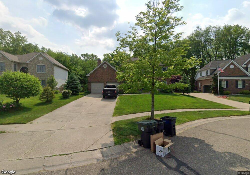
2936 Riverside Dr Unit 72 Lake Orion, MI 48359
Estimated Value: $516,000 - $571,000
4
Beds
3
Baths
2,585
Sq Ft
$213/Sq Ft
Est. Value
About This Home
This home is located at 2936 Riverside Dr Unit 72, Lake Orion, MI 48359 and is currently estimated at $549,513, approximately $212 per square foot. 2936 Riverside Dr Unit 72 is a home located in Oakland County with nearby schools including Carpenter Elementary School, Waldon Middle School, and Lake Orion Community High School.
Ownership History
Date
Name
Owned For
Owner Type
Purchase Details
Closed on
Oct 26, 2007
Sold by
Dfcu Financial Fcu
Bought by
Goetz Michael and Goetz Linda Marie
Current Estimated Value
Purchase Details
Closed on
Aug 1, 2007
Sold by
Shepherd Thomas and Shepherd Thomas W
Bought by
Dfcu Financial Fcu
Purchase Details
Closed on
Mar 19, 2002
Sold by
Silverman Development Co
Bought by
Shepherd Thomas
Create a Home Valuation Report for This Property
The Home Valuation Report is an in-depth analysis detailing your home's value as well as a comparison with similar homes in the area
Home Values in the Area
Average Home Value in this Area
Purchase History
| Date | Buyer | Sale Price | Title Company |
|---|---|---|---|
| Goetz Michael | $300,000 | None Available | |
| Dfcu Financial Fcu | -- | None Available | |
| Shepherd Thomas | $339,596 | -- |
Source: Public Records
Mortgage History
| Date | Status | Borrower | Loan Amount |
|---|---|---|---|
| Closed | Shepherd Thomas | -- |
Source: Public Records
Tax History Compared to Growth
Tax History
| Year | Tax Paid | Tax Assessment Tax Assessment Total Assessment is a certain percentage of the fair market value that is determined by local assessors to be the total taxable value of land and additions on the property. | Land | Improvement |
|---|---|---|---|---|
| 2024 | $3,712 | $230,790 | $0 | $0 |
| 2023 | $3,541 | $197,460 | $0 | $0 |
| 2022 | $4,994 | $184,080 | $0 | $0 |
| 2021 | $4,767 | $177,350 | $0 | $0 |
| 2020 | $3,245 | $175,400 | $0 | $0 |
| 2019 | $4,414 | $167,540 | $0 | $0 |
| 2018 | $4,402 | $161,010 | $0 | $0 |
| 2017 | $4,203 | $161,010 | $0 | $0 |
| 2016 | $4,188 | $165,460 | $0 | $0 |
| 2015 | -- | $158,740 | $0 | $0 |
| 2014 | -- | $147,310 | $0 | $0 |
| 2011 | -- | $122,920 | $0 | $0 |
Source: Public Records
Map
Nearby Homes
- 2494 Liter Rd
- 3733 W Madison Ave
- 3712 Grafton St
- 3268 Cranbrook Ct
- 3748 Minton Rd
- 3411 Ashley Dr
- 3657 Coleport St
- 2376 Forest Hills Dr
- 2875 Regency Dr Unit 11
- 3360 Gingell Dr
- 2262 Hammerslea Rd
- 3368 Gingell Dr
- 3395 Maybee Rd
- 3315 S Baldwin Rd
- 3755 Joslyn Rd
- 3224 Hickory Dr
- 2500 Judah Rd
- 3085 Oakridge Ct
- 2924 Meadowbrook Ct
- 2644 Wildwood Ct
- 2922 Riverside Dr
- 2950 Riverside Dr
- 2964 Riverside Dr Unit Bldg-Unit
- 2964 Riverside Dr Unit 74
- 2939 Riverside Dr Unit Bldg-Unit
- 2939 Riverside Dr Unit 63
- 2925 Riverside Dr Unit 64
- 2908 Riverside Dr
- 2967 Riverside Dr
- 2565 Mueller Rd
- 2897 Riverside Dr
- 2981 Riverside Dr Unit 61
- 2553 Mueller Rd
- 3842 Chesterfield Rd
- 3834 Chesterfield Rd
- 2880 Riverside Dr
- 3850 Chesterfield Rd
- 2883 Riverside Dr Unit 67
- 2537 Mueller Rd
- 3858 Chesterfield Rd