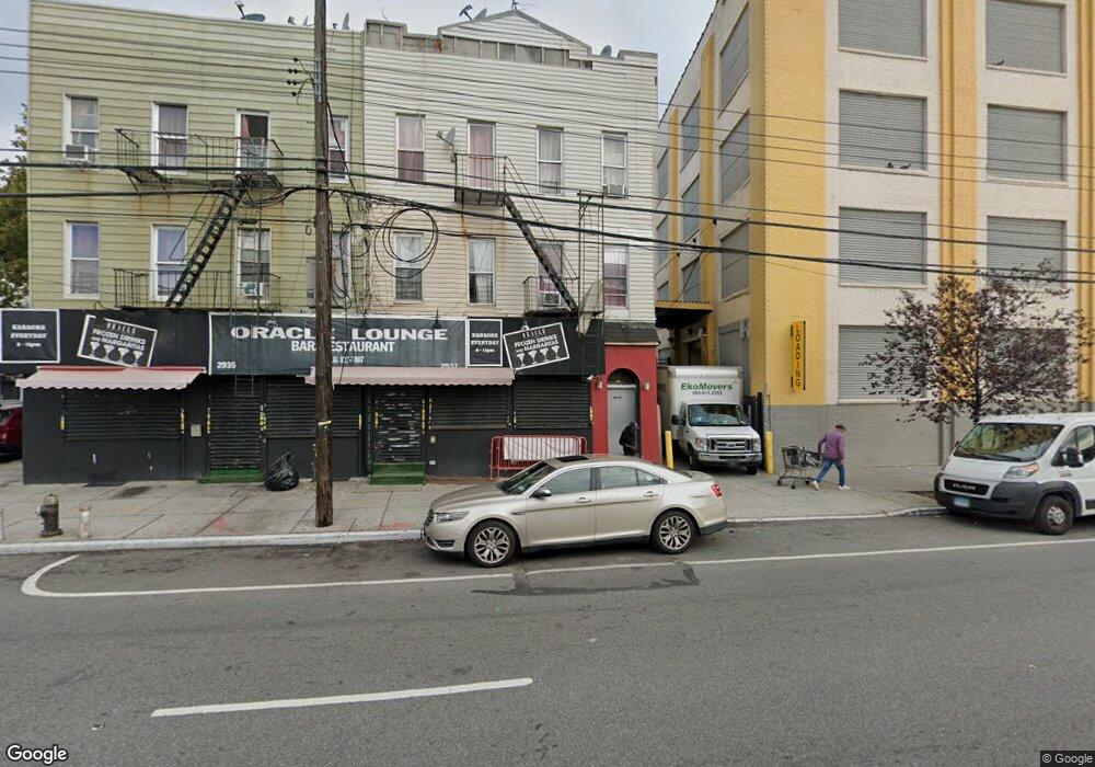
2937 Atlantic Ave Brooklyn, NY 11207
Cypress Hills NeighborhoodEstimated Value: $2,101,047
Studio
--
Bath
2,000
Sq Ft
$1,051/Sq Ft
Est. Value
About This Home
This home is located at 2937 Atlantic Ave, Brooklyn, NY 11207 and is currently estimated at $2,101,047, approximately $1,050 per square foot. 2937 Atlantic Ave is a home located in Kings County with nearby schools including P.S. 108 - Sal Abbracciamento, Liberty Avenue Middle School, and Vista Academy.
Ownership History
Date
Name
Owned For
Owner Type
Purchase Details
Closed on
Aug 30, 2017
Sold by
Hathorn Properties Inc
Bought by
Ez Grow Llc
Current Estimated Value
Home Financials for this Owner
Home Financials are based on the most recent Mortgage that was taken out on this home.
Original Mortgage
$125,000
Outstanding Balance
$104,356
Interest Rate
3.89%
Mortgage Type
Commercial
Estimated Equity
$1,996,691
Create a Home Valuation Report for This Property
The Home Valuation Report is an in-depth analysis detailing your home's value as well as a comparison with similar homes in the area
Home Values in the Area
Average Home Value in this Area
Purchase History
| Date | Buyer | Sale Price | Title Company |
|---|---|---|---|
| Ez Grow Llc | $1,450,000 | -- |
Source: Public Records
Mortgage History
| Date | Status | Borrower | Loan Amount |
|---|---|---|---|
| Open | Ez Grow Llc | $125,000 |
Source: Public Records
Tax History
| Year | Tax Paid | Tax Assessment Tax Assessment Total Assessment is a certain percentage of the fair market value that is determined by local assessors to be the total taxable value of land and additions on the property. | Land | Improvement |
|---|---|---|---|---|
| 2025 | $11,767 | $256,950 | $116,100 | $140,850 |
| 2024 | $11,767 | $214,200 | $116,100 | $98,100 |
| 2023 | $11,546 | $267,750 | $116,100 | $151,650 |
| 2022 | $8,368 | $223,200 | $116,100 | $107,100 |
| 2021 | $10,359 | $178,650 | $116,100 | $62,550 |
| 2019 | $9,131 | $216,900 | $116,100 | $100,800 |
| 2018 | $9,209 | $72,400 | $30,977 | $41,423 |
| 2017 | $8,922 | $70,151 | $32,033 | $38,118 |
| 2016 | $8,374 | $64,958 | $34,555 | $30,403 |
| 2015 | $5,437 | $60,148 | $38,411 | $21,737 |
| 2014 | $5,437 | $55,693 | $42,637 | $13,056 |
Source: Public Records
Map
Nearby Homes
- 2935 Atlantic Ave
- 2939 Atlantic Ave Unit 3R
- 191 Ashford St
- 2941 Atlantic Ave
- 189 Ashford St
- 187 Ashford St
- 185 Ashford St
- 2929 Atlantic Ave
- 280 Cleveland St
- 183 Ashford St
- 183 Ashford St
- 194 Ashford St
- 192 Ashford St
- 274 Cleveland St
- 179 Ashford St
- 188 Ashford St
- 177 Ashford St
- 272 Cleveland St
- 186 Ashford St
- 175 Ashford St
Your Personal Tour Guide
Ask me questions while you tour the home.