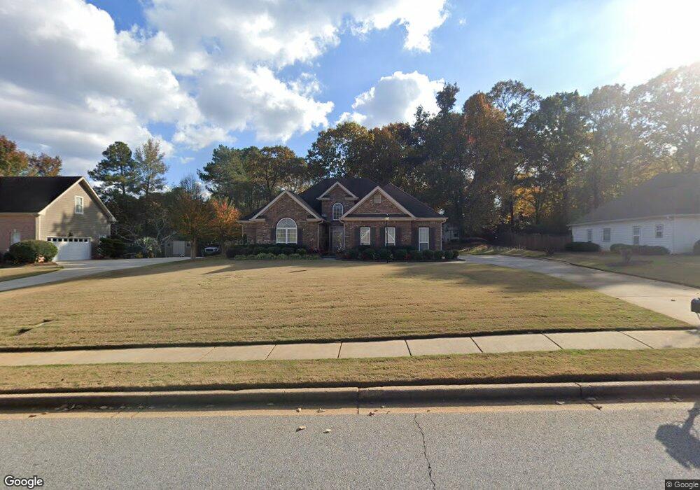
2937 Mandy Ct Unit II Jonesboro, GA 30236
Estimated Value: $306,508 - $319,000
3
Beds
3
Baths
2,081
Sq Ft
$150/Sq Ft
Est. Value
About This Home
This home is located at 2937 Mandy Ct Unit II, Jonesboro, GA 30236 and is currently estimated at $312,754, approximately $150 per square foot. 2937 Mandy Ct Unit II is a home located in Clayton County with nearby schools including Arnold Elementary School, M. D. Roberts Middle School, and Jonesboro High School.
Ownership History
Date
Name
Owned For
Owner Type
Purchase Details
Closed on
Dec 8, 1997
Sold by
John Christian Homes
Bought by
Neal Percy L and Neal Estella D
Current Estimated Value
Home Financials for this Owner
Home Financials are based on the most recent Mortgage that was taken out on this home.
Original Mortgage
$128,350
Outstanding Balance
$21,714
Interest Rate
7.23%
Mortgage Type
New Conventional
Estimated Equity
$291,040
Create a Home Valuation Report for This Property
The Home Valuation Report is an in-depth analysis detailing your home's value as well as a comparison with similar homes in the area
Home Values in the Area
Average Home Value in this Area
Purchase History
| Date | Buyer | Sale Price | Title Company |
|---|---|---|---|
| Neal Percy L | $160,500 | -- |
Source: Public Records
Mortgage History
| Date | Status | Borrower | Loan Amount |
|---|---|---|---|
| Open | Neal Percy L | $128,350 |
Source: Public Records
Tax History Compared to Growth
Tax History
| Year | Tax Paid | Tax Assessment Tax Assessment Total Assessment is a certain percentage of the fair market value that is determined by local assessors to be the total taxable value of land and additions on the property. | Land | Improvement |
|---|---|---|---|---|
| 2024 | $2,062 | $118,280 | $10,400 | $107,880 |
| 2023 | $4,315 | $119,520 | $10,400 | $109,120 |
| 2022 | $1,557 | $92,920 | $10,400 | $82,520 |
| 2021 | $1,189 | $73,040 | $10,400 | $62,640 |
| 2020 | $1,136 | $68,912 | $10,400 | $58,512 |
| 2019 | $1,192 | $70,027 | $10,000 | $60,027 |
| 2018 | $1,211 | $70,936 | $10,000 | $60,936 |
| 2017 | $1,126 | $64,395 | $10,000 | $54,395 |
| 2016 | $1,209 | $68,226 | $10,000 | $58,226 |
| 2015 | $1,193 | $0 | $0 | $0 |
| 2014 | $1,068 | $65,864 | $10,000 | $55,864 |
Source: Public Records
Map
Nearby Homes
- 2846 Highway 138 E
- 247 Spivey Ridge Cir
- 733 Berkeley Dr
- 732 Berkeley Dr
- 717 Berkeley Dr
- 706 Berkeley Dr
- 708 Berkeley Dr
- 725 Berkeley Dr
- 710 Berkeley Dr
- 745 Berkeley Dr
- 722 Berkeley Dr
- 718 Berkeley Dr
- 719 Berkeley Dr
- 712 Berkeley Dr
- 734 Berkeley Dr
- 702 Berkeley Dr
- 7719 Glen Devon Rd
- 2809 Highway 138 E
- Edmund 4 Bedroom Plan at Reeves Park
- Edmund Plan at Reeves Park
- 2927 Mandy Ct Unit II
- 2945 Mandy Ct
- 0 Mandy Ct Unit 7368307
- 0 Mandy Ct Unit 3280513
- 0 Mandy Ct Unit 7504283
- 0 Mandy Ct Unit 7034295
- 0 Mandy Ct
- 2940 Mandy Ct
- 2955 Mandy Ct
- 2919 Mandy Ct
- 2952 Melanie Ln
- 7976 Berry Rd
- 2950 Mandy Ct
- 2963 Mandy Ct
- 2911 Mandy Ct
- 2953 Melanie Ln Unit 1
- 2890 Mandy Ct
- 2958 Mandy Ct
- 2960 Melanie Ln
- 2846 Mandy Ct