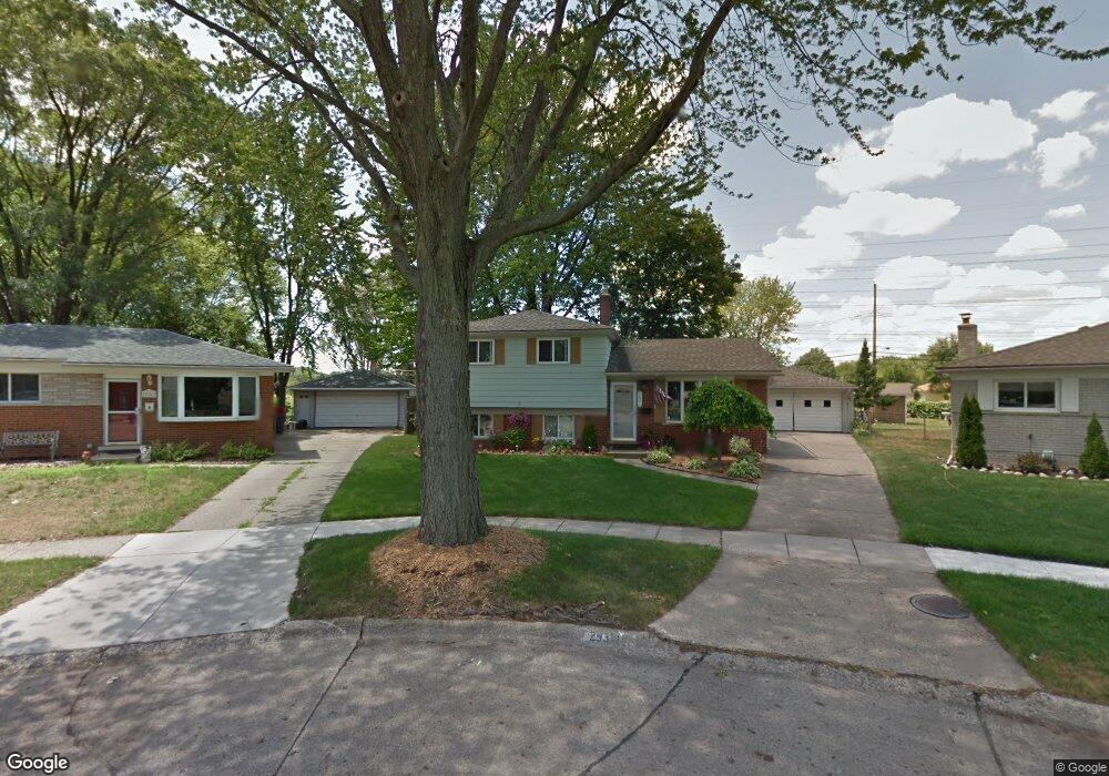
29371 Newport Dr Warren, MI 48088
Northeast Warren NeighborhoodEstimated Value: $267,000 - $279,000
3
Beds
2
Baths
1,672
Sq Ft
$164/Sq Ft
Est. Value
About This Home
This home is located at 29371 Newport Dr, Warren, MI 48088 and is currently estimated at $273,756, approximately $163 per square foot. 29371 Newport Dr is a home located in Macomb County with nearby schools including Warren Woods Tower High School, Frontier International Academy Elementary, and Warren Woods Christian School.
Ownership History
Date
Name
Owned For
Owner Type
Purchase Details
Closed on
Jul 19, 2004
Sold by
Campbell James Wayne and Campbell James W
Bought by
Campbell Lynn Marie
Current Estimated Value
Home Financials for this Owner
Home Financials are based on the most recent Mortgage that was taken out on this home.
Original Mortgage
$136,000
Interest Rate
6.65%
Mortgage Type
Stand Alone Refi Refinance Of Original Loan
Create a Home Valuation Report for This Property
The Home Valuation Report is an in-depth analysis detailing your home's value as well as a comparison with similar homes in the area
Home Values in the Area
Average Home Value in this Area
Purchase History
| Date | Buyer | Sale Price | Title Company |
|---|---|---|---|
| Campbell Lynn Marie | -- | Wilson Title Agency Llc |
Source: Public Records
Mortgage History
| Date | Status | Borrower | Loan Amount |
|---|---|---|---|
| Closed | Campbell Lynn Marie | $136,000 |
Source: Public Records
Tax History Compared to Growth
Tax History
| Year | Tax Paid | Tax Assessment Tax Assessment Total Assessment is a certain percentage of the fair market value that is determined by local assessors to be the total taxable value of land and additions on the property. | Land | Improvement |
|---|---|---|---|---|
| 2025 | $3,757 | $130,190 | $0 | $0 |
| 2024 | $3,650 | $126,650 | $0 | $0 |
| 2023 | $3,449 | $119,970 | $0 | $0 |
| 2022 | $3,382 | $99,940 | $0 | $0 |
| 2021 | $3,318 | $92,650 | $0 | $0 |
| 2020 | $3,180 | $88,300 | $0 | $0 |
| 2019 | $3,038 | $82,020 | $0 | $0 |
| 2018 | $3,069 | $72,370 | $0 | $0 |
| 2017 | $2,902 | $72,160 | $17,960 | $54,200 |
| 2016 | $2,880 | $72,160 | $0 | $0 |
| 2015 | -- | $64,230 | $0 | $0 |
| 2013 | $8,345 | $54,440 | $0 | $0 |
Source: Public Records
Map
Nearby Homes
- 29379 Newport Dr
- 29667 Newport Dr
- 29365 Dover Ave
- 13053 Geoffry Dr
- 29820 Palomino Dr
- 29366 Wagner Dr
- 29355 Eiffel Ave
- 13265 Geoffry Dr
- 29723 Roan Dr
- 29266 Moulin Ave
- 29161 Schoenherr Rd
- 11916 Geoffry Dr
- 28621 Pinto Dr
- 30154 Pinto Dr
- 29819 Bonnie Dr
- 30252 Newport Dr
- 30419 Iroquois Dr
- 13325 Iowa Dr
- 29638 Hoover Rd Unit 638
- 29626 Hoover Rd Unit 626
- 29363 Newport Dr
- 29349 Newport Dr
- 29277 Newport Dr
- 29387 Newport Dr
- 29337 Newport Dr
- 29325 Newport Dr
- 29269 Newport Dr
- 29511 Newport Dr
- 29311 Newport Dr
- 29557 Newport Dr
- 29519 Newport Dr
- 29352 Newport Dr
- 29340 Newport Dr
- 29364 Newport Dr
- 29261 Newport Dr
- 29328 Newport Dr
- 29376 Newport Dr
- 29565 Newport Dr
- 29531 Newport Dr
- 29316 Newport Dr