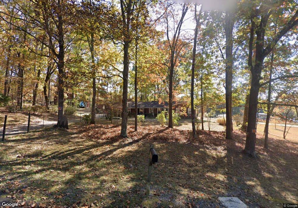
294 Curtis Cir SE Calhoun, GA 30701
Estimated Value: $269,000 - $284,000
3
Beds
2
Baths
1,540
Sq Ft
$180/Sq Ft
Est. Value
About This Home
This home is located at 294 Curtis Cir SE, Calhoun, GA 30701 and is currently estimated at $276,571, approximately $179 per square foot. 294 Curtis Cir SE is a home located in Gordon County with nearby schools including Belwood Elementary School, Red Bud Middle School, and Sonoraville High School.
Ownership History
Date
Name
Owned For
Owner Type
Purchase Details
Closed on
Sep 30, 2021
Sold by
Executor Cronon Larry
Bought by
Little Candy
Current Estimated Value
Home Financials for this Owner
Home Financials are based on the most recent Mortgage that was taken out on this home.
Original Mortgage
$99,000
Outstanding Balance
$90,279
Interest Rate
2.8%
Mortgage Type
New Conventional
Estimated Equity
$186,292
Create a Home Valuation Report for This Property
The Home Valuation Report is an in-depth analysis detailing your home's value as well as a comparison with similar homes in the area
Home Values in the Area
Average Home Value in this Area
Purchase History
| Date | Buyer | Sale Price | Title Company |
|---|---|---|---|
| Little Candy | $194,000 | -- |
Source: Public Records
Mortgage History
| Date | Status | Borrower | Loan Amount |
|---|---|---|---|
| Open | Little Candy | $99,000 |
Source: Public Records
Tax History Compared to Growth
Tax History
| Year | Tax Paid | Tax Assessment Tax Assessment Total Assessment is a certain percentage of the fair market value that is determined by local assessors to be the total taxable value of land and additions on the property. | Land | Improvement |
|---|---|---|---|---|
| 2024 | $1,774 | $71,808 | $23,240 | $48,568 |
| 2023 | $1,703 | $69,016 | $23,240 | $45,776 |
| 2022 | $1,496 | $57,372 | $15,520 | $41,852 |
| 2021 | $445 | $48,776 | $15,520 | $33,256 |
| 2020 | $454 | $49,336 | $15,520 | $33,816 |
| 2019 | $456 | $49,336 | $15,520 | $33,816 |
| 2018 | $436 | $47,256 | $15,520 | $31,736 |
| 2017 | $427 | $45,456 | $15,520 | $29,936 |
| 2016 | $428 | $45,456 | $15,520 | $29,936 |
| 2015 | $524 | $44,896 | $15,520 | $29,376 |
| 2014 | $489 | $44,073 | $15,540 | $28,533 |
Source: Public Records
Map
Nearby Homes
- 0 Curtis Cir SE Unit 10611011
- 0 Curtis Cir SE Unit 7654260
- 00 Curtis Cir
- 0 Lovers Lane Rd SE Unit 10509663
- 220 Porch Loop SE
- 252 Blackwood Place SE
- 133 Kensington Dr SE
- 251 Tucker Hollow Rd SE
- 106 Kensington Dr SE
- 201 Porch Loop SE
- 0 Richardson Rd SE Unit 10474273
- 0 Richardson Rd SE Unit 7537183
- 111 Lewis Dr SE
- The Alston Plan at Salacoa - The Overlook at Salacoa
- The Hartwell Plan at Salacoa - The Overlook at Salacoa
- The Perry Plan at Salacoa - The Overlook at Salacoa
- The Dalton Plan at Salacoa - The Overlook at Salacoa
- The Springfield Plan at Salacoa - The Overlook at Salacoa
- The Dexter Plan at Salacoa - The Overlook at Salacoa
- 271 Old Belwood Rd SE
- 297 Curtis Cir SE
- 271 Curtis Cir SE
- 278 Curtis Cir SE
- 326 Curtis Cir SE
- 258 Curtis Cir SE
- 259 Curtis Cir SE
- 244 Curtis Cir SE
- 237 Curtis Cir SE
- 328 Old Fairmount Hwy SE
- 232 Curtis Cir SE
- 223 Curtis Cir SE
- 224 Curtis Cir SE
- 0 Lovebridge Rd SE Unit 23365911
- 0 Lovebridge Rd SE Unit 10255148
- 0 Lovebridge Rd SE Unit 8721977
- 0 Lovebridge Rd SE Unit 7402255
- 0 Lovebridge Rd SE Unit 7364271
- 0 Lovebridge Rd SE
- 204 Curtis Cir SE
- 0 Curtis Cir SE Unit 10292115