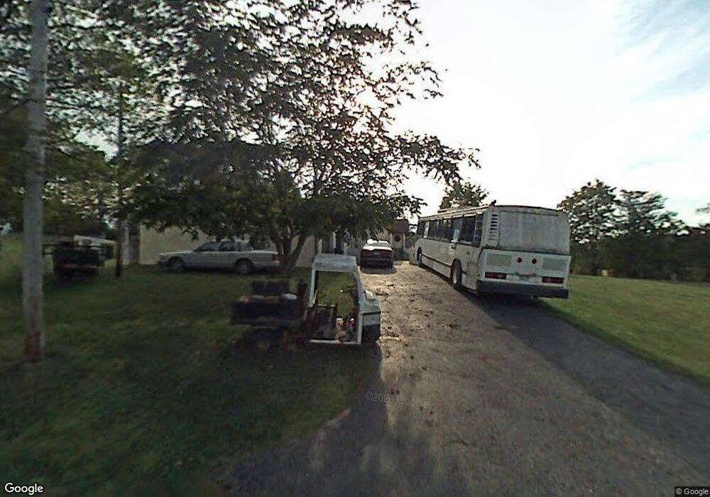
294 Forsythia Ave Davisville, WV 26142
Estimated Value: $300,000 - $329,000
3
Beds
3
Baths
2,804
Sq Ft
$110/Sq Ft
Est. Value
About This Home
This home is located at 294 Forsythia Ave, Davisville, WV 26142 and is currently estimated at $308,948, approximately $110 per square foot. 294 Forsythia Ave is a home located in Wood County with nearby schools including Kanawha Elementary School, Hamilton Middle School, and Parkersburg High School.
Ownership History
Date
Name
Owned For
Owner Type
Purchase Details
Closed on
Aug 31, 2009
Sold by
Logston Joyce D and Logston Joyce A
Bought by
Montgomery Scott and Montgomery Stacie
Current Estimated Value
Home Financials for this Owner
Home Financials are based on the most recent Mortgage that was taken out on this home.
Original Mortgage
$145,319
Outstanding Balance
$95,616
Interest Rate
5.31%
Mortgage Type
FHA
Estimated Equity
$213,332
Create a Home Valuation Report for This Property
The Home Valuation Report is an in-depth analysis detailing your home's value as well as a comparison with similar homes in the area
Home Values in the Area
Average Home Value in this Area
Purchase History
| Date | Buyer | Sale Price | Title Company |
|---|---|---|---|
| Montgomery Scott | $148,000 | None Available |
Source: Public Records
Mortgage History
| Date | Status | Borrower | Loan Amount |
|---|---|---|---|
| Open | Montgomery Scott | $145,319 |
Source: Public Records
Tax History Compared to Growth
Tax History
| Year | Tax Paid | Tax Assessment Tax Assessment Total Assessment is a certain percentage of the fair market value that is determined by local assessors to be the total taxable value of land and additions on the property. | Land | Improvement |
|---|---|---|---|---|
| 2024 | $1,685 | $136,440 | $19,440 | $117,000 |
| 2023 | $1,623 | $129,360 | $19,440 | $109,920 |
| 2022 | $1,395 | $126,360 | $19,440 | $106,920 |
| 2021 | $1,374 | $123,840 | $19,440 | $104,400 |
| 2020 | $1,333 | $119,760 | $19,440 | $100,320 |
| 2019 | $1,353 | $117,600 | $19,440 | $98,160 |
| 2018 | $1,372 | $116,040 | $19,440 | $96,600 |
| 2017 | $1,336 | $112,320 | $19,440 | $92,880 |
| 2016 | $1,216 | $110,220 | $19,440 | $90,780 |
| 2015 | $1,132 | $102,540 | $12,960 | $89,580 |
| 2014 | $1,101 | $99,660 | $12,960 | $86,700 |
Source: Public Records
Map
Nearby Homes
- 1068 E Poplar St
- 0 W Virginia 47
- 31 Timber Ln
- 6323 Staunton Turnpike
- 0 Tracewell St
- 34 Delta Place Rd
- 5 Grandview Dr
- 290 Washington Dr
- 0 Nicolette Rd
- 1056 Windsor Dr
- 0 River Rd
- 2 Millers Landing
- 140 Miller Ridge Rd
- 0 Chesterville Rd Unit Rd 24553803
- 0 Chesterville Rd Unit Lot WP001 23687476
- 2512 Elizabeth Pike
- 663 Happy Valley Rd
- 00 Elizabeth Pike
- 507 Dickens Dr
- 435 Emerick Ln
- 216 Honey Hill
- 212 Old Station Dr
- 202 Forsythia Ave
- 197 Forsythia Ave
- 238 Rivers Edge Dr
- 0 Forsythia Ave Unit 4437563
- 0 Forsythia Ave
- 247 Highland Meadows Dr
- 194 Highland Meadows Dr
- 128 Forsythia Ave
- 139 Forsythia Ave
- 171 Bob o Link Cir
- 36A Rr 2
- 1167 Farrow Hill Rd
- 116 Forsythia Ave
- 149 Bob o Link Cir
- 105 Highland Meadows Dr
- 4940 Staunton Turnpike
- 0 S Meadville Rd
- 92 Forsythia Ave
