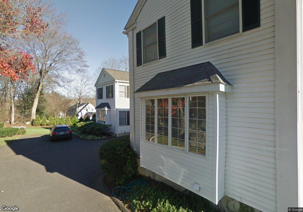
294 Main St Unit A New Canaan, CT 06840
Estimated Value: $1,495,000 - $1,788,000
4
Beds
3
Baths
2,300
Sq Ft
$718/Sq Ft
Est. Value
About This Home
This home is located at 294 Main St Unit A, New Canaan, CT 06840 and is currently estimated at $1,651,477, approximately $718 per square foot. 294 Main St Unit A is a home located in Fairfield County with nearby schools including South Elementary School, Saxe Middle School, and New Canaan High School.
Ownership History
Date
Name
Owned For
Owner Type
Purchase Details
Closed on
Nov 25, 2024
Sold by
Herring Pamela D
Bought by
Herring Peter E and Herring Pamela D
Current Estimated Value
Purchase Details
Closed on
Aug 5, 2016
Sold by
300 Main Street Assoc
Bought by
Gcfc 2007-Gc9 Main St
Purchase Details
Closed on
Oct 25, 2012
Sold by
Hughes Edward
Bought by
Herring Pamela D
Create a Home Valuation Report for This Property
The Home Valuation Report is an in-depth analysis detailing your home's value as well as a comparison with similar homes in the area
Home Values in the Area
Average Home Value in this Area
Purchase History
| Date | Buyer | Sale Price | Title Company |
|---|---|---|---|
| Herring Peter E | -- | None Available | |
| Herring Peter E | -- | None Available | |
| Gcfc 2007-Gc9 Main St | -- | -- | |
| Gcfc 2007-Gc9 Main St | -- | -- | |
| Herring Pamela D | $800,000 | -- | |
| Herring Pamela D | $800,000 | -- |
Source: Public Records
Mortgage History
| Date | Status | Borrower | Loan Amount |
|---|---|---|---|
| Previous Owner | Herring Pamela D | $500,000 | |
| Previous Owner | Herring Pamela D | $150,000 |
Source: Public Records
Tax History Compared to Growth
Tax History
| Year | Tax Paid | Tax Assessment Tax Assessment Total Assessment is a certain percentage of the fair market value that is determined by local assessors to be the total taxable value of land and additions on the property. | Land | Improvement |
|---|---|---|---|---|
| 2025 | $14,716 | $881,720 | $0 | $881,720 |
| 2024 | $14,231 | $881,720 | $0 | $881,720 |
| 2023 | $11,752 | $620,480 | $0 | $620,480 |
| 2022 | $11,398 | $620,480 | $0 | $620,480 |
| 2021 | $11,268 | $620,480 | $0 | $620,480 |
| 2020 | $11,268 | $620,480 | $0 | $620,480 |
| 2019 | $11,318 | $620,480 | $0 | $620,480 |
| 2018 | $9,923 | $563,570 | $0 | $563,570 |
| 2017 | $9,744 | $563,570 | $0 | $563,570 |
| 2016 | $9,522 | $563,570 | $0 | $563,570 |
| 2015 | $9,334 | $563,570 | $0 | $563,570 |
| 2014 | $9,074 | $563,570 | $0 | $563,570 |
Source: Public Records
Map
Nearby Homes
- 180 Summer St
- 50 Harrison Ave
- 31 Selleck Place
- 136 South Ave
- 96 East Ave Unit C
- 64 East Ave
- 60 East Ave
- 15 Burtis Ave Unit Townhome D
- 15 Burtis Ave Unit West Penthouse B
- 15 Burtis Ave Unit East Penthouse C
- 15 Burtis Ave Unit Townhome A
- 15 Burtis Ave Unit East Plaza 203
- 289 New Norwalk Rd Unit 22
- 38 Fitch Ln
- 197 Park St Unit 13
- 42 Forest St Unit A
- 79 Locust Ave Unit 212
- 12 Lincoln Dr
- 317 Park St
- 354 South Ave
- 294 Main St
- 296 Main St
- 19 Olmstead Ct
- 290 Main St
- 284 Main St
- 292 Main St
- 18 Olmstead Ct
- 304 Main St
- 27 Lakeview Ave
- 27 Lakeview Ave Unit 27
- 29 Lakeview Ave
- 282 Main St Unit 1
- 282 Main St
- 282 Main St Unit 2
- 17 Olmstead Ct
- 21 Lakeview Ave
- 23 Lakeview Ave
- 25 Lakeview Ave
- 21 Lakeview Ave Unit 2C
- 314 Main St