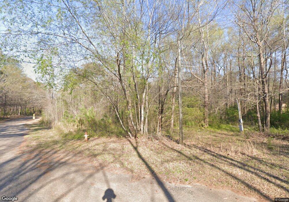
294 Sherwood Cir Danielsville, GA 30633
Estimated Value: $76,000 - $191,000
--
Bed
--
Bath
--
Sq Ft
0.49
Acres
About This Home
This home is located at 294 Sherwood Cir, Danielsville, GA 30633 and is currently estimated at $120,667. 294 Sherwood Cir is a home located in Madison County with nearby schools including Madison County High School.
Ownership History
Date
Name
Owned For
Owner Type
Purchase Details
Closed on
Jan 7, 2015
Sold by
Webb Tony C
Bought by
Espinoza Martin
Current Estimated Value
Purchase Details
Closed on
Jan 28, 2014
Sold by
Smith Jerry
Bought by
Webb Tony C
Purchase Details
Closed on
Nov 1, 2013
Sold by
Westbrook 5 Llc
Bought by
Smith Jerry
Purchase Details
Closed on
Dec 25, 2010
Sold by
Westbrook Harvey H and Westbrook George Cauthen
Bought by
Westbrook 5 Llc
Purchase Details
Closed on
Jan 20, 2009
Sold by
Hansford Michael S
Bought by
Westbrook Joan H and Westbrook Harvey H
Purchase Details
Closed on
Dec 20, 2002
Sold by
Westbrook G W
Bought by
Westbrook Joan H and Westbrook
Purchase Details
Closed on
Apr 22, 2002
Sold by
Floyd A J
Bought by
Westbrook G W
Purchase Details
Closed on
Nov 2, 1999
Sold by
Pascoe William H
Bought by
Floyd Floyd A and Floyd Westbroo
Purchase Details
Closed on
Jan 10, 1996
Bought by
Pascoe William H
Create a Home Valuation Report for This Property
The Home Valuation Report is an in-depth analysis detailing your home's value as well as a comparison with similar homes in the area
Home Values in the Area
Average Home Value in this Area
Purchase History
| Date | Buyer | Sale Price | Title Company |
|---|---|---|---|
| Espinoza Martin | $22,500 | -- | |
| Webb Tony C | $15,766 | -- | |
| Smith Jerry | $2,811 | -- | |
| Westbrook 5 Llc | -- | -- | |
| Westbrook Harvey H | -- | -- | |
| Westbrook Joan H | -- | -- | |
| Westbrook Joan H | -- | -- | |
| Westbrook G W | -- | -- | |
| Floyd Floyd A | $21,300 | -- | |
| Pascoe William H | $20,000 | -- |
Source: Public Records
Tax History Compared to Growth
Tax History
| Year | Tax Paid | Tax Assessment Tax Assessment Total Assessment is a certain percentage of the fair market value that is determined by local assessors to be the total taxable value of land and additions on the property. | Land | Improvement |
|---|---|---|---|---|
| 2024 | $87 | $2,744 | $2,744 | $0 |
| 2023 | $87 | $2,744 | $2,744 | $0 |
| 2022 | $89 | $2,744 | $2,744 | $0 |
| 2021 | $100 | $2,744 | $2,744 | $0 |
| 2020 | $101 | $2,744 | $2,744 | $0 |
| 2019 | $102 | $2,744 | $2,744 | $0 |
| 2018 | $102 | $2,744 | $2,744 | $0 |
| 2017 | $94 | $2,744 | $2,744 | $0 |
| 2016 | $95 | $2,744 | $2,744 | $0 |
| 2015 | $24 | $2,744 | $2,744 | $0 |
| 2014 | $20 | $2,744 | $2,744 | $0 |
| 2013 | -- | $2,744 | $2,744 | $0 |
Source: Public Records
Map
Nearby Homes
- 430 Sherwood Cir
- 255 Hillwood Dr Unit 1
- 105 Georgia 98
- 00 Highway 29 Unit A
- 0 Colbert Danielsville Lot 12 Rd
- 0 Colbert Danielsville Lot 10 Rd
- 0 Colbert Danielsville Lot 11 Rd
- 0 Irvin Kirk Rd
- 170 Northridge Dr
- 150 Northridge Dr Unit 3
- 150 Northridge Dr
- 140 Northridge Dr
- 140 Northridge Dr Unit 6
- 112 Northridge Dr Unit 8
- 112 Northridge Dr
- 96 Northridge Dr Unit 10
- 96 Northridge Dr
- 49 Ridgeway Dr
- 0 Veterans Dr Unit 10462425
- 0 Veterans Dr Unit 10462434
- 80 Hillwood Cir
- 205 Sherwood Cir
- 355 Sherwood Cir
- 175 Sherwood Cir
- 175 Sherwood Cir Unit 1
- 356 Sherwood Cir
- 61 Hillwood Cir
- 151 Sherwood Cir
- 400 Hillwood Dr
- 455 Hillwood Dr
- 166 Sherwood Cir
- 166 Sherwood Cir Unit 1
- 370 Sherwood Cir
- lot 8C Sherwood Cir
- 00 Sherwood Cir
- 146 Sherwood Cir
- 410 Sherwood Cir
- 108 Sherwood Cir
- 391 Hillwood Dr
- 85 Sherwood Cir
