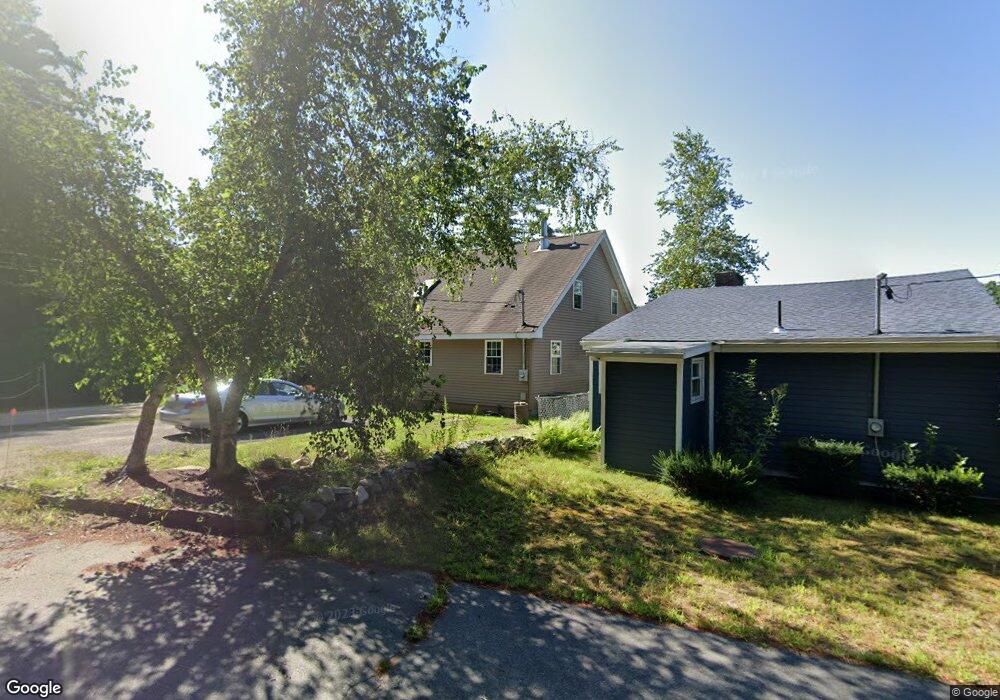
294 Wakefield Rd Pascoag, RI 02859
Estimated Value: $488,000 - $564,663
3
Beds
1
Bath
1,290
Sq Ft
$399/Sq Ft
Est. Value
About This Home
This home is located at 294 Wakefield Rd, Pascoag, RI 02859 and is currently estimated at $514,916, approximately $399 per square foot. 294 Wakefield Rd is a home with nearby schools including Austin T. Levy School, Burrillville Middle School, and Burrillville High School.
Ownership History
Date
Name
Owned For
Owner Type
Purchase Details
Closed on
May 13, 2014
Sold by
Ferland Albert H and Ferland Lucille S
Bought by
Ferland Albert H and Ferland Richard P
Current Estimated Value
Home Financials for this Owner
Home Financials are based on the most recent Mortgage that was taken out on this home.
Original Mortgage
$120,000
Outstanding Balance
$33,014
Interest Rate
4.36%
Estimated Equity
$481,902
Purchase Details
Closed on
Aug 18, 2010
Sold by
Ferland Robert N
Bought by
Ferland Albert H
Home Financials for this Owner
Home Financials are based on the most recent Mortgage that was taken out on this home.
Original Mortgage
$100,000
Interest Rate
4.48%
Create a Home Valuation Report for This Property
The Home Valuation Report is an in-depth analysis detailing your home's value as well as a comparison with similar homes in the area
Home Values in the Area
Average Home Value in this Area
Purchase History
| Date | Buyer | Sale Price | Title Company |
|---|---|---|---|
| Ferland Albert H | -- | -- | |
| Ferland Albert H | -- | -- | |
| Ferland Albert H | -- | -- | |
| Ferland Albert H | -- | -- | |
| Ferland Albert H | -- | -- |
Source: Public Records
Mortgage History
| Date | Status | Borrower | Loan Amount |
|---|---|---|---|
| Open | Ferland Albert H | $120,000 | |
| Previous Owner | Ferland Albert H | $100,000 |
Source: Public Records
Tax History
| Year | Tax Paid | Tax Assessment Tax Assessment Total Assessment is a certain percentage of the fair market value that is determined by local assessors to be the total taxable value of land and additions on the property. | Land | Improvement |
|---|---|---|---|---|
| 2025 | $6,607 | $555,200 | $212,900 | $342,300 |
| 2024 | $6,377 | $425,700 | $170,400 | $255,300 |
| 2023 | $6,126 | $425,700 | $170,400 | $255,300 |
| 2022 | $5,921 | $425,700 | $170,400 | $255,300 |
| 2021 | $5,210 | $317,300 | $147,100 | $170,200 |
| 2020 | $5,080 | $317,300 | $147,100 | $170,200 |
| 2019 | $5,077 | $317,300 | $147,100 | $170,200 |
| 2018 | $5,373 | $295,200 | $153,600 | $141,600 |
| 2017 | $5,184 | $295,200 | $153,600 | $141,600 |
| 2016 | $5,134 | $295,200 | $153,600 | $141,600 |
Source: Public Records
Map
Nearby Homes
- 75 Staghead Dr
- 50 Round Lake Dr
- 0 Stag Head Dr Unit 1380191
- 14 Indian Run Dr
- 11 Wrightson Dr
- 0 Wallum Lake Rd
- 32 Avery Ln
- 27 Avery Ln
- 151 Brandy Hill Rd
- 597 E Thompson Rd Unit Lot 10C
- 121 New Rd
- 117 New Rd
- 2535 Wallum Lake Rd
- 74 Crystal Terrace
- 5 Lees Ln
- 69 Sunset Hill Rd
- 0 Porter Plain Rd
- 369 Thompson Rd
- 22 Cady Ln
- 31 Marion Ave
- 316 Wakefield Rd
- 286 Wakefield Rd
- 11 Whiting Ln
- 25 Whiting Ln
- 33 Whiting Ln
- 43 Whiting Ln
- 28 W Shore Ln
- 0 Opp Pole 6 West Shore Ln
- 49 Whiting Ln
- 0 Whiting Ln Unit 1048196
- 0 Whiting Ln Unit 1076680
- 0 Whiting Ln Unit 1092781
- 0 Whiting Ln Unit 1100336
- 50 Slater Dr
- 76 Slater Dr
- 50 W Shore Ln
- 59 Whiting Ln
- 33 Lee Cir
- 52 W Shore Ln
- 73 Whiting Ln
Your Personal Tour Guide
Ask me questions while you tour the home.