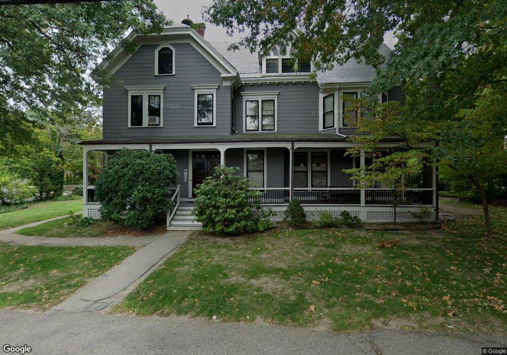
294 Walnut St Unit 2 Brookline, MA 02445
Brookline Village NeighborhoodEstimated Value: $560,000 - $730,000
1
Bed
1
Bath
860
Sq Ft
$734/Sq Ft
Est. Value
About This Home
This home is located at 294 Walnut St Unit 2, Brookline, MA 02445 and is currently estimated at $631,554, approximately $734 per square foot. 294 Walnut St Unit 2 is a home located in Norfolk County with nearby schools including William H. Lincoln School, Brookline High School, and Maimonides School.
Ownership History
Date
Name
Owned For
Owner Type
Purchase Details
Closed on
Sep 12, 1997
Sold by
Ramondo Charles G
Bought by
Huth Thomas R
Current Estimated Value
Home Financials for this Owner
Home Financials are based on the most recent Mortgage that was taken out on this home.
Original Mortgage
$132,000
Interest Rate
7.31%
Mortgage Type
Purchase Money Mortgage
Create a Home Valuation Report for This Property
The Home Valuation Report is an in-depth analysis detailing your home's value as well as a comparison with similar homes in the area
Home Values in the Area
Average Home Value in this Area
Purchase History
| Date | Buyer | Sale Price | Title Company |
|---|---|---|---|
| Huth Thomas R | $165,000 | -- |
Source: Public Records
Mortgage History
| Date | Status | Borrower | Loan Amount |
|---|---|---|---|
| Open | Huth Thomas R | $146,275 | |
| Closed | Huth Thomas R | $132,000 |
Source: Public Records
Tax History
| Year | Tax Paid | Tax Assessment Tax Assessment Total Assessment is a certain percentage of the fair market value that is determined by local assessors to be the total taxable value of land and additions on the property. | Land | Improvement |
|---|---|---|---|---|
| 2025 | $6,561 | $664,700 | $0 | $664,700 |
| 2024 | $6,367 | $651,700 | $0 | $651,700 |
| 2023 | $6,090 | $610,800 | $0 | $610,800 |
| 2022 | $6,044 | $593,100 | $0 | $593,100 |
| 2021 | $5,755 | $587,200 | $0 | $587,200 |
| 2020 | $5,494 | $581,400 | $0 | $581,400 |
| 2019 | $5,188 | $553,700 | $0 | $553,700 |
| 2018 | $4,989 | $527,400 | $0 | $527,400 |
| 2017 | $4,824 | $488,300 | $0 | $488,300 |
| 2016 | $4,625 | $443,900 | $0 | $443,900 |
| 2015 | $4,309 | $403,500 | $0 | $403,500 |
| 2014 | $4,344 | $381,400 | $0 | $381,400 |
Source: Public Records
Map
Nearby Homes
- 42 Prince St
- 20 Rice St Unit 2
- 18 Chestnut Place
- 236 Walnut St
- 124 Chestnut St Unit 2
- 8 Leverett St Unit 3
- 209 High St
- 140 Sumner Rd Unit 1
- 71 Highland Rd
- 21 Sargent Crossway
- 241 Perkins St Unit D405
- 241 Perkins St Unit C402
- 241 Perkins St Unit G102
- 75-83 Boylston St Unit R3
- 75 Greenough St Unit 2
- 71 Greenough St Unit 71-1
- 24 Blake Rd
- 12 Thayer St
- 12 Goodwin Place Unit 12-1
- 12 Goodwin Place Unit 12-2
- 294 Walnut St Unit 5
- 294 Walnut St Unit 4
- 294 Walnut St Unit 3
- 294 Walnut St Unit 1
- 302 Walnut St
- 200 Cypress St
- 295 Walnut St Unit 297
- 295 Walnut St
- 297 Walnut St Unit 1
- 297 Walnut St Unit 2
- 297 Walnut St
- 295 Walnut St Unit 1
- 193 Cypress St
- 193 Cypress St Unit 1
- 193 Cypress St Unit 2
- 193 Cypress St
- 193 Cypress St Unit 3
- 299 Walnut St Unit 301
- 301 Walnut St
- 299 Walnut St Unit A
Your Personal Tour Guide
Ask me questions while you tour the home.