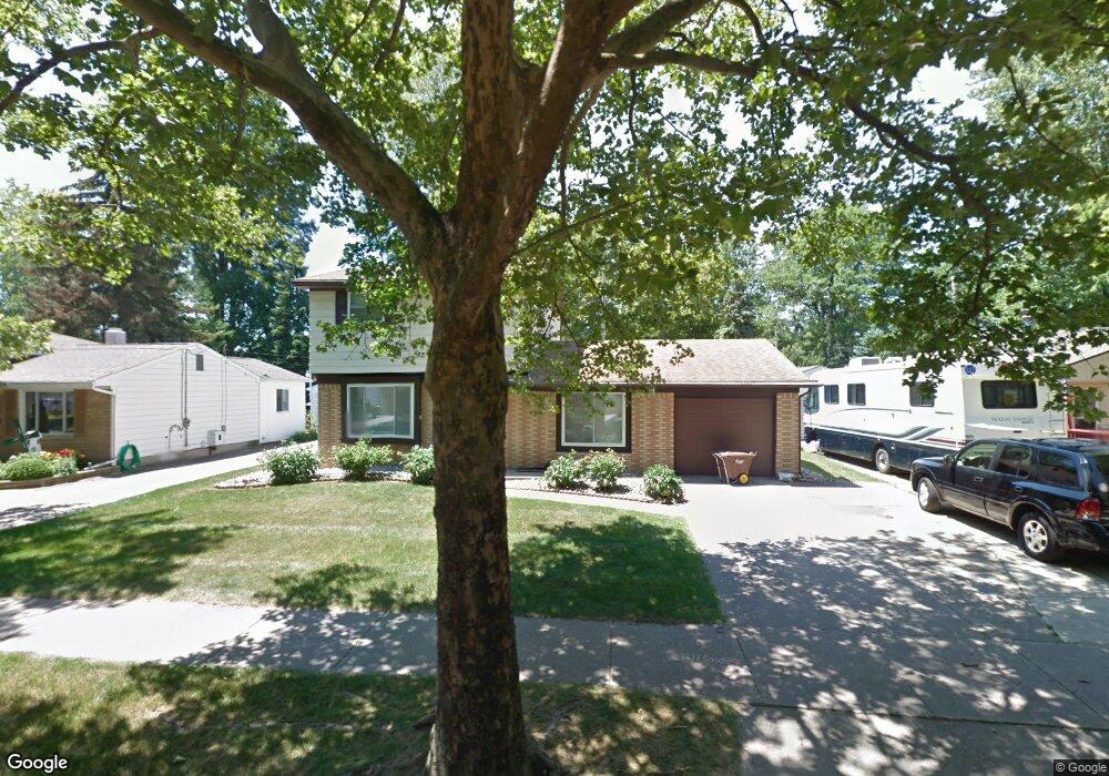
2940 Quincy Ln Lansing, MI 48910
Colonial Village NeighborhoodEstimated Value: $167,044 - $191,000
Studio
1
Bath
1,494
Sq Ft
$122/Sq Ft
Est. Value
About This Home
This home is located at 2940 Quincy Ln, Lansing, MI 48910 and is currently estimated at $182,511, approximately $122 per square foot. 2940 Quincy Ln is a home located in Ingham County with nearby schools including Averill Elementary School, Attwood School, and J.W. Sexton High School.
Ownership History
Date
Name
Owned For
Owner Type
Purchase Details
Closed on
Mar 8, 2000
Sold by
Jones Booker T
Bought by
Jones Gloria D
Current Estimated Value
Purchase Details
Closed on
Nov 30, 1998
Sold by
Flagstar Bank
Bought by
Adatsi George
Purchase Details
Closed on
Jan 10, 1997
Bought by
Flagstar Bank
Create a Home Valuation Report for This Property
The Home Valuation Report is an in-depth analysis detailing your home's value as well as a comparison with similar homes in the area
Home Values in the Area
Average Home Value in this Area
Purchase History
| Date | Buyer | Sale Price | Title Company |
|---|---|---|---|
| Jones Gloria D | -- | -- | |
| Adatsi George | $72,000 | -- | |
| Adatsi George | $72,000 | First American Title Ins Co | |
| Flagstar Bank | $71,000 | -- |
Source: Public Records
Tax History
| Year | Tax Paid | Tax Assessment Tax Assessment Total Assessment is a certain percentage of the fair market value that is determined by local assessors to be the total taxable value of land and additions on the property. | Land | Improvement |
|---|---|---|---|---|
| 2025 | $4,262 | $80,800 | $11,300 | $69,500 |
| 2024 | $36 | $81,100 | $11,300 | $69,800 |
| 2023 | $4,009 | $70,100 | $11,300 | $58,800 |
| 2022 | $3,657 | $62,400 | $9,800 | $52,600 |
| 2021 | $3,572 | $57,500 | $6,200 | $51,300 |
| 2020 | $3,547 | $54,200 | $6,200 | $48,000 |
| 2019 | $5,430 | $51,200 | $6,200 | $45,000 |
| 2018 | $3,250 | $47,200 | $6,200 | $41,000 |
| 2017 | $3,129 | $47,200 | $6,200 | $41,000 |
| 2016 | $3,023 | $42,400 | $6,200 | $36,200 |
| 2015 | $3,023 | $41,100 | $12,300 | $28,800 |
| 2014 | $3,023 | $40,700 | $9,300 | $31,400 |
Source: Public Records
Map
Nearby Homes
- 3125 Boston Blvd
- 2812 Pleasant Grove Rd
- 2409 Victor Ave
- 3330 Avalon St
- 1618 Loraine Ave
- 2010 Ferrol St
- 2924 Woodview Dr
- 3211 S Deerfield Ave
- 2200 Rossiter Place
- 0 S Deerfield Ave
- 3230 S Deerfield Ave
- 3401 S Deerfield Ave
- 2519 Marion Ave
- 3112 Shetland Rd
- 1534 Lenore Ave
- 1517 Lenore Ave
- 3100 Glenbrook Dr
- 1323 Cooper Ave
- 3907 Ingham St
- 1715 Hillcrest St
- 2936 Quincy Ln
- 2946 Quincy Ln
- 2930 Quincy Ln
- 2952 Quincy Ln
- 2941 Pleasant Grove Rd
- 2947 Pleasant Grove Rd
- 2931 Pleasant Grove Rd
- 2953 Pleasant Grove Rd
- 2956 Quincy Ln
- 2939 Quincy Ln
- 2945 Quincy Ln
- 2109 Rock Way
- 2951 Quincy Ln
- 2925 Pleasant Grove Rd
- 2959 Pleasant Grove Rd
- 2918 Quincy Ln
- 2957 Quincy Ln
- 3210 Boston Blvd
Your Personal Tour Guide
Ask me questions while you tour the home.