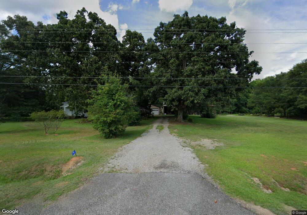
2941 Greensboro Hwy Watkinsville, GA 30677
Estimated Value: $912,000 - $1,383,670
2
Beds
2
Baths
1,732
Sq Ft
$712/Sq Ft
Est. Value
About This Home
This home is located at 2941 Greensboro Hwy, Watkinsville, GA 30677 and is currently estimated at $1,233,418, approximately $712 per square foot. 2941 Greensboro Hwy is a home located in Oconee County with nearby schools including Colham Ferry Elementary School, Oconee County Middle School, and Oconee County High School.
Ownership History
Date
Name
Owned For
Owner Type
Purchase Details
Closed on
Mar 25, 2024
Sold by
Branton Milton L
Bought by
Branton Milton L
Current Estimated Value
Purchase Details
Closed on
Dec 14, 2023
Sold by
Thompson Matt
Bought by
Athens Construction Group Property Holdi
Purchase Details
Closed on
Oct 4, 2017
Sold by
Branton Wayman H
Bought by
Branton Milton L Trustee and Branton Wayman Houston Trust
Purchase Details
Closed on
Jul 24, 2012
Sold by
Downs Eula Mae
Bought by
Branton Jean D and Branton Wayman H
Purchase Details
Closed on
Jun 12, 2007
Sold by
Not Provided
Bought by
Downs Eula Mae
Create a Home Valuation Report for This Property
The Home Valuation Report is an in-depth analysis detailing your home's value as well as a comparison with similar homes in the area
Home Values in the Area
Average Home Value in this Area
Purchase History
| Date | Buyer | Sale Price | Title Company |
|---|---|---|---|
| Branton Milton L | -- | -- | |
| Athens Construction Group Property Holdi | $1,200,000 | -- | |
| Branton Milton L Trustee | -- | -- | |
| Branton Wayman H | -- | -- | |
| Branton Jean D | -- | -- | |
| Downs Eula Mae | -- | -- |
Source: Public Records
Tax History Compared to Growth
Tax History
| Year | Tax Paid | Tax Assessment Tax Assessment Total Assessment is a certain percentage of the fair market value that is determined by local assessors to be the total taxable value of land and additions on the property. | Land | Improvement |
|---|---|---|---|---|
| 2024 | $2,547 | $526,068 | $437,566 | $88,502 |
| 2023 | $2,547 | $462,458 | $380,494 | $81,964 |
| 2022 | $2,412 | $403,083 | $333,061 | $70,022 |
| 2021 | $2,363 | $351,622 | $289,618 | $62,004 |
| 2020 | $2,224 | $316,649 | $258,288 | $58,361 |
| 2019 | $2,146 | $294,578 | $238,760 | $55,818 |
| 2018 | $1,888 | $261,568 | $217,054 | $44,514 |
| 2017 | $1,275 | $200,990 | $174,176 | $26,814 |
Source: Public Records
Map
Nearby Homes
- 1010 Bridlegate Dr Unit 25
- 2812 Astondale Rd
- 1491 Saxon Rd
- 4081 Greensboro Hwy
- 2750 Colham Ferry Rd
- 1800 Elder Mill Rd
- 2300 Colham Ferry Rd
- 1050 Pembrook Ct
- 1990 Elder Mill Rd
- 1100 Ryland Hills Dr
- 1081 Old Mill Dr
- 1200 Ryland Hills Dr
- 1180 Greensboro Hwy
- 88 Morrison St
- 88 Morrison St Unit 56
- 100 Morrison St Unit 52
- 100 Morrison St
- 1931 Oliver Bridge Rd
- 1075 Harmony Bend Unit LOT 24
- 1070 Watson Ln Unit F1
- 2937 Greensboro Hwy
- 2980 Greensboro Hwy
- 2860 Greensboro Hwy
- 3051 Greensboro Hwy
- 3070 Greensboro Hwy
- 3310 Astondale Rd
- 3185 Greensboro Hwy
- 3131 Greensboro Hwy
- 3161 Astondale Rd
- 2801 Greensboro Hwy
- 3100 Greensboro Hwy
- 2791 Greensboro Hwy
- 3270 Astondale Rd
- 3159 Greensboro Hwy
- 2700 Greensboro Hwy
- 2927 Greensboro Hwy
- 2761 Greensboro Hwy
- 3210 Astondale Rd
- 3130 Astondale Rd
- 3150 Greensboro Hwy
