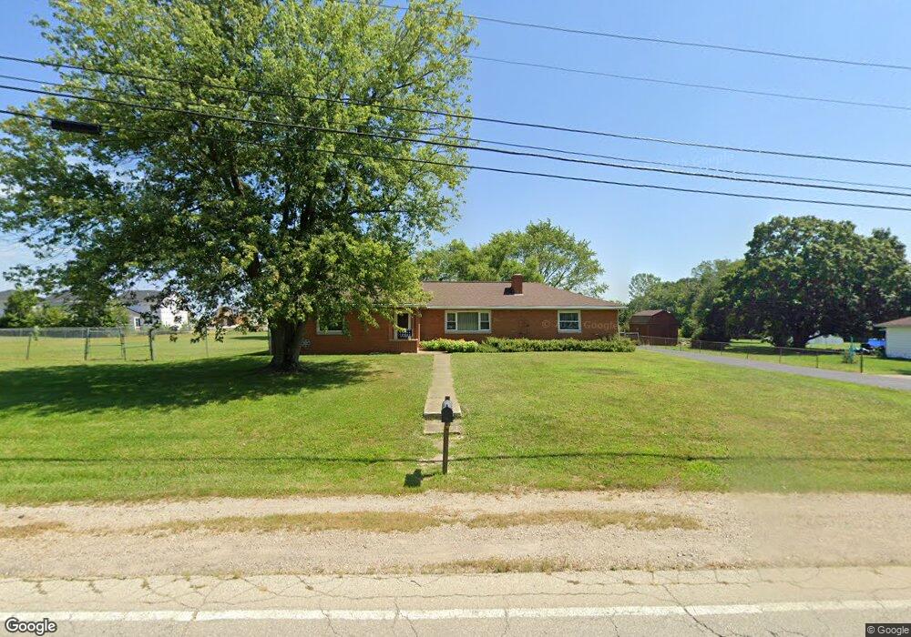
2942 Demorest Rd Grove City, OH 43123
Estimated Value: $307,830 - $335,000
3
Beds
2
Baths
1,440
Sq Ft
$223/Sq Ft
Est. Value
About This Home
This home is located at 2942 Demorest Rd, Grove City, OH 43123 and is currently estimated at $321,458, approximately $223 per square foot. 2942 Demorest Rd is a home located in Franklin County with nearby schools including Holt Crossing Intermediate School, Richard Avenue Elementary School, and Central Crossing High School.
Ownership History
Date
Name
Owned For
Owner Type
Purchase Details
Closed on
Oct 18, 2021
Sold by
Mills Richard E and Mills Theresa L
Bought by
City Of Grove City Ohio
Current Estimated Value
Purchase Details
Closed on
May 31, 1995
Sold by
Hahn Erick W
Bought by
Mills Richard E and Mills Theresa L
Home Financials for this Owner
Home Financials are based on the most recent Mortgage that was taken out on this home.
Original Mortgage
$60,000
Interest Rate
8.26%
Mortgage Type
New Conventional
Purchase Details
Closed on
Feb 7, 1995
Sold by
Prince Arthur Eugene
Bought by
Erick W Hahn
Home Financials for this Owner
Home Financials are based on the most recent Mortgage that was taken out on this home.
Original Mortgage
$20,000
Interest Rate
9.24%
Mortgage Type
New Conventional
Purchase Details
Closed on
Jan 19, 1993
Create a Home Valuation Report for This Property
The Home Valuation Report is an in-depth analysis detailing your home's value as well as a comparison with similar homes in the area
Home Values in the Area
Average Home Value in this Area
Purchase History
| Date | Buyer | Sale Price | Title Company |
|---|---|---|---|
| City Of Grove City Ohio | -- | None Listed On Document | |
| City Of Grove City Ohio | -- | Frost Brown Todd Llc | |
| Mills Richard E | $110,000 | -- | |
| Erick W Hahn | $80,000 | -- | |
| -- | $124,900 | -- |
Source: Public Records
Mortgage History
| Date | Status | Borrower | Loan Amount |
|---|---|---|---|
| Previous Owner | Mills Richard E | $60,000 | |
| Previous Owner | Erick W Hahn | $20,000 |
Source: Public Records
Tax History Compared to Growth
Tax History
| Year | Tax Paid | Tax Assessment Tax Assessment Total Assessment is a certain percentage of the fair market value that is determined by local assessors to be the total taxable value of land and additions on the property. | Land | Improvement |
|---|---|---|---|---|
| 2024 | $3,928 | $95,980 | $23,280 | $72,700 |
| 2023 | $3,901 | $95,980 | $23,280 | $72,700 |
| 2022 | $4,201 | $77,460 | $22,610 | $54,850 |
| 2021 | $4,282 | $77,460 | $22,610 | $54,850 |
| 2020 | $4,268 | $77,460 | $22,610 | $54,850 |
| 2019 | $3,791 | $65,350 | $18,830 | $46,520 |
| 2018 | $1,888 | $65,350 | $18,830 | $46,520 |
| 2017 | $3,763 | $65,350 | $18,830 | $46,520 |
| 2016 | $3,003 | $50,060 | $13,760 | $36,300 |
| 2015 | $1,502 | $50,060 | $13,760 | $36,300 |
| 2014 | $3,006 | $50,060 | $13,760 | $36,300 |
| 2013 | $1,510 | $52,710 | $14,490 | $38,220 |
Source: Public Records
Map
Nearby Homes
- 3864 Brody Dr
- 3834 Brody Dr
- 3663 Glacial Ln
- Fifth Avenue Plan at The Grove at Beulah Park
- Abbeyville Plan at The Grove at Beulah Park
- Boardwalk Plan at The Grove at Beulah Park
- Woodward Plan at The Grove at Beulah Park
- Park Place Plan at The Grove at Beulah Park
- 3786 Brody Dr Unit Lot 188
- 3780 Brody Dr Unit Lot 187
- 4041 Cypress Ave
- 3673 Magnolia St
- 3644 Beulah Park Dr
- 3707 Kassidy Dr
- 0 Elm St
- 3699 Kassidy Dr
- 3691 Kassidy Dr
- 4209 Marsol Ave
- 3675 Kassidy Dr
- 3669 Kassidy Dr
- 2950 Demorest Rd
- 3948 Marsol Ave
- 3939 Marsol Ave
- 2958 Demorest Rd
- 3953 Basswood Ave
- 3958 Marsol Ave
- 3951 Marsol Ave
- 3751 Mystic Way
- 3761 Mystic Way
- 3963 Basswood Ave
- 3968 Marsol Ave
- 3968 Marsol Ave Unit Ae
- 3745 Mystic Way
- 3963 Marsol Ave
- 3950 Basswood Ave Unit 952
- 3767 Mystic Way
- 2951 Demorest Rd
- 3973 Basswood Ave
- 3978 Marsol Ave
- 3760 Mystic Way