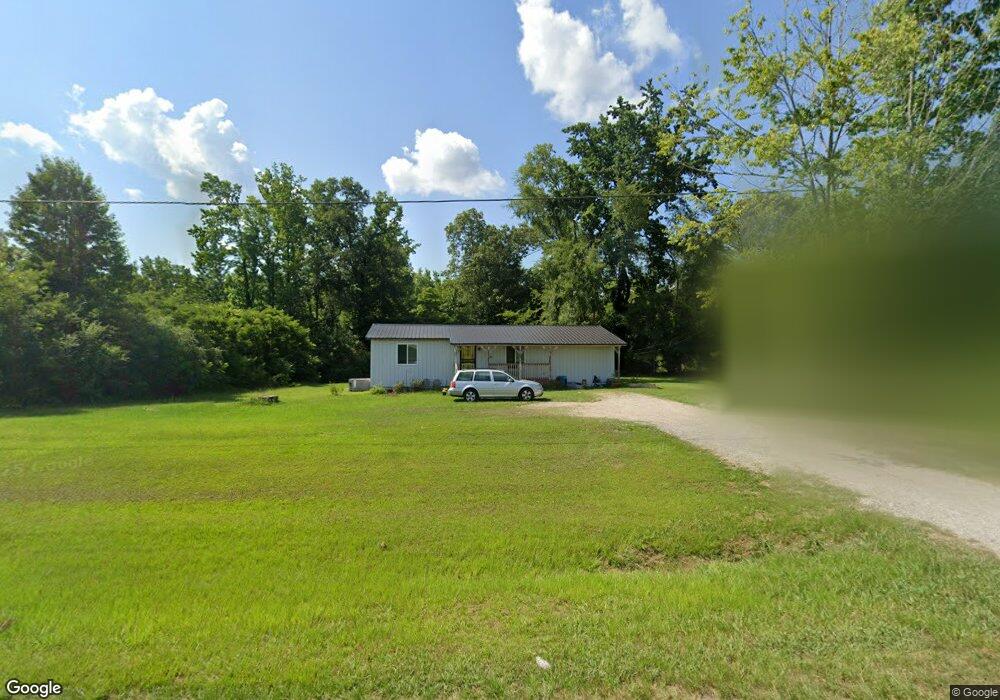
29421 State Highway 79 Locust Fork, AL 35097
Estimated Value: $111,058 - $214,000
--
Bed
--
Bath
1,274
Sq Ft
$142/Sq Ft
Est. Value
About This Home
This home is located at 29421 State Highway 79, Locust Fork, AL 35097 and is currently estimated at $181,515, approximately $142 per square foot. 29421 State Highway 79 is a home located in Blount County with nearby schools including Locust Fork Elementary School and Locust Fork High School.
Ownership History
Date
Name
Owned For
Owner Type
Purchase Details
Closed on
Sep 16, 2011
Sold by
Young Christopher L
Bought by
Edwards Kayla
Current Estimated Value
Purchase Details
Closed on
Jan 31, 2007
Sold by
Harris Euclid A and Harris Gloria S
Bought by
Mcmurrey Nickolas L
Home Financials for this Owner
Home Financials are based on the most recent Mortgage that was taken out on this home.
Original Mortgage
$53,000
Interest Rate
6.08%
Mortgage Type
Purchase Money Mortgage
Create a Home Valuation Report for This Property
The Home Valuation Report is an in-depth analysis detailing your home's value as well as a comparison with similar homes in the area
Home Values in the Area
Average Home Value in this Area
Purchase History
| Date | Buyer | Sale Price | Title Company |
|---|---|---|---|
| Edwards Kayla | -- | -- | |
| Mcmurrey Nickolas L | $53,000 | -- |
Source: Public Records
Mortgage History
| Date | Status | Borrower | Loan Amount |
|---|---|---|---|
| Previous Owner | Mcmurrey Nickolas L | $53,000 |
Source: Public Records
Tax History Compared to Growth
Tax History
| Year | Tax Paid | Tax Assessment Tax Assessment Total Assessment is a certain percentage of the fair market value that is determined by local assessors to be the total taxable value of land and additions on the property. | Land | Improvement |
|---|---|---|---|---|
| 2024 | $190 | $6,600 | $600 | $6,000 |
| 2023 | $190 | $6,140 | $600 | $5,540 |
| 2022 | $183 | $6,420 | $600 | $5,820 |
| 2021 | $145 | $5,420 | $640 | $4,780 |
| 2020 | $136 | $4,760 | $600 | $4,160 |
| 2019 | $121 | $4,760 | $600 | $4,160 |
| 2018 | $152 | $5,600 | $600 | $5,000 |
| 2017 | $137 | $5,200 | $0 | $0 |
| 2015 | $137 | $5,200 | $0 | $0 |
| 2014 | $151 | $5,580 | $0 | $0 |
| 2013 | -- | $5,560 | $0 | $0 |
Source: Public Records
Map
Nearby Homes
- 29542 Alabama 79
- #0 Shady Point Rd
- 178 Jerry Marsh Rd
- 3251 County Highway 13
- 380 Jerry Marsh Rd
- 89 Pine Tree Dr
- 159 Ray Dr
- 31730 Alabama 79
- 0 Center Hill Rd Unit 21411639
- 265 Riverview Dr
- 2898 County Highway 15
- 496 Tawbush Rd
- 1129 Baty Rd
- 32510 Alabama 79
- 25942 Alabama 79
- 707 Saint Andrews Pkwy
- 640 Gilman Bend Rd
- Lot 104 Muirfield Cir Unit 104
- 1065 Saint Andrews Pkwy
- 33412 Alabama 79
- 29421 Alabama 79
- 35 Massey Rd
- 29377 State Highway 79
- 29323 Alabama 79
- 130 Massey Rd
- 29297 Alabama 79
- 29297 State Highway 79
- 152 Massey Rd
- 150 Massey Rd
- 29273 State Highway 79
- 4718 Gibson Cir
- 190 Massey Rd
- 0 Highway 13 Unit 819273
- 29542 State Highway 79
- 0 Azzilee Cir Unit 12 1333271
- 0 Azzilee Cir Unit 9 1333270
- 0 Shallowbrook Dr Unit 1328254
- 856 Jerry Marsh Rd
- 0 County Road 15 Unit 1316248
- 29570 State Highway 79