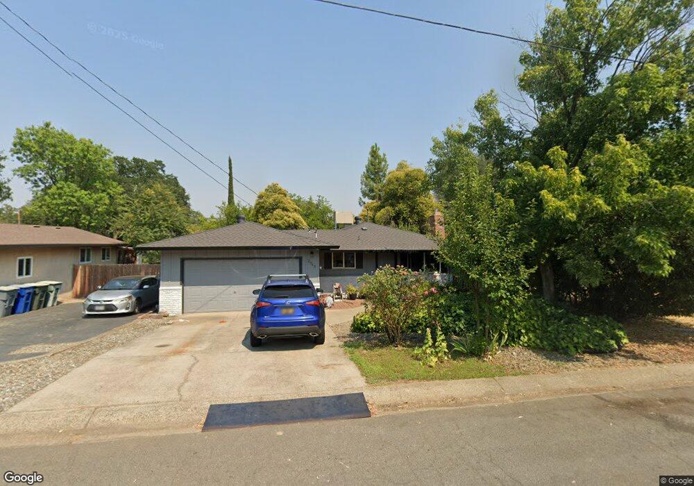
2943 Robert Ct Redding, CA 96002
Reservoir NeighborhoodEstimated Value: $230,000 - $296,000
3
Beds
2
Baths
1,008
Sq Ft
$259/Sq Ft
Est. Value
About This Home
This home is located at 2943 Robert Ct, Redding, CA 96002 and is currently estimated at $261,112, approximately $259 per square foot. 2943 Robert Ct is a home located in Shasta County with nearby schools including Shasta Meadows Elementary School, Parsons Junior High School, and Enterprise High School.
Ownership History
Date
Name
Owned For
Owner Type
Purchase Details
Closed on
Feb 23, 2011
Sold by
Obar Johnnie
Bought by
Obar Eva
Current Estimated Value
Purchase Details
Closed on
Feb 17, 2006
Sold by
Obar Johnnie and Blackburn Eva M
Bought by
Obar Johnnie and Obar Eva
Home Financials for this Owner
Home Financials are based on the most recent Mortgage that was taken out on this home.
Original Mortgage
$116,893
Outstanding Balance
$83,381
Interest Rate
11.25%
Mortgage Type
Stand Alone Refi Refinance Of Original Loan
Estimated Equity
$177,731
Purchase Details
Closed on
Jul 6, 1999
Sold by
Grise Thealen E and Grise Phyllis
Bought by
Obar Johnnie and Blackburn Eva M
Home Financials for this Owner
Home Financials are based on the most recent Mortgage that was taken out on this home.
Original Mortgage
$77,002
Interest Rate
7.47%
Mortgage Type
FHA
Purchase Details
Closed on
Jun 11, 1998
Sold by
Grise Thealen E and Grise Phyllis
Bought by
Grise Thealen E and Grise Phyllis R
Create a Home Valuation Report for This Property
The Home Valuation Report is an in-depth analysis detailing your home's value as well as a comparison with similar homes in the area
Home Values in the Area
Average Home Value in this Area
Purchase History
| Date | Buyer | Sale Price | Title Company |
|---|---|---|---|
| Obar Eva | -- | None Available | |
| Obar Johnnie | -- | First American Title Co | |
| Obar Johnnie | $77,500 | Fidelity National Title Co | |
| Grise Thealen E | -- | -- |
Source: Public Records
Mortgage History
| Date | Status | Borrower | Loan Amount |
|---|---|---|---|
| Open | Obar Johnnie | $116,893 | |
| Previous Owner | Obar Johnnie | $77,002 |
Source: Public Records
Tax History
| Year | Tax Paid | Tax Assessment Tax Assessment Total Assessment is a certain percentage of the fair market value that is determined by local assessors to be the total taxable value of land and additions on the property. | Land | Improvement |
|---|---|---|---|---|
| 2025 | $1,318 | $119,087 | $33,798 | $85,289 |
| 2024 | $1,300 | $116,753 | $33,136 | $83,617 |
| 2023 | $1,300 | $114,465 | $32,487 | $81,978 |
| 2022 | $1,263 | $112,221 | $31,850 | $80,371 |
| 2021 | $1,220 | $110,022 | $31,226 | $78,796 |
| 2020 | $1,214 | $108,895 | $30,906 | $77,989 |
| 2019 | $1,204 | $106,760 | $30,300 | $76,460 |
| 2018 | $1,190 | $104,667 | $29,706 | $74,961 |
| 2017 | $1,211 | $102,616 | $29,124 | $73,492 |
| 2016 | $1,133 | $100,604 | $28,553 | $72,051 |
| 2015 | $1,124 | $99,094 | $28,125 | $70,969 |
| 2014 | $1,116 | $97,154 | $27,575 | $69,579 |
Source: Public Records
Map
Nearby Homes
- 2906 Regal Ave
- 2976 West Way
- 2855 Irwin Rd
- 3283 Middleton Ln
- 2893 Alfreda Way
- 2820 Alfreda Way
- 3293 Middleton Ln
- 1701 E Cypress Ave
- 2583 Reservoir Ln
- 3072 Alta Mesa Dr
- 2631 Alfreda Way
- 3178 Lawrence Rd
- 3341 Timbercreek Dr
- 2728 Jasmine Way
- 3360 Lawrence Rd
- 3425 Silverwood St
- 3466 Silverwood St
- 3528 Silverwood St
- 1075 Le Brun Ln
- 1397 Empress Ln
- 2931 Robert Ct
- 2951 Robert Ct
- 2919 Robert Ct
- 2942 Robert Ct
- 2907 Robert Ct
- 2930 Robert Ct
- 2952 Robert Ct
- 2952 Robert Ct
- 2918 Robert Ct
- 1674 Hartnell Ave
- 2962 Robert Ct
- 2895 Robert Ct
- 2906 Robert Ct
- 2883 Robert Ct
- 2894 Robert Ct
- 2933 Fairway Ave
- 0 Victor Ave Unit 20-3131
- 0 Victor Ave Unit 98-73466
- 0 Victor Ave Unit 5-230
- 0 Victor Ave Unit 4-5629
Your Personal Tour Guide
Ask me questions while you tour the home.