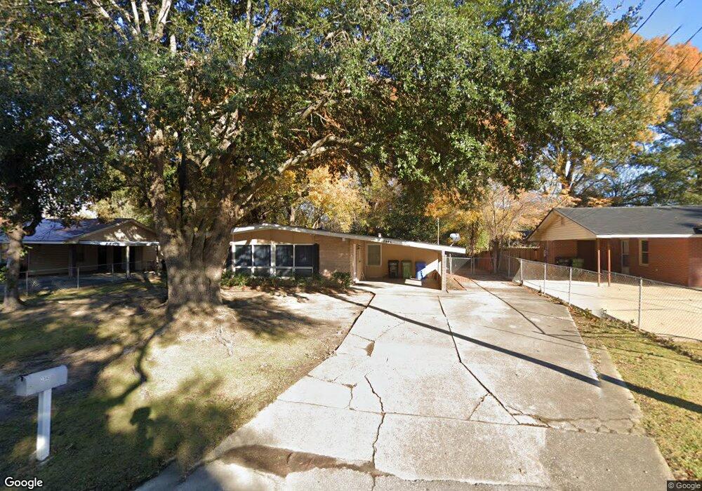
2945 Avondale Rd Columbus, GA 31903
Southern Columbus NeighborhoodEstimated Value: $120,000 - $159,000
3
Beds
3
Baths
1,869
Sq Ft
$72/Sq Ft
Est. Value
About This Home
This home is located at 2945 Avondale Rd, Columbus, GA 31903 and is currently estimated at $134,193, approximately $71 per square foot. 2945 Avondale Rd is a home located in Muscogee County with nearby schools including South Columbus Elementary School, Eddy Middle School, and Spencer High School.
Ownership History
Date
Name
Owned For
Owner Type
Purchase Details
Closed on
Oct 22, 2012
Sold by
Sec Of Housing & U
Bought by
Turman Frank A and Turman Edna E
Current Estimated Value
Purchase Details
Closed on
Oct 5, 2010
Sold by
Bac Home Loans Servicing L
Bought by
Sec Of Housing & Urban
Purchase Details
Closed on
Apr 18, 2008
Sold by
Barbian Henry N
Bought by
Snipes Shirley A and Snipes Theresa D
Home Financials for this Owner
Home Financials are based on the most recent Mortgage that was taken out on this home.
Original Mortgage
$94,516
Interest Rate
6.03%
Mortgage Type
FHA
Create a Home Valuation Report for This Property
The Home Valuation Report is an in-depth analysis detailing your home's value as well as a comparison with similar homes in the area
Home Values in the Area
Average Home Value in this Area
Purchase History
| Date | Buyer | Sale Price | Title Company |
|---|---|---|---|
| Turman Frank A | $45,000 | -- | |
| Sec Of Housing & Urban | $102,001 | -- | |
| Bac Home Loans Servicing Lp | $102,000 | None Available | |
| Snipes Shirley A | $96,000 | None Available |
Source: Public Records
Mortgage History
| Date | Status | Borrower | Loan Amount |
|---|---|---|---|
| Previous Owner | Snipes Shirley A | $94,516 |
Source: Public Records
Tax History Compared to Growth
Tax History
| Year | Tax Paid | Tax Assessment Tax Assessment Total Assessment is a certain percentage of the fair market value that is determined by local assessors to be the total taxable value of land and additions on the property. | Land | Improvement |
|---|---|---|---|---|
| 2025 | $1,787 | $45,660 | $4,252 | $41,408 |
| 2024 | $164 | $42,008 | $4,252 | $37,756 |
| 2023 | $1,655 | $42,008 | $4,252 | $37,756 |
| 2022 | $1,372 | $33,600 | $4,252 | $29,348 |
| 2021 | $1,315 | $32,216 | $4,252 | $27,964 |
| 2020 | $1,316 | $32,216 | $4,252 | $27,964 |
| 2019 | $1,320 | $32,216 | $4,252 | $27,964 |
| 2018 | $1,320 | $32,216 | $4,252 | $27,964 |
| 2017 | $1,324 | $32,216 | $4,252 | $27,964 |
| 2016 | $1,526 | $37,006 | $3,450 | $33,556 |
| 2015 | $1,528 | $37,006 | $3,450 | $33,556 |
| 2014 | $1,530 | $37,006 | $3,450 | $33,556 |
| 2013 | -- | $37,006 | $3,450 | $33,556 |
Source: Public Records
Map
Nearby Homes
- 2973 Hawthorne Dr
- 3009 Plantation Rd
- 2451 Brownie Ln
- 1274 Providence Ln
- 2463 Brownie Ln
- 2102 Somerset Ave
- 3042 Colonial Dr
- 2463 Brownie St
- 3015 Hendrix St
- 2203 Simmons Ave
- 2333 Bruce Ave
- 3135 Baker Cir
- 2404 Bruce Ave
- 3310 Albert St
- 2309 Ginny Ave
- 1029 Harbison Dr
- 3110 Victory Dr
- 2425 Howe Ave
- 2417 Manning Ave
- 2313 Dorothy Ave
- 2949 Avondale Rd
- 2941 Avondale Rd
- 0 Avondale Rd Unit 8005522
- 2880 Ramsey Rd
- 2874 Ramsey Rd
- 2951 Avondale Rd
- 2939 Avondale Rd
- 2886 Ramsey Rd
- 2870 Ramsey Rd
- 2950 Avondale Rd
- 2954 Avondale Rd
- 2864 Ramsey Rd
- 0 Ramsey Rd Unit 8729551
- 0 Ramsey Rd Unit 8232629
- 0 Ramsey Rd Unit 7578622
- 0 Ramsey Rd Unit 7468860
- 2935 Avondale Rd
- 2958 Avondale Rd
- 2942 Avondale Rd
- 2858 Ramsey Rd