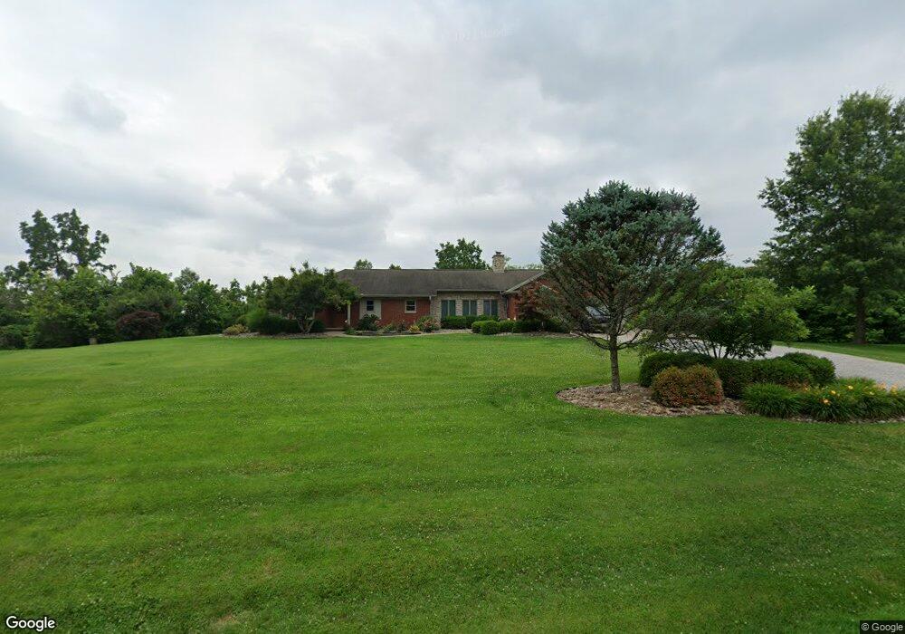
2945 Glendale Rd Marietta, OH 45750
Estimated Value: $315,000 - $364,000
3
Beds
2
Baths
2,238
Sq Ft
$152/Sq Ft
Est. Value
About This Home
This home is located at 2945 Glendale Rd, Marietta, OH 45750 and is currently estimated at $340,473, approximately $152 per square foot. 2945 Glendale Rd is a home with nearby schools including Marietta High School and St. Mary Catholic School.
Ownership History
Date
Name
Owned For
Owner Type
Purchase Details
Closed on
Dec 8, 2020
Sold by
Bertram Seth M and Bertram Melanie D
Bought by
Bertram Eric A and Collins Ashley N
Current Estimated Value
Home Financials for this Owner
Home Financials are based on the most recent Mortgage that was taken out on this home.
Original Mortgage
$217,045
Outstanding Balance
$175,904
Interest Rate
2.8%
Mortgage Type
New Conventional
Estimated Equity
$164,569
Purchase Details
Closed on
Jun 15, 2017
Sold by
Bertram Seth M and Bertram Melanie D
Bought by
Bertram Eric A
Home Financials for this Owner
Home Financials are based on the most recent Mortgage that was taken out on this home.
Original Mortgage
$234,000
Interest Rate
2.62%
Mortgage Type
Seller Take Back
Purchase Details
Closed on
Aug 15, 2000
Bought by
Bertram Seth M and Bertram Melanie
Create a Home Valuation Report for This Property
The Home Valuation Report is an in-depth analysis detailing your home's value as well as a comparison with similar homes in the area
Home Values in the Area
Average Home Value in this Area
Purchase History
| Date | Buyer | Sale Price | Title Company |
|---|---|---|---|
| Bertram Eric A | $260,000 | None Available | |
| Bertram Eric A | $260,000 | Attorney | |
| Bertram Seth M | $83,500 | -- |
Source: Public Records
Mortgage History
| Date | Status | Borrower | Loan Amount |
|---|---|---|---|
| Open | Bertram Eric A | $217,045 | |
| Previous Owner | Bertram Eric A | $234,000 |
Source: Public Records
Tax History Compared to Growth
Tax History
| Year | Tax Paid | Tax Assessment Tax Assessment Total Assessment is a certain percentage of the fair market value that is determined by local assessors to be the total taxable value of land and additions on the property. | Land | Improvement |
|---|---|---|---|---|
| 2024 | $1,981 | $53,920 | $6,680 | $47,240 |
| 2023 | $1,981 | $53,920 | $6,680 | $47,240 |
| 2022 | $1,959 | $53,920 | $6,680 | $47,240 |
| 2021 | $2,403 | $62,880 | $7,350 | $55,530 |
| 2020 | $2,466 | $62,880 | $7,350 | $55,530 |
| 2019 | $2,466 | $62,880 | $7,350 | $55,530 |
| 2018 | $2,162 | $53,320 | $6,120 | $47,200 |
| 2017 | $2,141 | $53,320 | $6,120 | $47,200 |
| 2016 | $3,635 | $53,320 | $6,120 | $47,200 |
| 2015 | $2,133 | $51,100 | $5,760 | $45,340 |
| 2014 | $3,489 | $51,100 | $5,760 | $45,340 |
| 2013 | $1,409 | $67,630 | $8,770 | $58,860 |
Source: Public Records
Map
Nearby Homes
- 2585 Glendale Rd
- 107 Country Meadow Dr
- 101 Winters Dr
- 123 Deerwalk Cir
- 520 Millgate Rd
- 1 Brooks Ln
- 120 Meadow Ln
- 8 Mountain Laurel Dr
- 6 Mountain Laurel Dr
- 5 Mountain Laurel Dr
- 3 Mountain Laurel Dr
- 0 Mountain Laurel Dr
- 1320 Caywood Rd
- 105 Woodcrest Dr
- 0 Academy Dr
- 207 Lindsey Ave
- 1099 Colegate Dr
- 120 Woodcrest Dr
- 1 Hickory Ln
- 126 Sylvan Way
- 3045 Glendale Rd
- 1730 Glendale Rd
- 30 Stanleyville Rd
- 160 Stanleyville Rd
- 2670 Glendale Rd
- 3345 Glendale Rd
- 3215 Glendale Rd
- 3380 Glendale Rd
- 3230 Glendale Rd
- 140 Stanleyville Rd
- 2600 Glendale Rd
- 3240 Glendale Rd
- 0 Glendale Rd
- 000 Glendale Rd
- 00 Glendale Rd
- 16022 Glendale Rd
- 16043 Glendale Rd
- 1755 Ohio 821
- 1755 State Route 821
- 2015 State Route 821