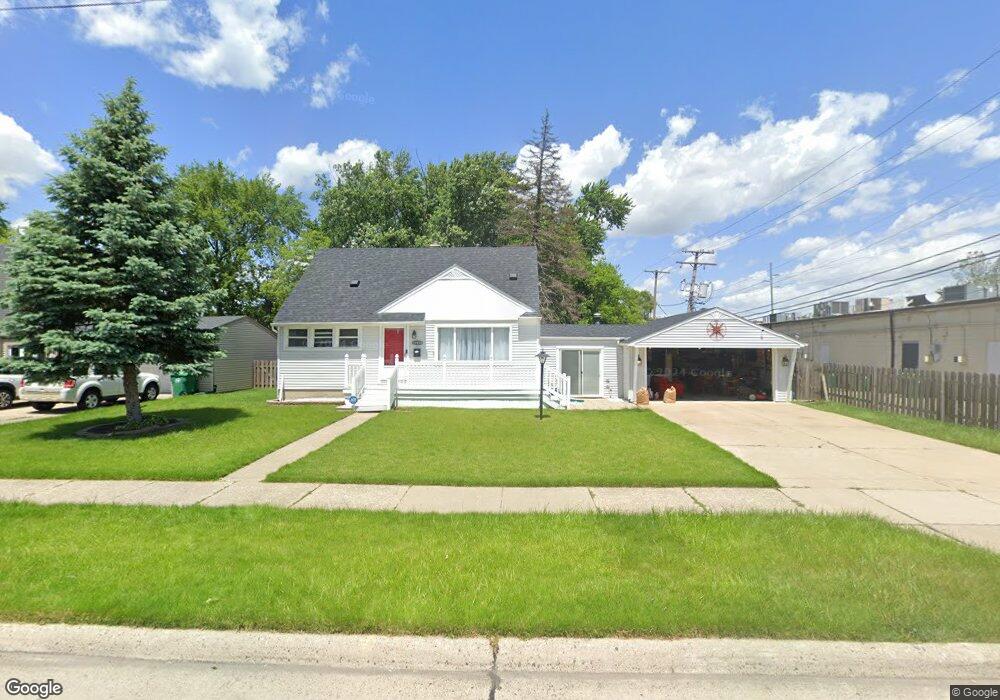
29450 Windsor St Unit Bldg-Unit Garden City, MI 48135
Estimated Value: $234,000 - $274,000
--
Bed
1
Bath
1,446
Sq Ft
$171/Sq Ft
Est. Value
About This Home
This home is located at 29450 Windsor St Unit Bldg-Unit, Garden City, MI 48135 and is currently estimated at $247,219, approximately $170 per square foot. 29450 Windsor St Unit Bldg-Unit is a home located in Wayne County with nearby schools including Douglas Elementary 3-4 Campus, Memorial Elementary 1-2 Campus, and Garden City Middle School.
Ownership History
Date
Name
Owned For
Owner Type
Purchase Details
Closed on
Sep 28, 2018
Sold by
Zabik Kristie Welsh
Bought by
Nearhood Elspeth
Current Estimated Value
Purchase Details
Closed on
Aug 11, 2016
Sold by
Livi Zabik Kristie Welsh
Bought by
Zabik Kristie Welsh
Purchase Details
Closed on
Dec 18, 2007
Sold by
Welsh William W and Welsh Gretchen C
Bought by
Welsh William W and William W Welsh Revocable Trust
Create a Home Valuation Report for This Property
The Home Valuation Report is an in-depth analysis detailing your home's value as well as a comparison with similar homes in the area
Home Values in the Area
Average Home Value in this Area
Purchase History
| Date | Buyer | Sale Price | Title Company |
|---|---|---|---|
| Nearhood Elspeth | $132,500 | Vintage Title Agency | |
| Zabik Kristie Welsh | -- | Attorney | |
| Welsh William W | -- | None Available |
Source: Public Records
Tax History Compared to Growth
Tax History
| Year | Tax Paid | Tax Assessment Tax Assessment Total Assessment is a certain percentage of the fair market value that is determined by local assessors to be the total taxable value of land and additions on the property. | Land | Improvement |
|---|---|---|---|---|
| 2025 | $3,753 | $95,900 | $0 | $0 |
| 2024 | $3,753 | $95,200 | $0 | $0 |
| 2023 | $4,387 | $87,600 | $0 | $0 |
| 2022 | $4,019 | $76,100 | $0 | $0 |
| 2021 | $5,158 | $71,300 | $0 | $0 |
| 2020 | $4,027 | $68,900 | $0 | $0 |
| 2019 | $3,236 | $62,700 | $0 | $0 |
| 2018 | $2,185 | $51,400 | $0 | $0 |
| 2017 | $1,272 | $48,300 | $0 | $0 |
| 2016 | $2,425 | $44,400 | $0 | $0 |
| 2015 | $3,688 | $40,500 | $0 | $0 |
| 2013 | $3,670 | $38,000 | $0 | $0 |
| 2012 | $2,124 | $39,200 | $13,700 | $25,500 |
Source: Public Records
Map
Nearby Homes
- 29498 Bridge St
- 29801 Bridge St
- 6747 Burnly St
- 6649 Burnly St
- 28912 Cambridge St
- 6705 Whitby St
- 29878 Malvern St
- 28627 Bridge St
- 28843 Balmoral St
- 28832 Block St
- 29825 Dawson Ave
- 29825 Dawson St
- 28614 Block St
- 6727 Hawthorne St
- 28538 Block St
- 7505 Donna St
- 28343 Maplewood St
- 7637 Melvin Ave
- 28424 Elmwood St
- 6253 Lathers St
- 29450 Windsor St
- 29458 Windsor St
- 6719 Middlebelt Rd
- 29417 Cambridge St
- 6773 Middlebelt Rd
- 29471 Cambridge St Unit Bldg-Unit
- 29471 Cambridge St
- 29490 Windsor St
- 29427 Windsor St
- 29503 Cambridge St
- 29463 Windsor St
- 29530 Windsor St
- 29522 Windsor St
- 6629 Middlebelt Rd Unit Bldg-Unit
- 6629 Middlebelt Rd
- 6629 Middlebelt Rd Unit 6659
- 6629 Middlebelt Rd Unit 6629
- 29517 Cambridge St
- 29519 Windsor St
- 29529 Cambridge St