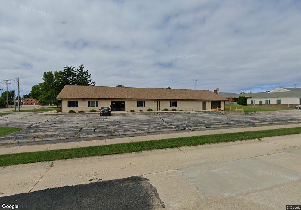
2946 Division St St. Joseph, MI 49085
Estimated Value: $447,255
--
Bed
1
Bath
6,353
Sq Ft
$70/Sq Ft
Est. Value
About This Home
This home is located at 2946 Division St, St. Joseph, MI 49085 and is currently estimated at $447,255, approximately $70 per square foot. 2946 Division St is a home located in Berrien County with nearby schools including Upton Middle School, St. Joseph High School, and Trinity Lutheran School.
Ownership History
Date
Name
Owned For
Owner Type
Purchase Details
Closed on
Jun 13, 2023
Sold by
Drew Holdings Llc
Bought by
Berrien County Treasurer
Current Estimated Value
Purchase Details
Closed on
Jan 29, 2018
Sold by
Buesing Walter E and Buesing Joanne
Bought by
Drew Holdings Llc
Home Financials for this Owner
Home Financials are based on the most recent Mortgage that was taken out on this home.
Original Mortgage
$201,600
Interest Rate
3.94%
Mortgage Type
Commercial
Purchase Details
Closed on
Jan 4, 1996
Create a Home Valuation Report for This Property
The Home Valuation Report is an in-depth analysis detailing your home's value as well as a comparison with similar homes in the area
Home Values in the Area
Average Home Value in this Area
Purchase History
| Date | Buyer | Sale Price | Title Company |
|---|---|---|---|
| Berrien County Treasurer | -- | -- | |
| Drew Holdings Llc | $252,000 | None Available | |
| -- | $250,000 | -- |
Source: Public Records
Mortgage History
| Date | Status | Borrower | Loan Amount |
|---|---|---|---|
| Previous Owner | Drew Holdings Llc | $201,600 |
Source: Public Records
Tax History Compared to Growth
Tax History
| Year | Tax Paid | Tax Assessment Tax Assessment Total Assessment is a certain percentage of the fair market value that is determined by local assessors to be the total taxable value of land and additions on the property. | Land | Improvement |
|---|---|---|---|---|
| 2025 | $13,332 | $242,900 | $0 | $0 |
| 2024 | $12,241 | $221,200 | $0 | $0 |
| 2023 | $11,714 | $203,200 | $0 | $0 |
| 2022 | $11,291 | $204,900 | $0 | $0 |
| 2021 | $11,129 | $199,400 | $62,700 | $136,700 |
| 2020 | $11,310 | $186,700 | $0 | $0 |
| 2019 | $11,005 | $177,200 | $59,300 | $117,900 |
| 2018 | $10,288 | $177,200 | $0 | $0 |
| 2017 | $9,878 | $169,300 | $0 | $0 |
| 2016 | $9,878 | $175,200 | $0 | $0 |
| 2015 | $10,040 | $179,200 | $0 | $0 |
| 2014 | $9,822 | $187,300 | $0 | $0 |
Source: Public Records
Map
Nearby Homes
- Parcel 2-B Niles Road M-63
- 816 Saint Joseph Dr
- 1189 Lydia Dr
- 705 Columbia Ave
- 2816 Evergreen Dr
- 1100 Highland Ave
- 3118 Cleveland Ave
- 2469 Washington Ave
- 944 Eagle Point Dr
- 924 Eagle Point Dr
- 227 N Sunnybank Rd
- 00 Lakeshore Dr
- 0 Lakeshore Dr Unit 24019795
- V/L Niles Rd
- 2530 Bristol Terrace Unit 85
- 2317 S Pointe Way Unit 5
- 2214 S State St Unit 107
- 2401 Bay Pointe Dr
- 2500 Bay Pointe Dr
- 315 Kingsley Ave
- 2918 Division St
- 717 Saint Joseph Dr
- 731 St Joseph Dr
- 731 Saint Joseph Dr
- 2919 Division St
- 3001 S State St
- 2930 Niles Ave
- 2944 Niles Ave
- 2916 Niles Ave
- 3333 S State St
- 700 Midway Ave
- 2932 Niles Ave
- 2942 Niles Ave
- 2946 Niles Ave
- 2824 S State St Unit 2
- 2824 S State St Unit 1
- 2824 S State St
- 2820 S State St
- 718 Melody Ln
- 2844 Niles Ave