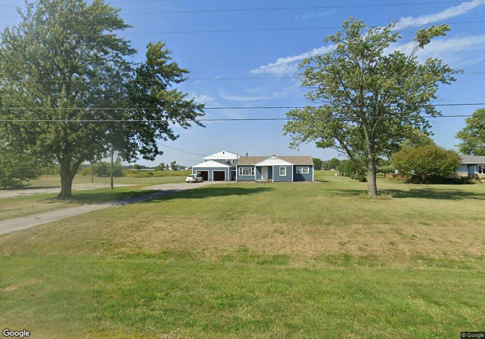
2947 W Us Highway 224 Tiffin, OH 44883
Estimated Value: $171,000 - $319,000
3
Beds
2
Baths
3,064
Sq Ft
$77/Sq Ft
Est. Value
About This Home
This home is located at 2947 W Us Highway 224, Tiffin, OH 44883 and is currently estimated at $235,789, approximately $76 per square foot. 2947 W Us Highway 224 is a home with nearby schools including Hopewell-Loudon Local Elementary School, North Central Academy - Fremont, and Calvert Catholic Elementary School.
Ownership History
Date
Name
Owned For
Owner Type
Purchase Details
Closed on
May 17, 2007
Sold by
Logsdon James L and Logsdon Barbara A
Bought by
R Investments Llc
Current Estimated Value
Home Financials for this Owner
Home Financials are based on the most recent Mortgage that was taken out on this home.
Original Mortgage
$88,000
Outstanding Balance
$12,844
Interest Rate
7%
Mortgage Type
Adjustable Rate Mortgage/ARM
Estimated Equity
$222,945
Purchase Details
Closed on
Mar 25, 1992
Sold by
Williams Ruth and Williams Donavan
Bought by
Logsdon James L
Create a Home Valuation Report for This Property
The Home Valuation Report is an in-depth analysis detailing your home's value as well as a comparison with similar homes in the area
Home Values in the Area
Average Home Value in this Area
Purchase History
| Date | Buyer | Sale Price | Title Company |
|---|---|---|---|
| R Investments Llc | $87,000 | None Available | |
| Logsdon James L | $55,000 | -- |
Source: Public Records
Mortgage History
| Date | Status | Borrower | Loan Amount |
|---|---|---|---|
| Open | R Investments Llc | $88,000 |
Source: Public Records
Tax History Compared to Growth
Tax History
| Year | Tax Paid | Tax Assessment Tax Assessment Total Assessment is a certain percentage of the fair market value that is determined by local assessors to be the total taxable value of land and additions on the property. | Land | Improvement |
|---|---|---|---|---|
| 2024 | $1,645 | $43,210 | $9,730 | $33,480 |
| 2023 | $1,645 | $43,210 | $9,730 | $33,480 |
| 2022 | $1,496 | $36,220 | $9,760 | $26,460 |
| 2021 | $1,505 | $36,220 | $9,760 | $26,460 |
| 2020 | $1,512 | $36,219 | $9,762 | $26,457 |
| 2019 | $1,328 | $31,494 | $8,488 | $23,006 |
| 2018 | $1,360 | $31,494 | $8,488 | $23,006 |
| 2017 | $1,383 | $31,494 | $8,488 | $23,006 |
| 2016 | $1,160 | $28,827 | $7,809 | $21,018 |
| 2015 | $1,145 | $28,827 | $7,809 | $21,018 |
| 2014 | $1,423 | $28,827 | $7,809 | $21,018 |
| 2013 | $1,513 | $28,827 | $7,809 | $21,018 |
Source: Public Records
Map
Nearby Homes
- 0 Shaffer Park Dr Unit 20251435
- 0 County Road 54 Unit 225023228
- 0 County Road 54 Unit 20242258
- 0 W Market St
- 2483 W County Road 52
- 2031 W County Road 52
- 1590 Meadowlake Dr
- 841 S Sandusky St
- 169 Nelson St
- 115 Lindsay Ave
- 2050 W County Road 52
- 39 Cherry St
- 0 Township Road 198a Unit 20242098
- 0 Township Road 198a Unit 6116514
- 185 Longfellow Dr
- 2351 S State Route 53
- 0 Miami St Unit 20242078
- 0 Miami St Unit 6116475
- 29 Virginia Ave
- 314 S Sandusky St
- 2917 U S 224
- 2917 W Us Highway 224
- 2889 W Us Highway 224
- 2889 U S 224
- 2912 W Us Highway 224
- 2934 W Us Highway 224
- 2896 W Us Highway 224
- 2878 U S 224
- 2878 W Us Highway 224
- 2849 W Us Highway 224
- 2862 W Us Highway 224
- 2976 W Us Highway 224
- 2833 W Us Highway 224
- 2833 U S 224
- 2844 W Us Highway 224
- 2976 U S 224
- 2822 U S 224
- 2822 St Rt 224
- 2822 W Us Highway 224
- 2801 W Us Highway 224