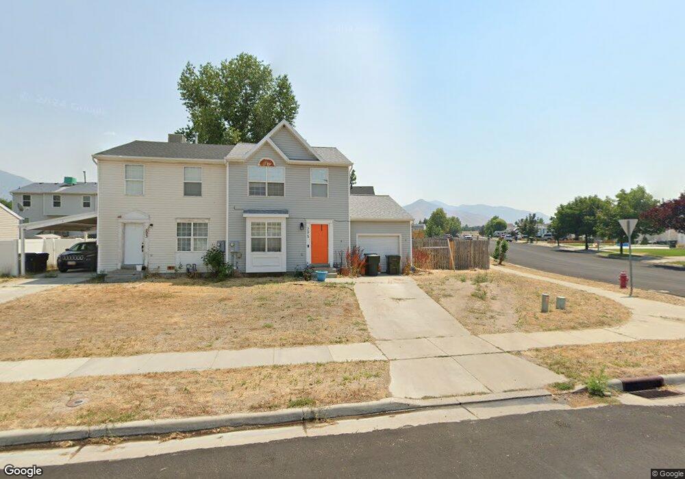
295 Alfred Dr Tooele, UT 84074
Estimated Value: $336,000 - $370,000
3
Beds
1
Bath
1,596
Sq Ft
$219/Sq Ft
Est. Value
About This Home
This home is located at 295 Alfred Dr, Tooele, UT 84074 and is currently estimated at $349,251, approximately $218 per square foot. 295 Alfred Dr is a home located in Tooele County with nearby schools including Northlake Elementary School, Tooele Junior High School, and Tooele High School.
Ownership History
Date
Name
Owned For
Owner Type
Purchase Details
Closed on
May 30, 2008
Sold by
Dunn Jessica and Bunn Jessica
Bought by
Wanlass Keith Kaed and Wanlass Adrianna Doris
Current Estimated Value
Home Financials for this Owner
Home Financials are based on the most recent Mortgage that was taken out on this home.
Original Mortgage
$132,914
Outstanding Balance
$84,502
Interest Rate
5.87%
Mortgage Type
FHA
Estimated Equity
$264,749
Create a Home Valuation Report for This Property
The Home Valuation Report is an in-depth analysis detailing your home's value as well as a comparison with similar homes in the area
Purchase History
| Date | Buyer | Sale Price | Title Company |
|---|---|---|---|
| Wanlass Keith Kaed | -- | Equity Title |
Source: Public Records
Mortgage History
| Date | Status | Borrower | Loan Amount |
|---|---|---|---|
| Open | Wanlass Keith Kaed | $132,914 |
Source: Public Records
Tax History
| Year | Tax Paid | Tax Assessment Tax Assessment Total Assessment is a certain percentage of the fair market value that is determined by local assessors to be the total taxable value of land and additions on the property. | Land | Improvement |
|---|---|---|---|---|
| 2025 | $2,060 | $312,417 | $93,750 | $218,667 |
| 2024 | $2,318 | $176,929 | $51,563 | $125,366 |
| 2023 | $2,318 | $174,962 | $49,117 | $125,845 |
| 2022 | $2,241 | $192,796 | $63,498 | $129,298 |
| 2021 | $1,506 | $108,348 | $19,216 | $89,132 |
| 2020 | $1,439 | $179,633 | $34,938 | $144,695 |
| 2019 | $1,463 | $179,633 | $34,938 | $144,695 |
| 2018 | $1,311 | $152,623 | $30,000 | $122,623 |
| 2017 | $1,024 | $141,475 | $30,000 | $111,475 |
| 2016 | $752 | $60,869 | $17,188 | $43,681 |
| 2015 | $752 | $54,657 | $0 | $0 |
| 2014 | -- | $54,657 | $0 | $0 |
Source: Public Records
Map
Nearby Homes
- 235 Alfred Dr
- 312 W Sapphire Dr
- 277 W 670 N
- 409 W Sapphire Dr Unit 7040
- 412 W Sapphire Dr Unit 7009
- 429 W Sapphire Dr Unit 7038
- 367 W 670 N
- 294 W Quartz Rd
- 344 W 630 N Unit 13
- 344 W 630 N
- 354 W 630 N
- 354 W 630 N Unit 12
- 443 W Sapphire Dr Unit 7036
- 374 W 630 North St Unit 10
- 374 W 630 N
- 182 Alfred Dr
- 343 W 630 North St Unit 18
- 262 W Quartz Rd
- 332 W 600 N Unit 46
- 342 W 600 N Unit 45