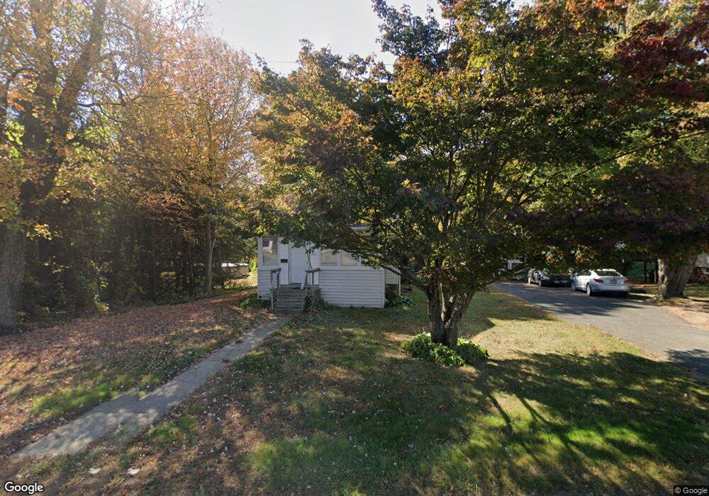
295 Brook St Bristol, CT 06010
Forestville NeighborhoodEstimated Value: $266,000 - $326,519
2
Beds
2
Baths
1,013
Sq Ft
$293/Sq Ft
Est. Value
About This Home
This home is located at 295 Brook St, Bristol, CT 06010 and is currently estimated at $297,130, approximately $293 per square foot. 295 Brook St is a home located in Hartford County with nearby schools including Stafford School, Chippens Hill Middle School, and Bristol Eastern High School.
Ownership History
Date
Name
Owned For
Owner Type
Purchase Details
Closed on
Jan 9, 2002
Sold by
Zipp William N Est
Bought by
Doty Richard C
Current Estimated Value
Home Financials for this Owner
Home Financials are based on the most recent Mortgage that was taken out on this home.
Original Mortgage
$72,100
Outstanding Balance
$29,463
Interest Rate
7.04%
Estimated Equity
$267,667
Purchase Details
Closed on
Jul 9, 1993
Sold by
Linberg Warren L Est
Bought by
Zipp Ronald F
Home Financials for this Owner
Home Financials are based on the most recent Mortgage that was taken out on this home.
Original Mortgage
$65,000
Interest Rate
7%
Mortgage Type
Purchase Money Mortgage
Create a Home Valuation Report for This Property
The Home Valuation Report is an in-depth analysis detailing your home's value as well as a comparison with similar homes in the area
Home Values in the Area
Average Home Value in this Area
Purchase History
| Date | Buyer | Sale Price | Title Company |
|---|---|---|---|
| Doty Richard C | $82,000 | -- | |
| Zipp Ronald F | $95,000 | -- |
Source: Public Records
Mortgage History
| Date | Status | Borrower | Loan Amount |
|---|---|---|---|
| Open | Zipp Ronald F | $72,100 | |
| Previous Owner | Zipp Ronald F | $65,000 |
Source: Public Records
Tax History
| Year | Tax Paid | Tax Assessment Tax Assessment Total Assessment is a certain percentage of the fair market value that is determined by local assessors to be the total taxable value of land and additions on the property. | Land | Improvement |
|---|---|---|---|---|
| 2025 | $5,091 | $150,850 | $56,350 | $94,500 |
| 2024 | $4,738 | $148,750 | $56,350 | $92,400 |
| 2023 | $4,515 | $148,750 | $56,350 | $92,400 |
| 2022 | $4,298 | $112,070 | $45,920 | $66,150 |
| 2021 | $4,298 | $112,070 | $45,920 | $66,150 |
| 2020 | $4,298 | $112,070 | $45,920 | $66,150 |
| 2019 | $4,264 | $112,070 | $45,920 | $66,150 |
| 2018 | $4,133 | $112,070 | $45,920 | $66,150 |
| 2017 | $4,159 | $115,430 | $57,540 | $57,890 |
| 2016 | $4,159 | $115,430 | $57,540 | $57,890 |
| 2015 | $3,995 | $115,430 | $57,540 | $57,890 |
| 2014 | $3,995 | $115,430 | $57,540 | $57,890 |
Source: Public Records
Map
Nearby Homes
- 64 Douglas Rd
- 92 Garfield Rd
- 10 Pine Ct
- 20 Westchester Dr
- 64 Fanway Ave
- 81 Lancaster Rd
- 941 Farmington Ave
- 66 Beths Ave Unit 15
- 30 Adeline Ave
- 55 Beths Ave Unit 77
- 334 W Washington St
- 79 Beths Ave Unit 100
- 102 Renee St
- 196 Frederick St
- 115 Daniel Rd
- 156 New St
- 206 Burton St
- 46 Vance Rd
- 64 4th St
- 63 Jerome Ave
Your Personal Tour Guide
Ask me questions while you tour the home.