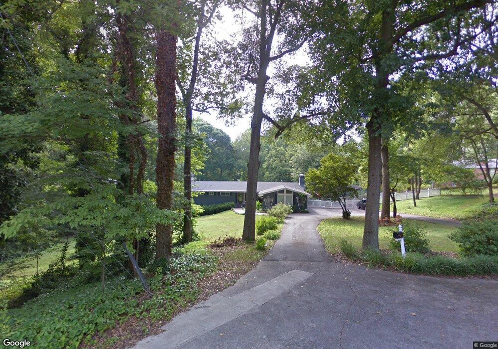
295 Heritage Ln Unit I Alpharetta, GA 30009
Estimated Value: $803,000 - $1,200,000
3
Beds
2
Baths
1,975
Sq Ft
$482/Sq Ft
Est. Value
About This Home
This home is located at 295 Heritage Ln Unit I, Alpharetta, GA 30009 and is currently estimated at $952,103, approximately $482 per square foot. 295 Heritage Ln Unit I is a home located in Fulton County with nearby schools including Alpharetta Elementary School, Hopewell Middle School, and Cambridge High School.
Ownership History
Date
Name
Owned For
Owner Type
Purchase Details
Closed on
Feb 9, 2004
Sold by
Robinson Scott
Bought by
Long Ann M
Current Estimated Value
Home Financials for this Owner
Home Financials are based on the most recent Mortgage that was taken out on this home.
Original Mortgage
$164,000
Outstanding Balance
$77,022
Interest Rate
5.85%
Mortgage Type
New Conventional
Estimated Equity
$875,081
Purchase Details
Closed on
Jul 28, 1998
Sold by
Sanders Donald W
Bought by
Robinson Scott
Home Financials for this Owner
Home Financials are based on the most recent Mortgage that was taken out on this home.
Original Mortgage
$121,600
Interest Rate
6.94%
Mortgage Type
New Conventional
Create a Home Valuation Report for This Property
The Home Valuation Report is an in-depth analysis detailing your home's value as well as a comparison with similar homes in the area
Home Values in the Area
Average Home Value in this Area
Purchase History
| Date | Buyer | Sale Price | Title Company |
|---|---|---|---|
| Long Ann M | $205,000 | -- | |
| Robinson Scott | $128,000 | -- |
Source: Public Records
Mortgage History
| Date | Status | Borrower | Loan Amount |
|---|---|---|---|
| Open | Long Ann M | $164,000 | |
| Previous Owner | Robinson Scott | $121,600 |
Source: Public Records
Tax History Compared to Growth
Tax History
| Year | Tax Paid | Tax Assessment Tax Assessment Total Assessment is a certain percentage of the fair market value that is determined by local assessors to be the total taxable value of land and additions on the property. | Land | Improvement |
|---|---|---|---|---|
| 2025 | $224 | $320,240 | $134,400 | $185,840 |
| 2023 | $5,532 | $196,000 | $39,680 | $156,320 |
| 2022 | $1,824 | $277,160 | $122,120 | $155,040 |
| 2021 | $2,056 | $168,480 | $39,680 | $128,800 |
| 2020 | $2,098 | $196,080 | $125,520 | $70,560 |
| 2019 | $248 | $122,000 | $33,320 | $88,680 |
| 2018 | $2,681 | $119,120 | $32,520 | $86,600 |
| 2017 | $1,553 | $65,160 | $18,640 | $46,520 |
| 2016 | $1,551 | $65,160 | $18,640 | $46,520 |
| 2015 | $1,732 | $65,160 | $18,640 | $46,520 |
| 2014 | $1,607 | $65,160 | $18,640 | $46,520 |
Source: Public Records
Map
Nearby Homes
- 355 Heritage Ln Unit 1
- 362 Mayfield Cir
- 417 Lynne Cir
- 170 Mayfield Cir
- 1810 Broadwell Oaks Dr
- 205 Mayfield Cir
- 181 Brooke Dr
- 326 Treble Way
- 3051 Maple Ln
- 250 Mayfield Rd
- 171 Upshaw Dr
- 260 Mayfield Rd
- Hillstone with Basement Plan at Emberly - Monarch Collection
- Rockmart Elite Plan at Emberly - Mariposa Collection
- Rockmart Plan at Emberly - Mariposa Collection
- Hedgewood with Basement Plan at Emberly - Monarch Collection
- Hedgewood Plan at Emberly - Monarch Collection
- Hillstone Plan at Emberly - Monarch Collection
- Rockmart Grand Plan at Emberly - Mariposa Collection
- Antoinette with Basement Plan at Emberly - Monarch Collection
- 353 Lynne Cir
- 315 Heritage Ln
- 315 Heritage Ln
- 300 Meadow Dr
- 306 Heritage Ln
- 355 Lynne Cir
- 290 Meadow Dr
- 312 Meadow Dr
- 312 Meadow Dr Unit LOT 3
- 325 Heritage Ln
- 316 Heritage Ln
- 324 Meadow Dr
- 280 Meadow Dr Unit 1
- 369 Lynne Cir
- 336 Meadow Dr Unit 1
- 370 Lynne Cir
- 291 Meadow Dr
- 270 Meadow Dr
- 332 Lynne Cir
- 165 Mayfield Cir