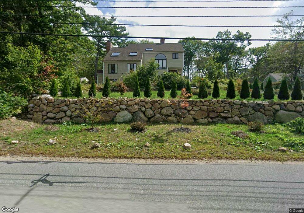
295 Magnolia Ave Gloucester, MA 01930
West Gloucester NeighborhoodEstimated Value: $727,000 - $840,000
4
Beds
4
Baths
2,157
Sq Ft
$365/Sq Ft
Est. Value
About This Home
This home is located at 295 Magnolia Ave, Gloucester, MA 01930 and is currently estimated at $786,863, approximately $364 per square foot. 295 Magnolia Ave is a home located in Essex County with nearby schools including West Parish, Ralph B O'maley Middle School, and Gloucester High School.
Ownership History
Date
Name
Owned For
Owner Type
Purchase Details
Closed on
Feb 2, 2023
Sold by
Swett Lorraine M
Bought by
Lorraine M Swett Irt
Current Estimated Value
Purchase Details
Closed on
Sep 1, 1986
Bought by
Swett Richard G and Swett Lorraine
Create a Home Valuation Report for This Property
The Home Valuation Report is an in-depth analysis detailing your home's value as well as a comparison with similar homes in the area
Home Values in the Area
Average Home Value in this Area
Purchase History
| Date | Buyer | Sale Price | Title Company |
|---|---|---|---|
| Lorraine M Swett Irt | -- | None Available | |
| Swett Richard G | $75,000 | -- |
Source: Public Records
Mortgage History
| Date | Status | Borrower | Loan Amount |
|---|---|---|---|
| Previous Owner | Swett Richard G | $173,000 | |
| Previous Owner | Swett Richard G | $22,808 | |
| Previous Owner | Swett Richard G | $187,600 |
Source: Public Records
Tax History Compared to Growth
Tax History
| Year | Tax Paid | Tax Assessment Tax Assessment Total Assessment is a certain percentage of the fair market value that is determined by local assessors to be the total taxable value of land and additions on the property. | Land | Improvement |
|---|---|---|---|---|
| 2025 | $6,944 | $714,400 | $218,000 | $496,400 |
| 2024 | $6,807 | $699,600 | $207,600 | $492,000 |
| 2023 | $7,006 | $661,600 | $185,300 | $476,300 |
| 2022 | $6,610 | $563,500 | $161,100 | $402,400 |
| 2021 | $6,468 | $519,900 | $146,500 | $373,400 |
| 2020 | $6,159 | $499,500 | $146,500 | $353,000 |
| 2019 | $5,792 | $456,400 | $146,500 | $309,900 |
| 2018 | $5,462 | $422,400 | $146,500 | $275,900 |
| 2017 | $5,239 | $397,200 | $139,500 | $257,700 |
| 2016 | $5,192 | $381,500 | $145,500 | $236,000 |
| 2015 | $5,113 | $374,600 | $145,500 | $229,100 |
Source: Public Records
Map
Nearby Homes
- 50 Laurel St
- 49 Woodward Ave
- 7 Emily Ln
- 5 Samoset Rd Unit A
- 359 Western Ave
- 24 Cobblestone Ln Unit 603
- 6 Stanwood Point Unit 2
- 145 Essex Ave Unit 610
- 450 Summer St
- 156 Hesperus Ave Unit 4
- 146 Hesperus Ave
- 11 Overlook Ave
- 29 Fuller St
- 7 Kent Cir
- 370 Summer St
- 587 Essex Ave
- 7 Cove Way
- 4 Dexter Ln
- 335 Summer St
- 13 & 10 Ferry Hill Rd
- 295 Magnolia Ave Unit Rain Gaudreau
- 293 Magnolia Ave
- 290 Magnolia Ave
- 291 Magnolia Ave
- 287 Magnolia Ave
- 282 Magnolia Ave
- 288 Magnolia Ave
- 285 Magnolia Ave
- 283 Magnolia Ave
- 270 Magnolia Ave
- 8 Carrie Ln
- 268 Magnolia Ave
- 350 Magnolia Ave
- 215 Magnolia Ave
- 6 Carrie Ln
- 251 Magnolia Ave
- 255 Magnolia Ave
- 253 Magnolia Ave
- 56 Laurel St
- 54 Laurel St