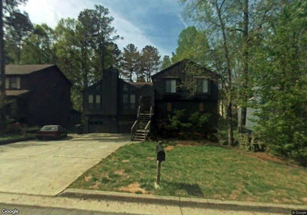
295 McKees Rock Ln Unit 2 Lawrenceville, GA 30044
Estimated Value: $334,947 - $380,000
3
Beds
2
Baths
1,546
Sq Ft
$234/Sq Ft
Est. Value
About This Home
This home is located at 295 McKees Rock Ln Unit 2, Lawrenceville, GA 30044 and is currently estimated at $362,237, approximately $234 per square foot. 295 McKees Rock Ln Unit 2 is a home located in Gwinnett County with nearby schools including Craig Elementary School, Five Forks Middle School, and Brookwood High School.
Ownership History
Date
Name
Owned For
Owner Type
Purchase Details
Closed on
Aug 25, 2005
Sold by
White Patrick H
Bought by
Diaz Victor H and Diaz Anjanette
Current Estimated Value
Home Financials for this Owner
Home Financials are based on the most recent Mortgage that was taken out on this home.
Original Mortgage
$169,834
Outstanding Balance
$90,061
Interest Rate
5.71%
Mortgage Type
VA
Estimated Equity
$272,176
Purchase Details
Closed on
Dec 23, 1993
Sold by
Walker Eunice G
Bought by
White Patrick H
Home Financials for this Owner
Home Financials are based on the most recent Mortgage that was taken out on this home.
Original Mortgage
$108,600
Interest Rate
7.19%
Mortgage Type
VA
Create a Home Valuation Report for This Property
The Home Valuation Report is an in-depth analysis detailing your home's value as well as a comparison with similar homes in the area
Home Values in the Area
Average Home Value in this Area
Purchase History
| Date | Buyer | Sale Price | Title Company |
|---|---|---|---|
| Diaz Victor H | $172,500 | -- | |
| White Patrick H | $106,500 | -- |
Source: Public Records
Mortgage History
| Date | Status | Borrower | Loan Amount |
|---|---|---|---|
| Open | Diaz Victor H | $169,834 | |
| Previous Owner | White Patrick H | $108,600 |
Source: Public Records
Tax History Compared to Growth
Tax History
| Year | Tax Paid | Tax Assessment Tax Assessment Total Assessment is a certain percentage of the fair market value that is determined by local assessors to be the total taxable value of land and additions on the property. | Land | Improvement |
|---|---|---|---|---|
| 2024 | $3,648 | $126,680 | $26,120 | $100,560 |
| 2023 | $3,648 | $132,080 | $31,200 | $100,880 |
| 2022 | $3,227 | $108,120 | $24,800 | $83,320 |
| 2021 | $2,675 | $79,560 | $18,000 | $61,560 |
| 2020 | $2,619 | $76,160 | $18,000 | $58,160 |
| 2019 | $2,446 | $71,600 | $18,000 | $53,600 |
| 2018 | $2,205 | $60,960 | $14,000 | $46,960 |
| 2016 | $2,134 | $58,320 | $12,800 | $45,520 |
| 2015 | $1,672 | $44,640 | $9,200 | $35,440 |
| 2014 | -- | $38,240 | $8,000 | $30,240 |
Source: Public Records
Map
Nearby Homes
- 270 Saint Simons Cove
- 461 Saint Simons Cove Unit 3
- 275 Sageglen Rd Unit 2
- 315 Sageglen Rd Unit 2
- 2493 Barndale Dr
- 2518 Candlewood Way
- 280 Hayward Ln Unit 1
- 305 Melanie Way
- 353 Ansley Brook Dr
- 450 Battersea Dr
- 2497 Planters Cove Dr
- 2532 Gloster Mill Dr SW
- 506 Ridgedale Way
- 280 Kentshire Place
- 546 Wagon Wheel Climb Unit 2
- 2715 Huff Dr
- 582 Arnold Rd
- 285 McKees Rock Ln Unit 2
- 305 McKees Rock Ln
- 275 McKees Rock Ln
- 340 Saint Simons Cove
- 330 Saint Simons Cove
- 350 Saint Simons Cove
- 294 McKees Rock Ln
- 304 McKees Rock Ln
- 265 McKees Rock Ln Unit 2
- 325 McKees Rock Ln
- 284 McKees Rock Ln Unit 2
- 360 Saint Simons Cove
- 314 McKees Rock Ln
- 320 Saint Simon's Cove
- 310 Saint Simons Cove
- 274 McKees Rock Ln
- 324 McKees Rock Ln Unit 2
- 320 Saint Simons Cove
- 0 McKees Rock Ln Unit 8417406
- 0 McKees Rock Ln Unit 7322636