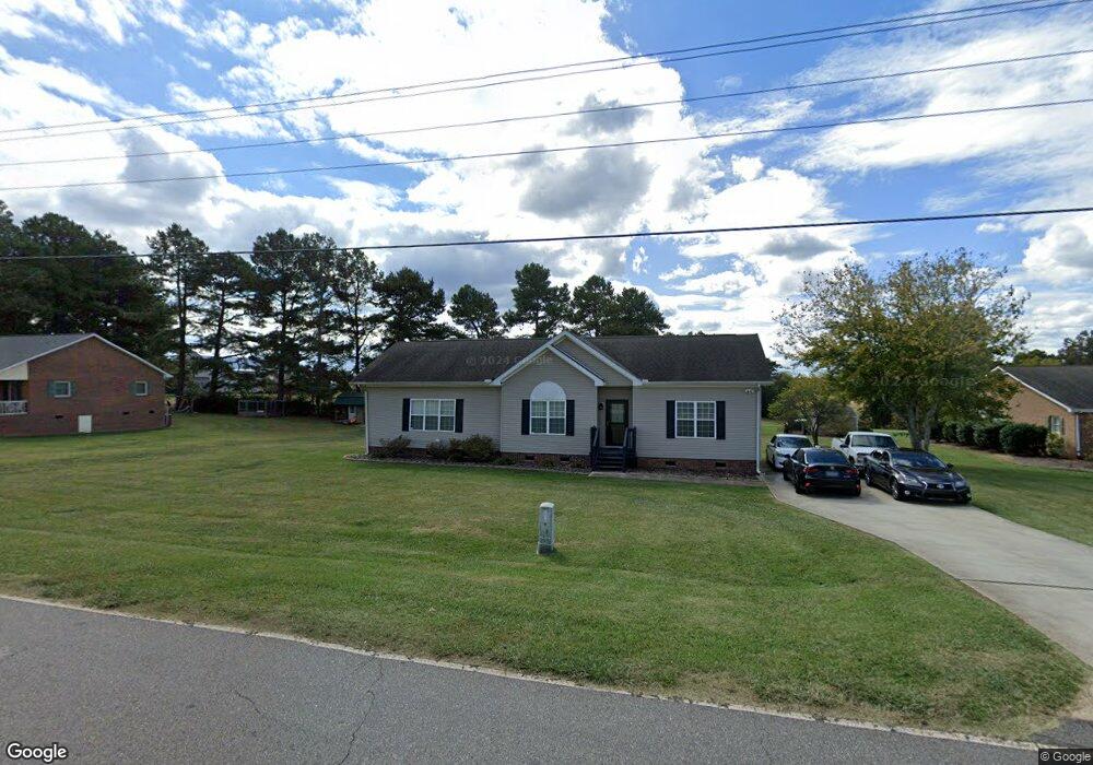
295 Old Airport Rd Statesville, NC 28677
Estimated Value: $229,000 - $288,000
3
Beds
2
Baths
1,666
Sq Ft
$158/Sq Ft
Est. Value
About This Home
This home is located at 295 Old Airport Rd, Statesville, NC 28677 and is currently estimated at $263,146, approximately $157 per square foot. 295 Old Airport Rd is a home located in Iredell County with nearby schools including Celeste Henkel Elementary School, West Iredell Middle School, and West Iredell High School.
Ownership History
Date
Name
Owned For
Owner Type
Purchase Details
Closed on
Mar 10, 2000
Sold by
A Home America Inc
Bought by
Patterson Lafreda A
Current Estimated Value
Home Financials for this Owner
Home Financials are based on the most recent Mortgage that was taken out on this home.
Original Mortgage
$10,700
Outstanding Balance
$3,650
Interest Rate
8.38%
Mortgage Type
Seller Take Back
Estimated Equity
$259,496
Purchase Details
Closed on
May 1, 1991
Purchase Details
Closed on
Dec 1, 1988
Create a Home Valuation Report for This Property
The Home Valuation Report is an in-depth analysis detailing your home's value as well as a comparison with similar homes in the area
Home Values in the Area
Average Home Value in this Area
Purchase History
| Date | Buyer | Sale Price | Title Company |
|---|---|---|---|
| Patterson Lafreda A | $11,000 | -- | |
| A Home America Inc | $8,000 | -- | |
| -- | $8,000 | -- | |
| -- | -- | -- |
Source: Public Records
Mortgage History
| Date | Status | Borrower | Loan Amount |
|---|---|---|---|
| Open | Patterson Lafreda A | $10,700 |
Source: Public Records
Tax History Compared to Growth
Tax History
| Year | Tax Paid | Tax Assessment Tax Assessment Total Assessment is a certain percentage of the fair market value that is determined by local assessors to be the total taxable value of land and additions on the property. | Land | Improvement |
|---|---|---|---|---|
| 2024 | $1,134 | $181,980 | $22,000 | $159,980 |
| 2023 | $1,134 | $181,980 | $22,000 | $159,980 |
| 2022 | $910 | $135,510 | $16,500 | $119,010 |
| 2021 | $906 | $135,510 | $16,500 | $119,010 |
| 2020 | $906 | $135,510 | $16,500 | $119,010 |
| 2019 | $893 | $135,510 | $16,500 | $119,010 |
| 2018 | $782 | $122,200 | $13,500 | $108,700 |
| 2017 | $782 | $122,200 | $13,500 | $108,700 |
| 2016 | $782 | $122,200 | $13,500 | $108,700 |
| 2015 | $782 | $122,200 | $13,500 | $108,700 |
| 2014 | $764 | $128,220 | $13,500 | $114,720 |
Source: Public Records
Map
Nearby Homes
- 178 Old Airport Rd
- 133 Tower Dr Unit 35
- 130 Aviation Dr
- 103 Dublin Ct
- 289 Mary Locke Way
- 1129 Rita Ave
- 130 Greenwich Dr
- 1120 Rita Ave
- 3004 Newton Dr
- 109 Gatwick Ct
- 1309 Williams Rd
- 818 Candy Dr
- 812 Candy Dr
- 00 Jamie Dr Unit 6
- Robie Plan at Bristol Terrace
- Penwell Plan at Bristol Terrace
- Hayden Plan at Bristol Terrace
- 119 Mary Locke Way
- Cali Plan at Bristol Terrace
- Aria Plan at Bristol Terrace
- 107 Sandtrap Dr
- 287 Old Airport Rd
- LT 32 Sandtrap Dr Unit 32
- 113 Sandtrap Dr
- 276 Old Airport Rd
- 0 Airport Rd
- 000 Airport Rd Unit 34
- 11 Sandtrap Dr
- 31 Sandtrap Dr
- 6 Sandtrap Dr
- 139 Sandtrap Dr
- 133 Sandtrap Dr
- 255 Old Airport Rd
- 113 Parker Lake Loop
- 121 Parker Lake Loop
- Lot 31 Sandtrap Dr
- lot 7 Sandtrap Dr
- 247 Old Airport Rd
- 137 Parker Lake Loop
- 155 Sandtrap Dr