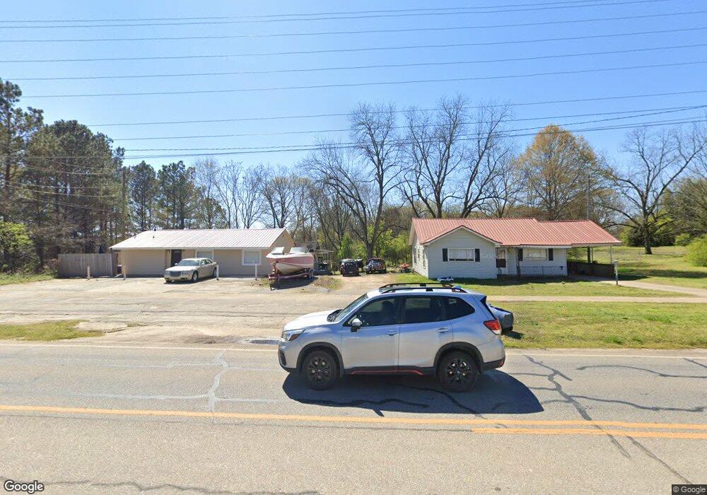
295 S Elm St Commerce, GA 30529
Estimated Value: $197,282 - $256,000
--
Bed
4
Baths
1,082
Sq Ft
$205/Sq Ft
Est. Value
About This Home
This home is located at 295 S Elm St, Commerce, GA 30529 and is currently estimated at $222,321, approximately $205 per square foot. 295 S Elm St is a home located in Jackson County with nearby schools including Commerce Primary School, Commerce Elementary School, and Commerce Middle School.
Ownership History
Date
Name
Owned For
Owner Type
Purchase Details
Closed on
Nov 11, 2024
Sold by
Cheek Douglas Anthony
Bought by
Douglas Anthony Cheek Revocable Living T and Cheek Vicki Petina
Current Estimated Value
Purchase Details
Closed on
May 17, 1999
Sold by
Maddox Grace and Maddox Farri
Bought by
Cheek Douglas A
Purchase Details
Closed on
Jan 22, 1997
Bought by
Maddox Grace and Maddox Farri
Create a Home Valuation Report for This Property
The Home Valuation Report is an in-depth analysis detailing your home's value as well as a comparison with similar homes in the area
Home Values in the Area
Average Home Value in this Area
Purchase History
| Date | Buyer | Sale Price | Title Company |
|---|---|---|---|
| Douglas Anthony Cheek Revocable Living T | -- | -- | |
| Cheek Douglas A | $85,000 | -- | |
| Maddox Grace | -- | -- |
Source: Public Records
Tax History Compared to Growth
Tax History
| Year | Tax Paid | Tax Assessment Tax Assessment Total Assessment is a certain percentage of the fair market value that is determined by local assessors to be the total taxable value of land and additions on the property. | Land | Improvement |
|---|---|---|---|---|
| 2024 | $1,502 | $59,320 | $25,600 | $33,720 |
| 2023 | $1,493 | $55,560 | $25,600 | $29,960 |
| 2022 | $1,185 | $41,320 | $17,040 | $24,280 |
| 2021 | $1,193 | $41,320 | $17,040 | $24,280 |
| 2020 | $1,188 | $37,560 | $17,040 | $20,520 |
| 2019 | $1,206 | $37,560 | $17,040 | $20,520 |
| 2018 | $1,203 | $36,936 | $17,040 | $19,896 |
| 2017 | $1,177 | $35,830 | $17,076 | $18,754 |
| 2016 | $1,184 | $35,830 | $17,076 | $18,754 |
| 2015 | $1,065 | $32,082 | $13,328 | $18,754 |
| 2014 | $1,025 | $30,656 | $13,328 | $17,328 |
| 2013 | -- | $31,765 | $13,328 | $18,437 |
Source: Public Records
Map
Nearby Homes
- 395 S Elm St
- 0 S Elm St Unit 16541343
- 554 Spring St
- 562 Madison St Unit 110
- 562 Madison St Unit 100
- 0 Harmony Gates Dr Unit Tract 24 CM1025291
- 0 Harmony Gates Dr Unit 7506513
- 0 Harmony Gates Dr Unit TRACT 24 10193711
- 548 Madison St Unit 100
- 548 Madison St Unit 110
- The Whitney Plan at Cotton Gin Row
- 526 Madison St
- 102 Barber St
- 581 Ila Rd
- 711 Ila Rd
- 1029 S Elm St
- 184 Ashford Ln
- 91 Neal St
- 1269 S Elm St
- 45 Williford St
- 256 S Elm St Unit 3
- 283 S Broad Street Extension
- 261 S Broad Street Extension
- 343 S Elm St
- 331 S Broad Street Extension
- 353 S Elm St
- 331 S Broad Street Extension
- S S Broad Street Extension
- 283 S Broad St Extension
- 373 S Elm St
- 335 S Broad Street Extension
- 399 S Elm St
- 399 S Elm St Unit 89Y/405
- 399 S Elm St Unit 3
- 261 S Broad St
- 25 Stark St
- 70 Stark St
- 0 Hwy 334 Unit 8248200
- 0 Hwy 334 Unit 3262387
- 0 Hwy 334 Unit 3262446