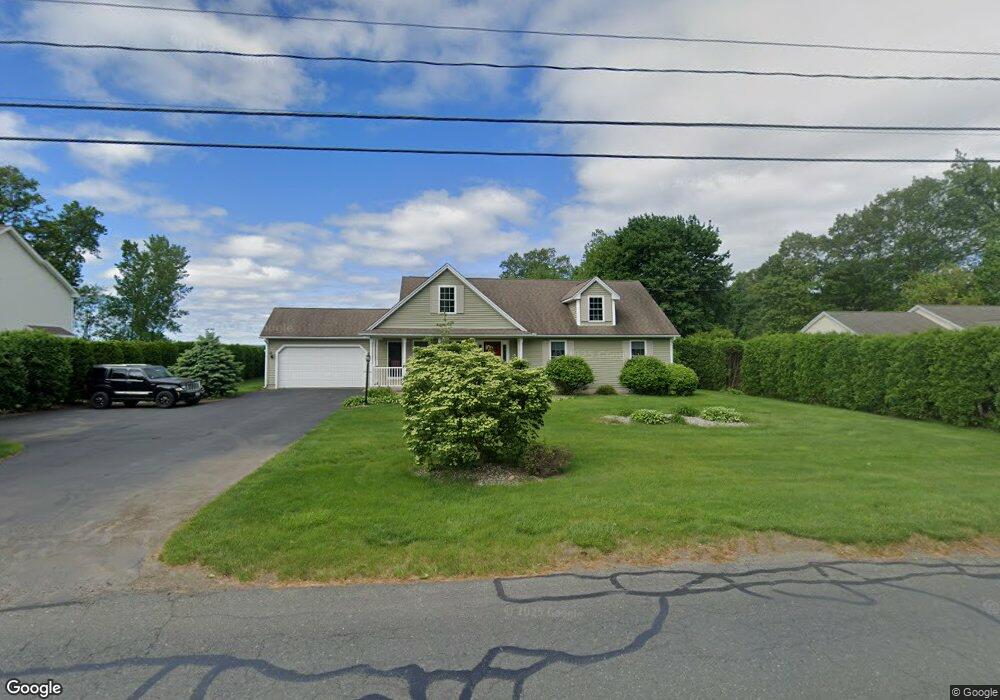
295 Springdale Rd Westfield, MA 01085
Estimated Value: $454,000 - $484,000
3
Beds
2
Baths
1,493
Sq Ft
$311/Sq Ft
Est. Value
About This Home
This home is located at 295 Springdale Rd, Westfield, MA 01085 and is currently estimated at $464,319, approximately $310 per square foot. 295 Springdale Rd is a home located in Hampden County with nearby schools including Westfield High School and Saint Mary High School.
Ownership History
Date
Name
Owned For
Owner Type
Purchase Details
Closed on
Nov 22, 2002
Sold by
Sunnyside Corp
Bought by
Fuller Cheryl A
Current Estimated Value
Home Financials for this Owner
Home Financials are based on the most recent Mortgage that was taken out on this home.
Original Mortgage
$50,000
Outstanding Balance
$21,020
Interest Rate
6.07%
Mortgage Type
Purchase Money Mortgage
Estimated Equity
$443,299
Create a Home Valuation Report for This Property
The Home Valuation Report is an in-depth analysis detailing your home's value as well as a comparison with similar homes in the area
Home Values in the Area
Average Home Value in this Area
Purchase History
| Date | Buyer | Sale Price | Title Company |
|---|---|---|---|
| Fuller Cheryl A | $232,900 | -- |
Source: Public Records
Mortgage History
| Date | Status | Borrower | Loan Amount |
|---|---|---|---|
| Open | Fuller Cheryl A | $50,000 |
Source: Public Records
Tax History Compared to Growth
Tax History
| Year | Tax Paid | Tax Assessment Tax Assessment Total Assessment is a certain percentage of the fair market value that is determined by local assessors to be the total taxable value of land and additions on the property. | Land | Improvement |
|---|---|---|---|---|
| 2025 | $5,976 | $393,700 | $121,800 | $271,900 |
| 2024 | $6,115 | $382,900 | $111,000 | $271,900 |
| 2023 | $5,726 | $349,800 | $105,300 | $244,500 |
| 2022 | $5,726 | $309,700 | $93,900 | $215,800 |
| 2021 | $5,554 | $294,200 | $88,800 | $205,400 |
| 2020 | $5,490 | $285,200 | $88,800 | $196,400 |
| 2019 | $5,362 | $272,600 | $84,300 | $188,300 |
| 2018 | $5,278 | $272,600 | $84,300 | $188,300 |
| 2017 | $5,166 | $266,000 | $85,800 | $180,200 |
| 2016 | $5,171 | $266,000 | $85,800 | $180,200 |
| 2015 | $5,082 | $274,100 | $85,800 | $188,300 |
| 2014 | $3,803 | $274,100 | $85,800 | $188,300 |
Source: Public Records
Map
Nearby Homes
- 14 Lynnwood Dr
- 0 Holyoke Rd
- 119 Union St Unit 4
- 26 Deepwoods Dr
- 111 Union St Unit 6
- 99 Woodmont St
- 20 Greenwood St Unit 10
- 351 N Elm St
- 72-74 Notre Dame St
- 19 Arch Rd
- 120 Woodcliff Dr
- 13 William St
- 9 Crown St
- 10 Ethan Ave
- Lot 3 Montgomery
- 97 Mechanic St
- 99 Hillcrest Cir
- 53 Bristol St
- 13 Furrow St
- 3 Norton St
- 305 Springdale Rd
- 279 Springdale Rd
- 311 Springdale Rd
- 280 Springdale Rd
- 304 Springdale Rd
- 308 Springdale Rd
- 35 Denise Dr
- 265 Springdale Rd
- 172 Sandy Hill Rd
- 319 Springdale Rd
- 319 Springdale Rd
- 191 Sandy Hill Rd
- 31 Aldrich Dr
- 23 Aldrich Dr
- 8 Mary Ln
- 41 Aldrich Dr
- 15 Aldrich Dr
- 32 Denise Dr
- 257 Springdale Rd
- 47 Aldrich Dr