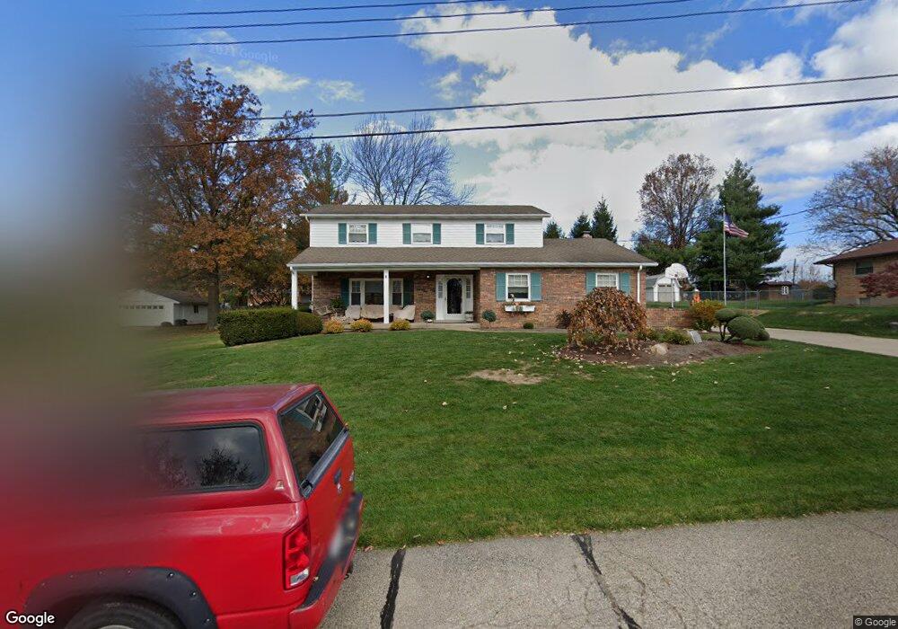
2950 Loretta Dr Cincinnati, OH 45239
White Oak East NeighborhoodEstimated Value: $120,108 - $327,000
Studio
--
Bath
--
Sq Ft
15,072
Sq Ft Lot
About This Home
This home is located at 2950 Loretta Dr, Cincinnati, OH 45239 and is currently estimated at $223,554. 2950 Loretta Dr is a home located in Hamilton County with nearby schools including White Oak Middle School, Colerain High School, and Cincinnati Achievement Academy.
Ownership History
Date
Name
Owned For
Owner Type
Purchase Details
Closed on
Jul 19, 2024
Sold by
Fischesser Family Preservation Trust and Fischesser Gregory P
Bought by
Gullett Ian and Merrill Katrina
Current Estimated Value
Home Financials for this Owner
Home Financials are based on the most recent Mortgage that was taken out on this home.
Original Mortgage
$256,000
Outstanding Balance
$239,682
Interest Rate
6.17%
Mortgage Type
New Conventional
Estimated Equity
-$16,128
Purchase Details
Closed on
Mar 26, 2014
Sold by
Fischesser Melvin J and Fischesser Elizabeth A
Bought by
Fischesser Greogry P and The Fischesser Family Preservation Trust
Purchase Details
Closed on
Mar 20, 2000
Sold by
Fischesser Elizabeth A
Bought by
Fischesser Melvin J and Fischesser Elizabeth A
Create a Home Valuation Report for This Property
The Home Valuation Report is an in-depth analysis detailing your home's value as well as a comparison with similar homes in the area
Home Values in the Area
Average Home Value in this Area
Purchase History
| Date | Buyer | Sale Price | Title Company |
|---|---|---|---|
| Gullett Ian | $320,000 | None Listed On Document | |
| Fischesser Greogry P | -- | Attorney | |
| Fischesser Melvin J | -- | -- |
Source: Public Records
Mortgage History
| Date | Status | Borrower | Loan Amount |
|---|---|---|---|
| Open | Gullett Ian | $256,000 |
Source: Public Records
Tax History
| Year | Tax Paid | Tax Assessment Tax Assessment Total Assessment is a certain percentage of the fair market value that is determined by local assessors to be the total taxable value of land and additions on the property. | Land | Improvement |
|---|---|---|---|---|
| 2025 | $784 | $14,169 | $8,166 | $6,003 |
| 2024 | $785 | $14,169 | $8,166 | $6,003 |
| 2023 | $776 | $14,169 | $8,166 | $6,003 |
| 2022 | $1,047 | $15,659 | $10,885 | $4,774 |
| 2021 | $980 | $15,659 | $10,885 | $4,774 |
| 2020 | $967 | $15,659 | $10,885 | $4,774 |
| 2019 | $957 | $13,983 | $9,720 | $4,263 |
| 2018 | $855 | $13,983 | $9,720 | $4,263 |
| 2017 | $819 | $13,983 | $9,720 | $4,263 |
| 2016 | $799 | $13,304 | $9,622 | $3,682 |
| 2015 | $796 | $13,304 | $9,622 | $3,682 |
| 2014 | $798 | $13,304 | $9,622 | $3,682 |
| 2013 | $756 | $13,441 | $9,720 | $3,721 |
Source: Public Records
Map
Nearby Homes
- 2801 Byrneside Dr
- 2937 Blue Rock Rd
- 2806 Breezy Way
- 5970 Colerain Ave
- 2820 Geraldine Dr
- 2730 Byrneside Dr
- 3191 Preserve Ln
- 3181 Preserve Ln
- 3181 Preserve Ln Unit 1C
- 3217 Rockacres Ct
- 3260 Blueacres Dr
- 3236 Deborah Ln
- 6751 Rutherford Ct
- 3250 March Terrace
- 2603 Kipling Ave
- 6278 Seiler Dr
- 2757 Banning Rd
- 3140 Banning Rd
- 2836 Banning Rd
- 2503 Flanigan Ct
Your Personal Tour Guide
Ask me questions while you tour the home.