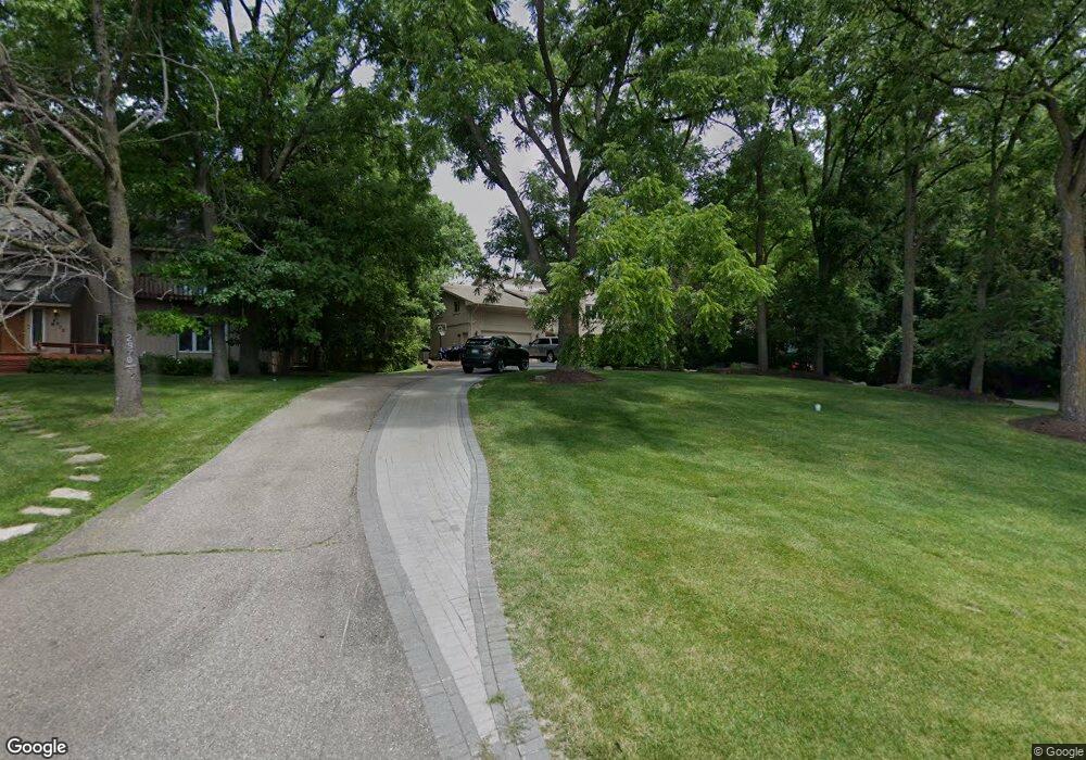
2950 Walnut Lake Rd West Bloomfield, MI 48323
Estimated Value: $1,064,866 - $1,482,000
4
Beds
4
Baths
4,126
Sq Ft
$307/Sq Ft
Est. Value
About This Home
This home is located at 2950 Walnut Lake Rd, West Bloomfield, MI 48323 and is currently estimated at $1,266,467, approximately $306 per square foot. 2950 Walnut Lake Rd is a home located in Oakland County with nearby schools including Wylie E. Groves High School, West Maple Elementary School, and Berkshire Middle School.
Ownership History
Date
Name
Owned For
Owner Type
Purchase Details
Closed on
Apr 17, 2003
Sold by
Simon Frank R
Bought by
Simon Frank R and Simon Lena R
Current Estimated Value
Purchase Details
Closed on
Oct 4, 1999
Sold by
Cairns Stewart Pc
Bought by
Simon Frank
Purchase Details
Closed on
Feb 28, 1996
Sold by
Comerica Bank
Bought by
Cairns Stewart
Purchase Details
Closed on
Oct 10, 1995
Sold by
Forbert Robert
Bought by
Comerica Bank
Create a Home Valuation Report for This Property
The Home Valuation Report is an in-depth analysis detailing your home's value as well as a comparison with similar homes in the area
Home Values in the Area
Average Home Value in this Area
Purchase History
| Date | Buyer | Sale Price | Title Company |
|---|---|---|---|
| Simon Frank R | -- | -- | |
| Simon Frank | -- | -- | |
| Cairns Stewart | $220,199 | -- | |
| Comerica Bank | $211,483 | -- |
Source: Public Records
Mortgage History
| Date | Status | Borrower | Loan Amount |
|---|---|---|---|
| Closed | Simon Frank | -- |
Source: Public Records
Tax History Compared to Growth
Tax History
| Year | Tax Paid | Tax Assessment Tax Assessment Total Assessment is a certain percentage of the fair market value that is determined by local assessors to be the total taxable value of land and additions on the property. | Land | Improvement |
|---|---|---|---|---|
| 2024 | $7,269 | $502,570 | $0 | $0 |
| 2022 | $7,072 | $408,020 | $41,760 | $366,260 |
| 2021 | $11,930 | $381,630 | $0 | $0 |
| 2020 | $6,701 | $383,200 | $41,760 | $341,440 |
| 2018 | $11,180 | $333,550 | $41,760 | $291,790 |
| 2015 | -- | $321,160 | $0 | $0 |
| 2014 | -- | $284,480 | $0 | $0 |
| 2011 | -- | $259,250 | $0 | $0 |
Source: Public Records
Map
Nearby Homes
- 3104 Spring St
- 5415 Fairway Ln
- 5321 Fairway Ln Unit 7
- 5622 Powder Horn Dr
- 3035 Parkland Dr
- 5815 Bloomfield Glens Rd
- 5881 Naneva Ct
- 5780 Swan Lake Ct
- 0000 Putnam Dr
- 4710 Cove Rd
- 4670 Cove Rd
- 4724 Tara Ct
- 4941 Fairway Ridge Cir
- 4768 Wendrick Dr
- 2149 Sunnycrest Dr
- 5620 Eastman Blvd
- 4641 Cove Rd
- 3075 Bloomfield Park Dr
- 3865 Stonecrest Rd
- 5620 Inkster Rd
- 2970 Walnut Lake Rd
- 2930 Walnut Lake Rd
- 5573 Middlebelt Rd Unit Bldg-Unit
- 5573 Middlebelt Rd
- 2900 Walnut Lake Rd
- 2965 Walnut Lake Rd
- 5565 Middlebelt Rd
- 5515 Middlebelt Rd
- 3025 Walnut Lake Rd
- 2880 Walnut Lake Rd
- 2898 Walnut Lake Rd
- 3333 Walnut Lake Rd
- 2870 Walnut Lake Rd
- 5503 Middlebelt Rd
- 5650 Middlebelt Rd
- 5700 Independence Ln
- 2890 Walnut Lake Rd
- LOT A Walnut Lake Rd
- 5591 White Hall Cir
- 3049 Walnut Lake Rd