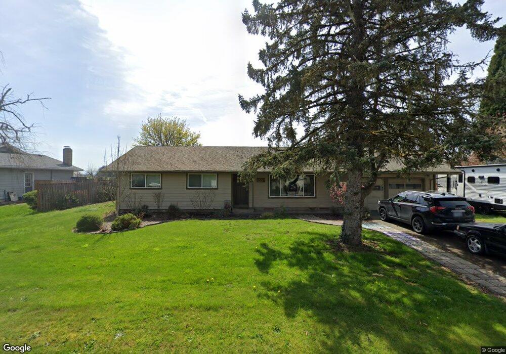
29506 NE Weslinn Dr Corvallis, OR 97333
Estimated Value: $443,819 - $531,000
3
Beds
2
Baths
1,219
Sq Ft
$400/Sq Ft
Est. Value
About This Home
This home is located at 29506 NE Weslinn Dr, Corvallis, OR 97333 and is currently estimated at $487,410, approximately $399 per square foot. 29506 NE Weslinn Dr is a home located in Linn County with nearby schools including Garfield Elementary School, Linus Pauling Middle School, and Corvallis High School.
Ownership History
Date
Name
Owned For
Owner Type
Purchase Details
Closed on
Mar 21, 2018
Sold by
Sabatino Helen L and Marney Valerie S
Bought by
Barmore Brenton J and Barmore Mary F
Current Estimated Value
Home Financials for this Owner
Home Financials are based on the most recent Mortgage that was taken out on this home.
Original Mortgage
$289,750
Outstanding Balance
$247,939
Interest Rate
4.32%
Mortgage Type
New Conventional
Estimated Equity
$239,471
Purchase Details
Closed on
Aug 10, 2006
Sold by
Marney Carl M and Marney Diane
Bought by
Marney Carl M and Marney Diane
Home Financials for this Owner
Home Financials are based on the most recent Mortgage that was taken out on this home.
Original Mortgage
$50,000
Interest Rate
6.76%
Mortgage Type
Credit Line Revolving
Create a Home Valuation Report for This Property
The Home Valuation Report is an in-depth analysis detailing your home's value as well as a comparison with similar homes in the area
Home Values in the Area
Average Home Value in this Area
Purchase History
| Date | Buyer | Sale Price | Title Company |
|---|---|---|---|
| Barmore Brenton J | $305,000 | Amerititle | |
| Marney Carl M | -- | First American Title | |
| Marney Carl M | -- | First American Title |
Source: Public Records
Mortgage History
| Date | Status | Borrower | Loan Amount |
|---|---|---|---|
| Open | Barmore Brenton J | $289,750 | |
| Previous Owner | Marney Carl M | $50,000 |
Source: Public Records
Tax History Compared to Growth
Tax History
| Year | Tax Paid | Tax Assessment Tax Assessment Total Assessment is a certain percentage of the fair market value that is determined by local assessors to be the total taxable value of land and additions on the property. | Land | Improvement |
|---|---|---|---|---|
| 2024 | $3,995 | $259,580 | -- | -- |
| 2023 | $3,878 | $252,020 | $0 | $0 |
| 2022 | $3,765 | $244,680 | $0 | $0 |
| 2021 | $3,593 | $237,560 | $0 | $0 |
| 2020 | $3,402 | $230,650 | $0 | $0 |
| 2019 | $3,311 | $223,940 | $0 | $0 |
| 2018 | $3,248 | $217,420 | $0 | $0 |
| 2017 | $2,829 | $211,090 | $0 | $0 |
| 2016 | $2,720 | $204,950 | $0 | $0 |
| 2015 | $2,622 | $195,960 | $0 | $0 |
| 2014 | $2,715 | $198,990 | $0 | $0 |
Source: Public Records
Map
Nearby Homes
- 29509 NE Pheasant Ave
- 33844 SE White Oak Rd
- 34123 Cushman Rd Unit 1400
- 34123 Cushman Rd Unit 1300
- 34123 Cushman Rd Unit 3 Lots
- 34123 Cushman Rd Unit 1200
- (Near 34123) Rd
- (Near 34123) Cushman (Lot 1400) Rd
- (Near 34123) Cushman (Lot 1300) Rd
- (Near 34123) Cushman (Lot 1200) Rd
- 33321 SE Peoria Rd
- 33125 SE White Oak Rd Unit 5 Rd
- 33125 SE White Oak Rd Unit 21 Rd
- 33125 SE White Oak Rd Unit 17
- 33125 SE White Oak (#20) Rd Unit 20
- 33125 SE White Oak (#1) Rd Unit 1
- 33125 SE White Oak (#56) Rd Unit 56
- 2635 NE Seavy Place
- Lot 601 NE Circle Blvd
- 800 (next to) NE Circle Bl
- 29516 NE Weslinn Dr
- 29492 NE Weslinn Dr
- 29532 NE Weslinn Dr
- 29488 NE Weslinn Dr
- 29505 NE Weslinn Dr
- 29495 NE Weslinn Dr
- 29531 NE Weslinn Dr
- 29485 NE Weslinn Dr
- 29542 NE Weslinn Dr
- 29541 NE Weslinn Dr
- 29552 NE Weslinn Dr
- 29547 NE Weslinn Dr
- 29475 NE Weslinn Dr
- 29508 NE Pheasant Ave
- 29518 NE Pheasant Ave
- 29528 NE Pheasant Ave
- 29492 NE Pheasant Ave
- 29562 NE Weslinn Dr
- 29476 NE Pheasant Ave
- 34026 NE Colorado Lake Dr