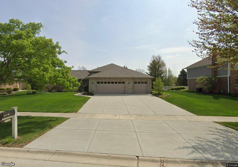
2951 Northwind Dr New Lenox, IL 60451
Estimated Value: $495,854 - $585,000
--
Bed
--
Bath
--
Sq Ft
0.34
Acres
About This Home
This home is located at 2951 Northwind Dr, New Lenox, IL 60451 and is currently estimated at $525,964. 2951 Northwind Dr is a home located in Will County with nearby schools including Spencer Trail, Spencer Pointe, and Spencer Crossing Intermediate School.
Ownership History
Date
Name
Owned For
Owner Type
Purchase Details
Closed on
Jan 20, 2016
Sold by
Cernauskas Karla K
Bought by
Cernrkas Karla K and Karla Trust
Current Estimated Value
Purchase Details
Closed on
Oct 30, 2000
Sold by
Marquette National Bank
Bought by
Cernauskas Donald F and Cernauskas Karla K
Home Financials for this Owner
Home Financials are based on the most recent Mortgage that was taken out on this home.
Original Mortgage
$130,000
Interest Rate
7.87%
Create a Home Valuation Report for This Property
The Home Valuation Report is an in-depth analysis detailing your home's value as well as a comparison with similar homes in the area
Home Values in the Area
Average Home Value in this Area
Purchase History
| Date | Buyer | Sale Price | Title Company |
|---|---|---|---|
| Cernrkas Karla K | -- | Chicago Title Insurance Co | |
| Cernauskas Donald F | $228,000 | -- |
Source: Public Records
Mortgage History
| Date | Status | Borrower | Loan Amount |
|---|---|---|---|
| Previous Owner | Cernauskas Donald F | $130,000 |
Source: Public Records
Tax History Compared to Growth
Tax History
| Year | Tax Paid | Tax Assessment Tax Assessment Total Assessment is a certain percentage of the fair market value that is determined by local assessors to be the total taxable value of land and additions on the property. | Land | Improvement |
|---|---|---|---|---|
| 2024 | $10,489 | $145,248 | $36,393 | $108,855 |
| 2023 | $10,489 | $132,405 | $33,175 | $99,230 |
| 2022 | $9,602 | $121,976 | $30,562 | $91,414 |
| 2021 | $9,090 | $114,715 | $28,743 | $85,972 |
| 2020 | $8,815 | $110,622 | $27,717 | $82,905 |
| 2019 | $8,861 | $107,192 | $26,858 | $80,334 |
| 2018 | $8,658 | $103,497 | $25,932 | $77,565 |
| 2017 | $8,227 | $100,521 | $25,186 | $75,335 |
| 2016 | $7,987 | $97,831 | $24,512 | $73,319 |
| 2015 | $7,694 | $94,751 | $23,740 | $71,011 |
| 2014 | $7,694 | $93,581 | $23,447 | $70,134 |
| 2013 | $7,694 | $94,842 | $23,763 | $71,079 |
Source: Public Records
Map
Nearby Homes
- 2758 Bluestone Bay Dr
- 2848 Southwind Dr
- 2667 E Lincoln Hwy
- 190 Pottawatomie Ln
- 21359 Saddle Ln
- 21170 Sage Brush Ln
- 21244 Sage Brush Ln
- 651 Schooner Dr
- 21606 Skyway Dr
- 21409 Foxtail Dr
- 11326 Wexford Dr
- 11826 Leigh Ct
- 641 Lisson Grove
- 701 Bishops Gate
- 1587 Glenbrooke Ln
- 1583 Glenbrooke Ln
- 1591 Glenbrooke Ln
- 1579 Glenbrooke Bldg 60 Ln
- 1595 Glenbrooke Ln
- 21970 Emily Ln
- 780 Eastwind Dr
- 2933 Gannet Ln
- 781 Eastwind Dr
- 2924 Northwind Dr
- 2917 Gannet Ln Unit 5
- 800 Eastwind Dr
- 2921 Northwind Dr
- 21222 Prestancia Dr
- 2908 Northwind Dr
- 799 Eastwind Dr
- 2901 Gannet Ln
- 780 Laurel Bay
- 21234 Prestancia Dr
- 21210 Prestancia Dr
- 810 Eastwind Dr
- 2913 Northwind Dr
- 790 Laurel Bay
- 21162 Prestancia Dr
- 807 Eastwind Dr
- 2890 Northwind Dr